Small shower/storm chance Sunday, then turning hot for next week


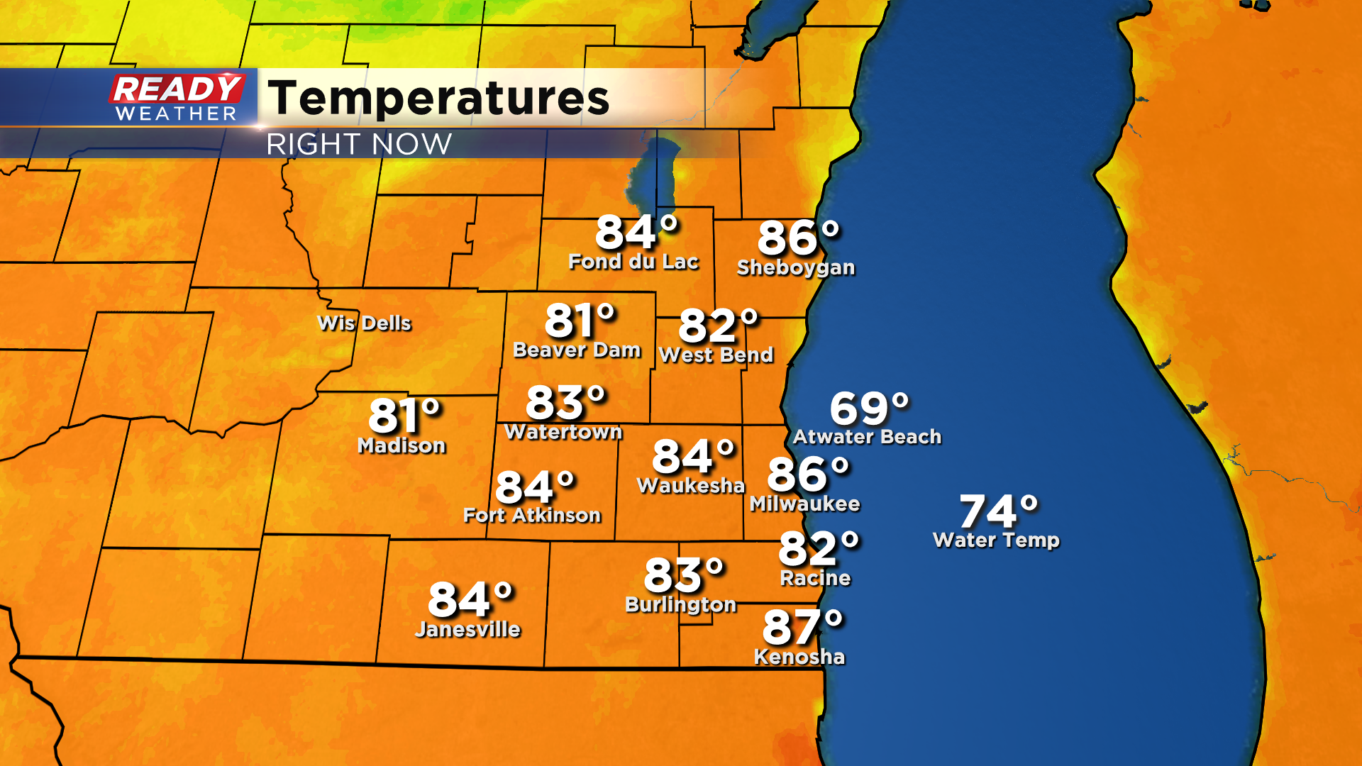
It's been another warm summer day across southeast Wisconsin with 4pm temperatures sitting in the low to mid 80s. While we've had an uptick in humidity today, it hasn't felt too bad thanks to the breezy southerly wind we've had all day.
Today's sunshine has been filtered at times as a few areas of showers and storms have been ongoing to our north and west.
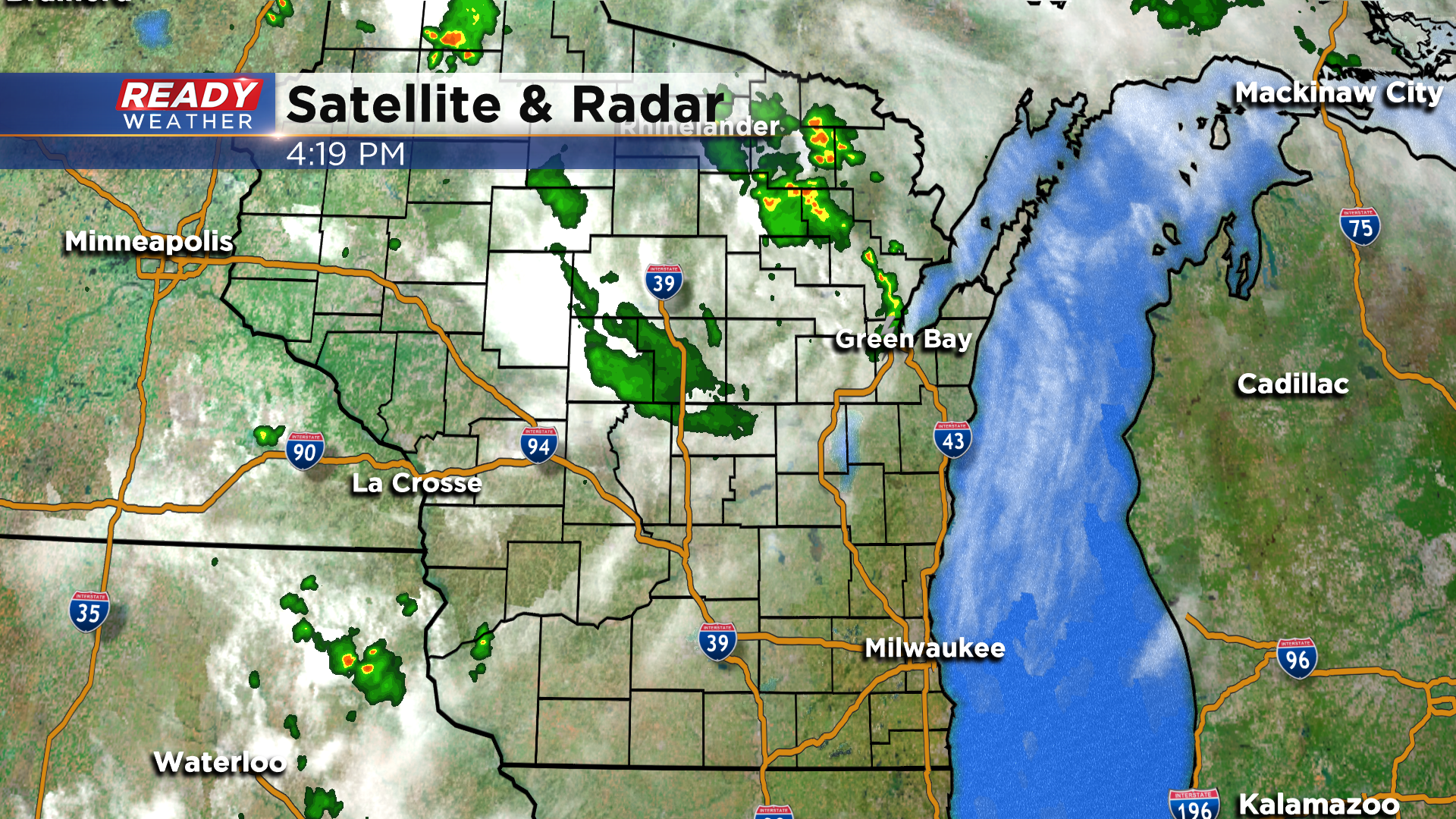
This activity is expected to remain north and west of the area, but will bring a few more clouds into southeast Wisconsin heading into tonight. We can't rule out a stray shower or storm overnight or early tomorrow morning, but the best chance (only a 30% chance) for a few pop up showers or storms will come Sunday afternoon.
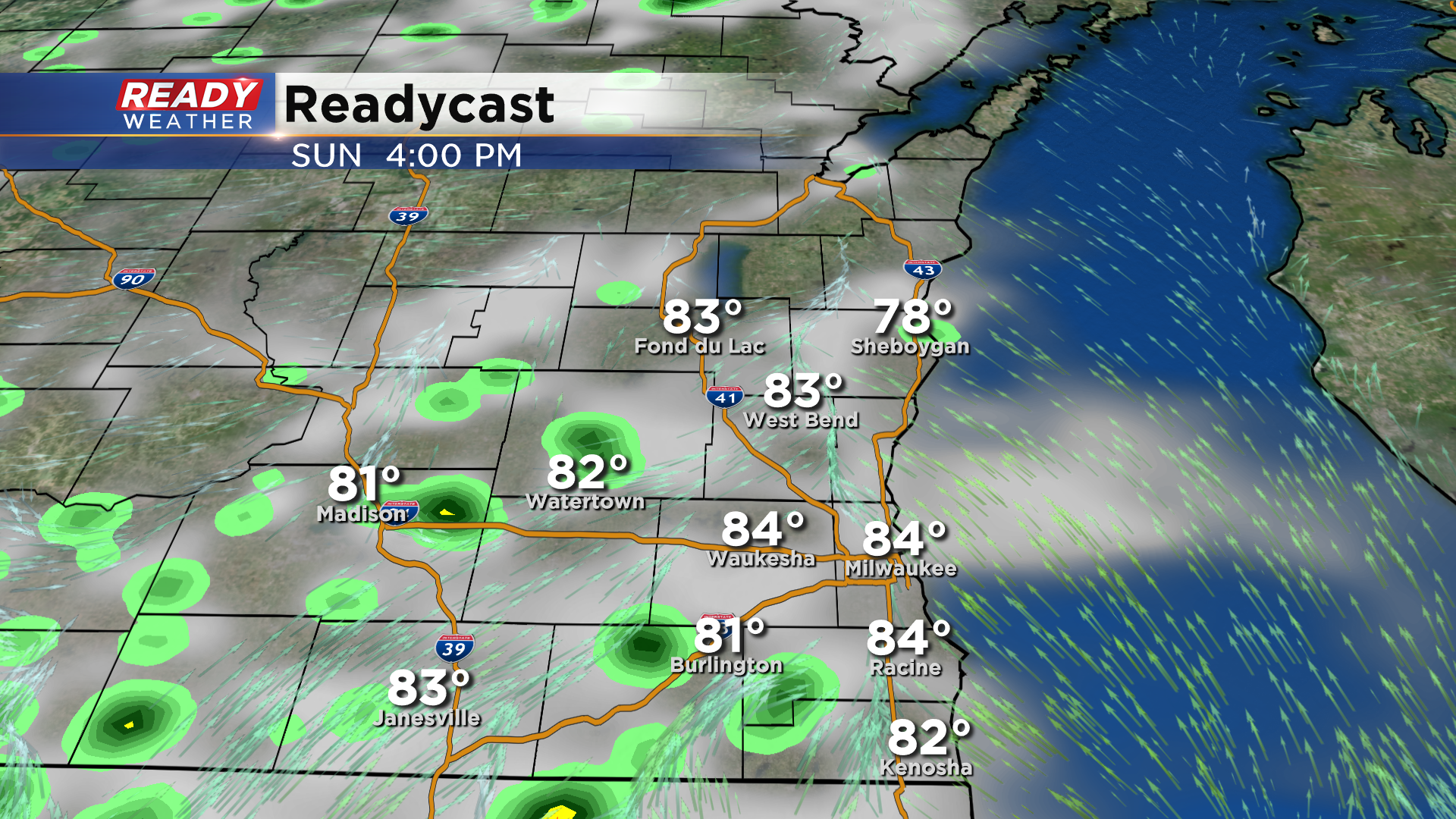
Not everyone will see rain on Sunday, and any showers and storms that pop up will fizzle out by sunset. With a few more clouds in the area tomorrow, temps will be a couple of degrees cooler than today. However, the heat is on as we start the new work week with highs in the upper 80s to low 90s possible through at least Wednesday.
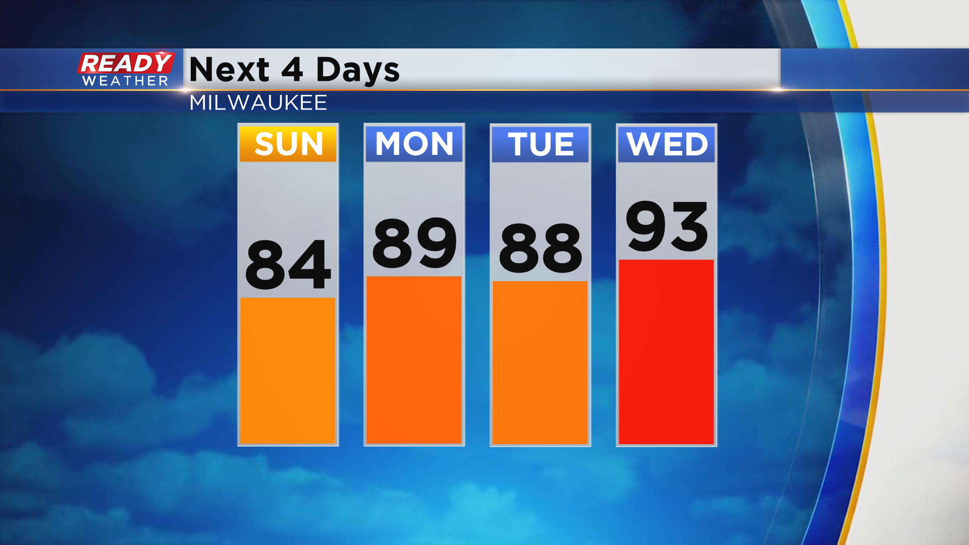
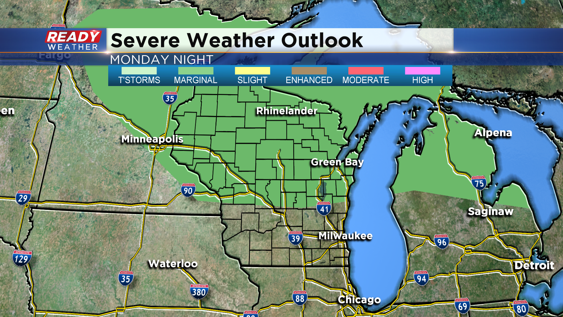
Mainly dry weather is expected during this time, but we'll have to watch for a complex of storms early Tuesday morning that'll be pushing across the northern half of the state. That line of storms may clip areas north of Milwaukee to start the day before we dry out in the afternoon. A few of those storms could be strong, with parts of Fond du Lac and Sheboygan counties included in the Marginal Risk (Level 1 of 5).
The heat and humidity won't last all week. Download the CBS 58 Ready Weather App to see when the 70s return.