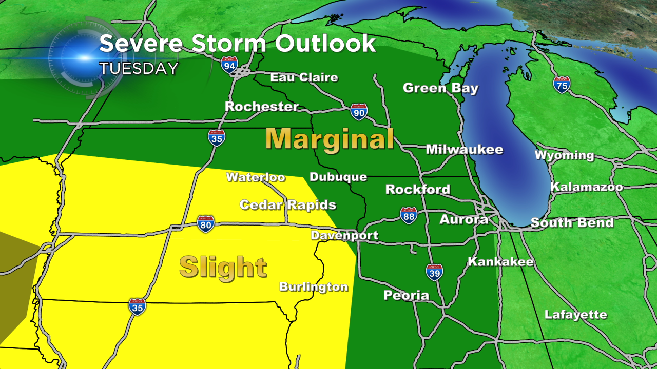
Severe Storms Tuesday?
The warm temperatures continue this week! The last time we had this warm of a stretch was back during the beginning of September. Temperatures will spike back into the upper 70s and lower 80s by Tuesday afternoon. Extra heat and humidity could help to produce some showers and storms by the late afternoon and early evening.
Widespread severe weather is not anticipated for Tuesday. The upper level dynamics are pretty weak. Late tonight some showers will dissipate to the west of us going into Tuesday morning. That could put down an outflow boundary that would serve as a focus for Tuesday afternoon storms.
Storms that do fire could contain small hail and gusty winds, so an isolated strong to severe storm can't be ruled out. The SPC has our area under a marginal risk for severe weather. Better ingredients and dynamics to our west will produce better chances for severe storms away from our area. Any storms that do fire would fall apart once the sun goes down Tuesday evening.
