Late Evening Update: All watches and warnings have been canceled


Updated: 9:05 p.m. Mar. 31, 2023
All severe thunderstorm warnings (in addition to earlier tornado warnings) have been canceled. The tornado watch for southeast Wisconsin has also been canceled. The severe threat is over.
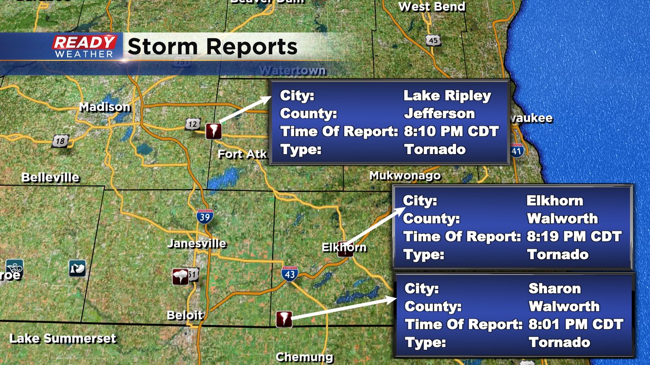
The storms were strongest in Jefferson and Walworth Counties before moving north and east into less favorable environments where there wasn't as much warmth or moisture. An observed tornado was reported in Walworth County with tornado debris being picked up on radar from Darien northeast to East Troy. A second tornado was also observed in Jefferson County near Lake Mills. The National Weather Service will likely survey the damage from these tornadoes over the next few days to determine what strength they were.
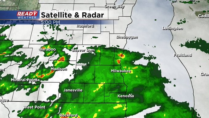
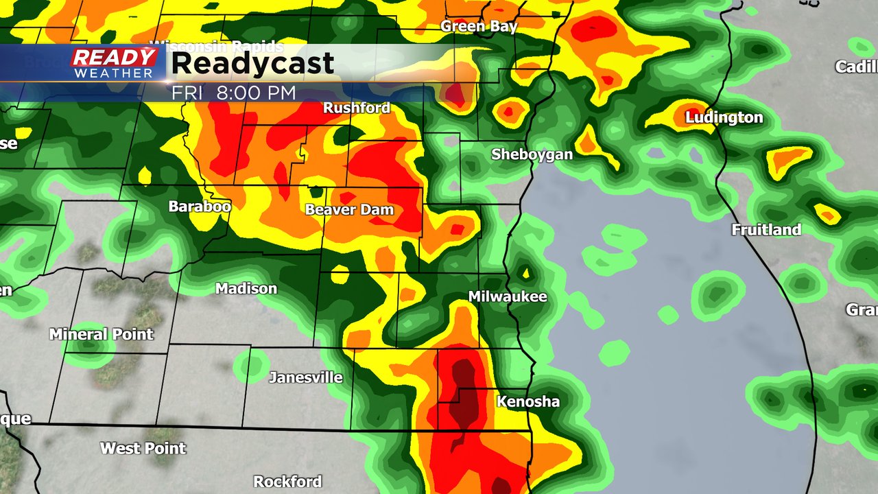
Here is a radar image that will update with time to track the lingering showers and storms:
------
Updated: 8:35 p.m. Mar. 31, 2023
As of 8:30 PM all tornado warnings have been canceled across southeast Wisconsin. A Severe Thunderstorm Warning is still in effect for parts of Jefferson, Waukesha, Milwaukee, Racine, Kenosha and Walworth Counties until 9:30 PM. Wind gusts up to 60 mph are possible.

------
Updated: 8:22 p.m. Mar. 31, 2023
Two observed tornadoes are currently on the ground in southeast Wisconsin. The first tornado in Walworth County has been showing a tornado debris signature indicating that damage from the tornado has been lofted into the air. Darien, Delavan, Elkhorn and East Troy have been hit by this storm. The warning in Walworth County is in effect until 8:30 PM.
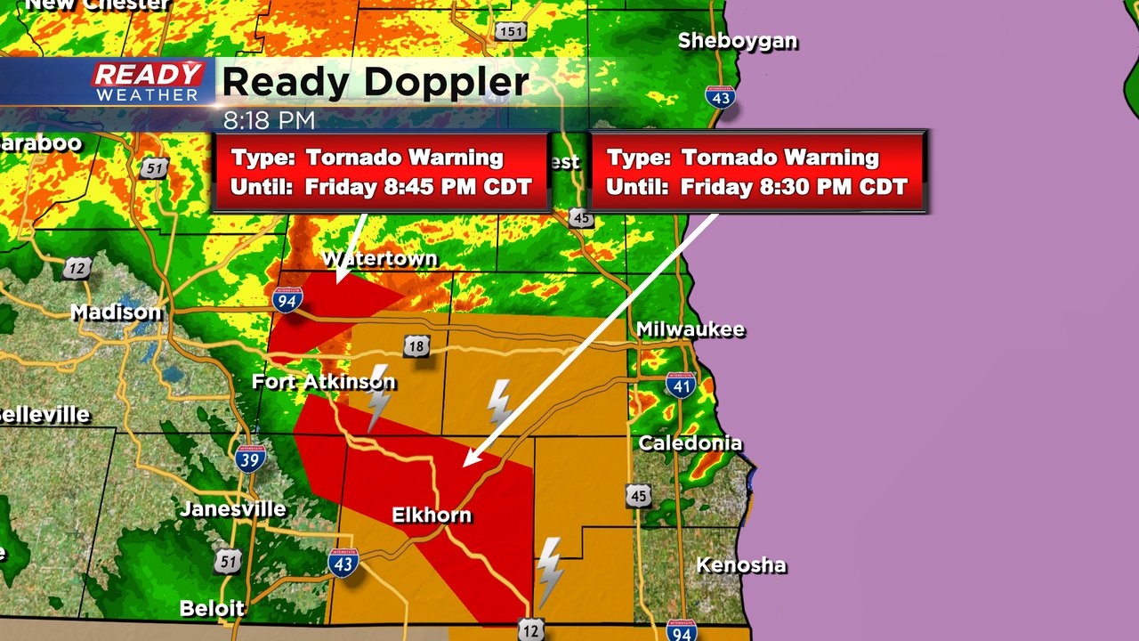
A second tornado has been confirmed near Lake Mills in western Jefferson County. This tornado warning goes until 8:45 PM.
------
Updated: Friday, March 31st 7:05pm:
A severe line of storms is racing to the northeast as 65 mph. The entire line is severe or tornado warned for intense straight-line winds and embedded tornadoes.
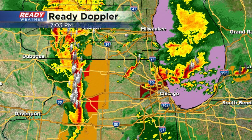
This is still on track to cross southeast Wisconsin between 8-10pm. Download the CBS 58 Ready Weather App to get any warnings sent directly to your phone.
---------------------------------------------------------------------------
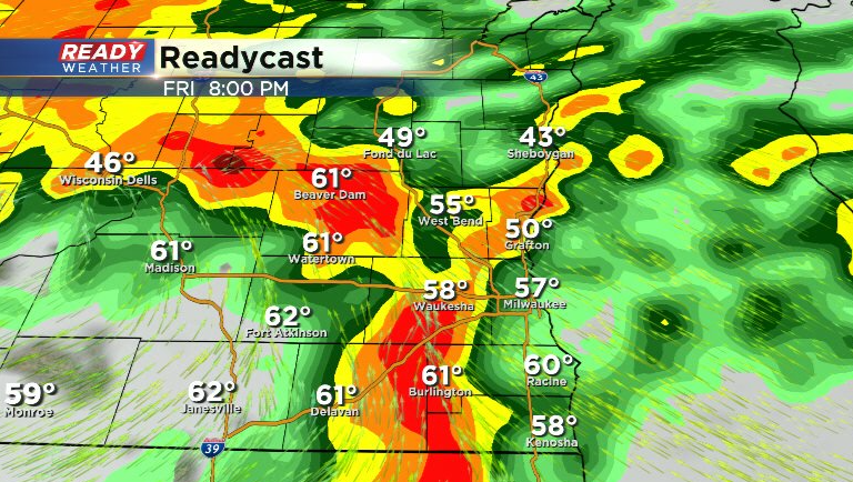
Update: Friday, March 31st 5:15 pm:
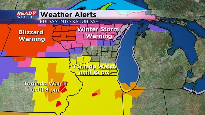
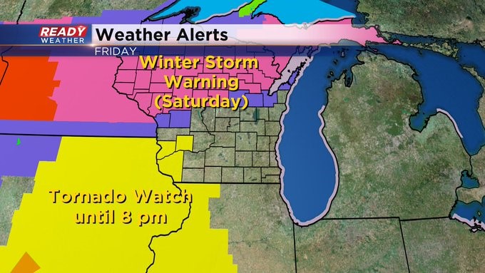
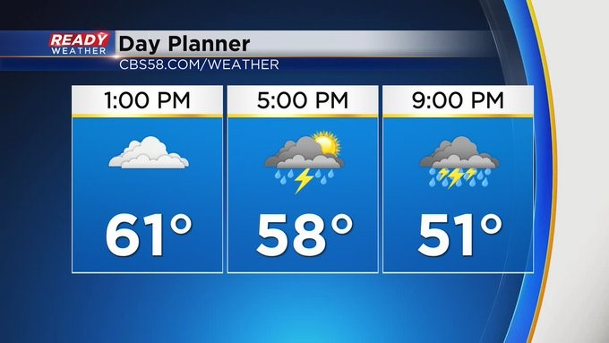
A few showers and storms, non-severe, have made their way across southeast Wisconsin. We still have the chance of strong to severe storms through 9 pm. The Tornado Watch lasts until 10 pm for the southern half of the viewing area. Late tonight, the rain switches to snow. Could see a slight accumulation through Saturday morning.
_
Updated: Friday, March 31st 2:45pm:
A Tornado Watch has been issued for Milwaukee, Racine, Waukesha, Kenosha, Walworth, and Jefferson counties through 10 pm this evening.

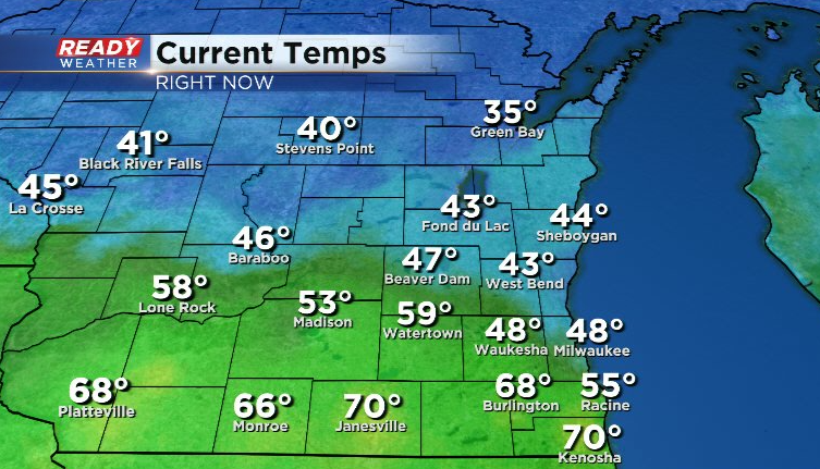
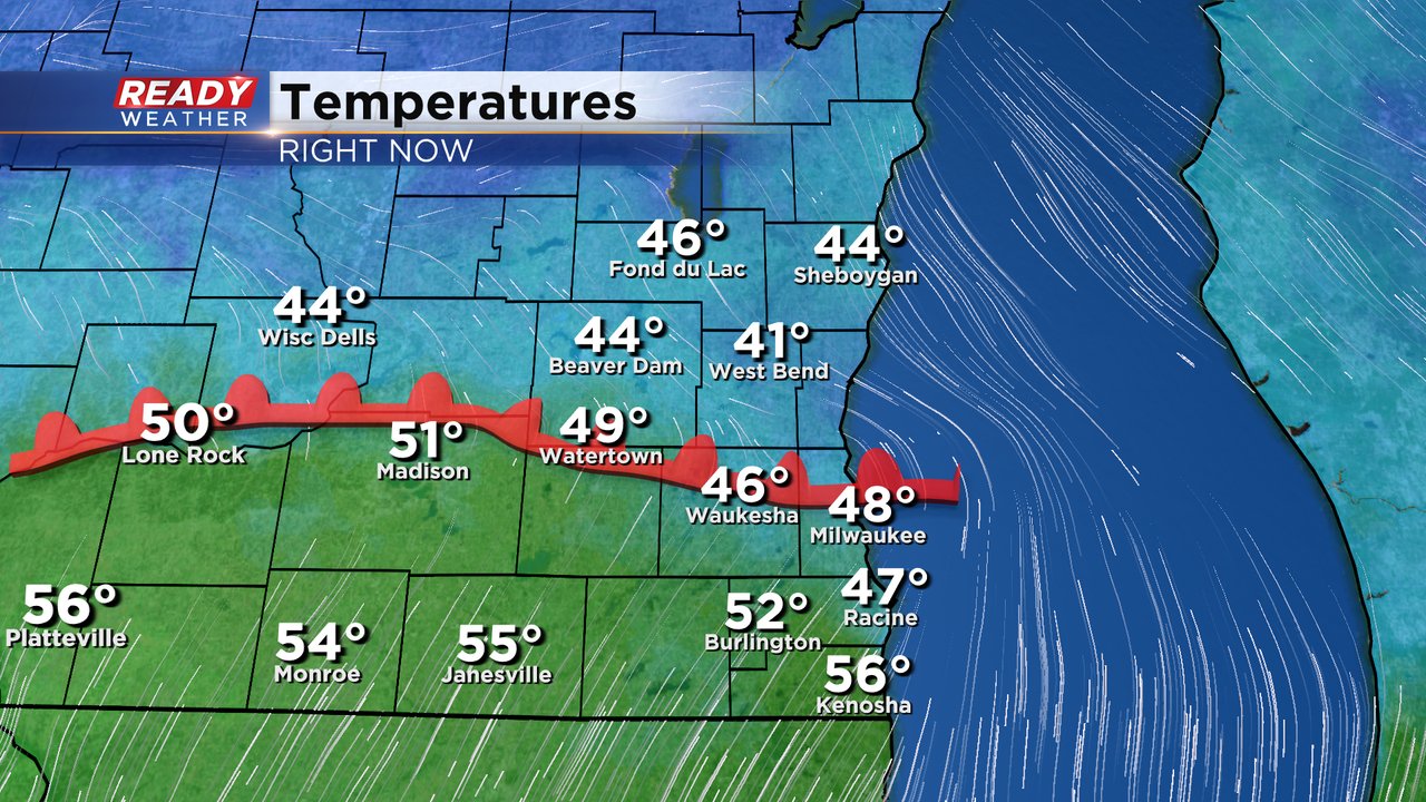
The warm front is currently draped across these counties and has put temps in the mid 60s to low 70s from Kenosha to Jefferson.
This has allowed the area to rapidly become favorable for severe storms. Currently, a cluster of severe storms located in western Illinois is racing to the northeast at 70 mph towards an area favorable for intensification.
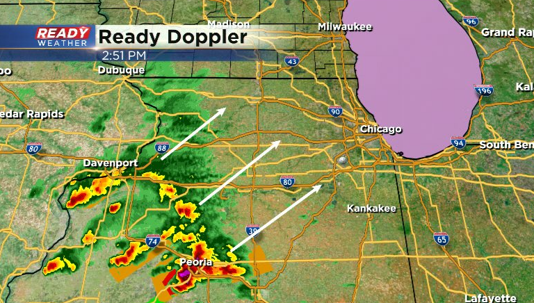
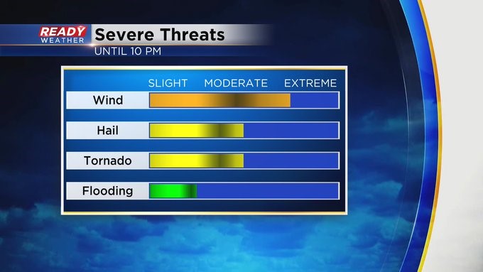
Storms will reach the Wisconsin Illinois border between 4-5pm and pose a risk for tornadoes, damaging winds, and large hail. A second round of severe storms with mainly a damaging wind risk will move through the area between 8-10pm.
Download the CBS 58 Ready Weather App to get warnings send to your phone.
------------------------------------------------------------
Updated: 12:30 p.m. Mar. 31, 2023
A Tornado Watch is issued until 8 p.m. just west of our area. Wouldn't be surprised if some kind of watch is issued here in the next few hours. I do think we're quiet until 3 or 4 p.m. I think there will be two rounds of storms, one late in the day and the other toward mid evening.
Of course the CBS 58 Ready Weather team will be monitoring the situation all day.
_____________________________________________________________________________________________________________
Updated: 9:14 a.m. Mar. 31, 2023
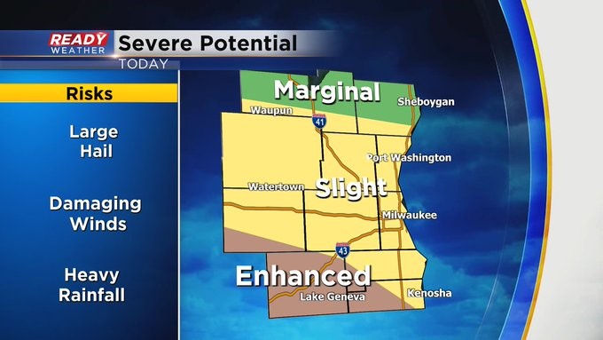
The morning update for the severe risk across the country shows no real changes locally. Southwest counties, especially Walworth County, are still under the Level 3 Enhanced Risk with a Level 2 Slight Risk for most of the Waukesha/Milwaukee Metro area and a Level 1 Marginal risk in Sheboygan and Fond du Lac Counties. The biggest change nationally was expanding the Level 4 Moderate Risk into most of Illinois. That's where tornadoes could be most likely.

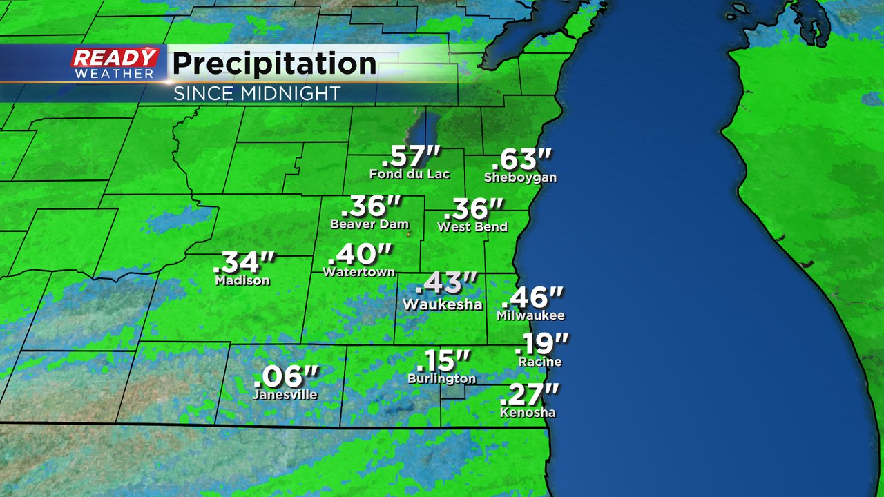
Locally the biggest threat will be damaging wind but a few isolated tornadoes are a possibility. The round of thunderstorms from Thursday night wrapped up around 6 AM. Fond du Lac and Sheboygan Counties may see continued showers the rest of the morning but the rest of southeast Wisconsin will stay fairly dry until the afternoon. Rain totals already range from 0.25-0.50" with last night's rain.
The warm front will be a focus of severe storms Friday afternoon and evening. That front slowly pushed north early this morning and now sits just north of Milwaukee and Waukesha. Areas within the "warm sector" or south of the warm front have the best chance for severe weather as well as the warmest highs in the 60s.
The National Weather Service is already eyeing Missouri for the start of a Tornado Watch. Our risk is better in the afternoon. Download the CBS 58 Ready Weather app to track storms as they develop and get alerts when warnings are issued.
------
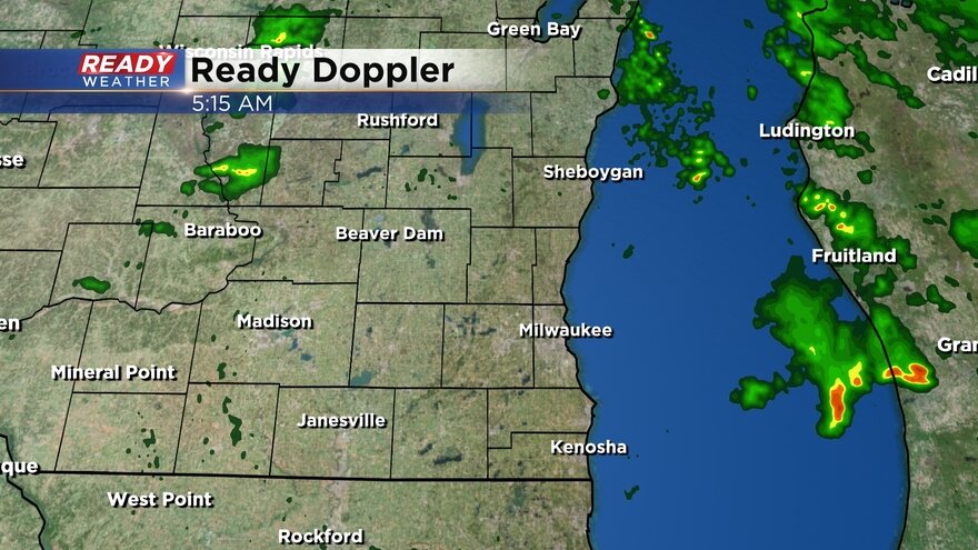
Posted: 6:21 a.m. Mar. 31, 2023
The severe risk for Saturday is still here. Our first round of showers and thunderstorms is just about over as a round of non-severe thunderstorms rolled through southeast Wisconsin between 2-6 AM. Some communities have already picked up nearly a half inch of rainfall from the overnight storms. Now besides a few stray showers we stay mostly dry the rest of Friday morning through the early afternoon. Our next chance for severe storms arrives after 3 PM with best chances between 5-9 PM.
Storms during the late afternoon and evening have the best chance to become severe. Locally there are no major changes to the severe risk we showed you Thursday afternoon with a Level 3 Enhanced Risk still in place for Walworth County and parts of Jefferson, Racine and Kenosha Counties. Most of the rest of southeast Wisconsin is in the Level 2 Slight Risk with parts of Fond du Lac and Sheboygan Counties under the Level 1 Marginal Risk.
The greatest chance for severe weather is still in eastern Iowa and western Illinois where a Level 4 Marginal Risk is in place.

Locally, the tornado threat has increased a bit but mainly in those areas under the Enhanced Risk and specifically Walworth and Kenosha Counties. Damaging wind still remains the biggest threat with a secondary threat for hail.

Rain totals by the end of Friday should reach or even surpass 1". Flooding is not expected to be a big issue but some ponding on area roadways is a possibility.

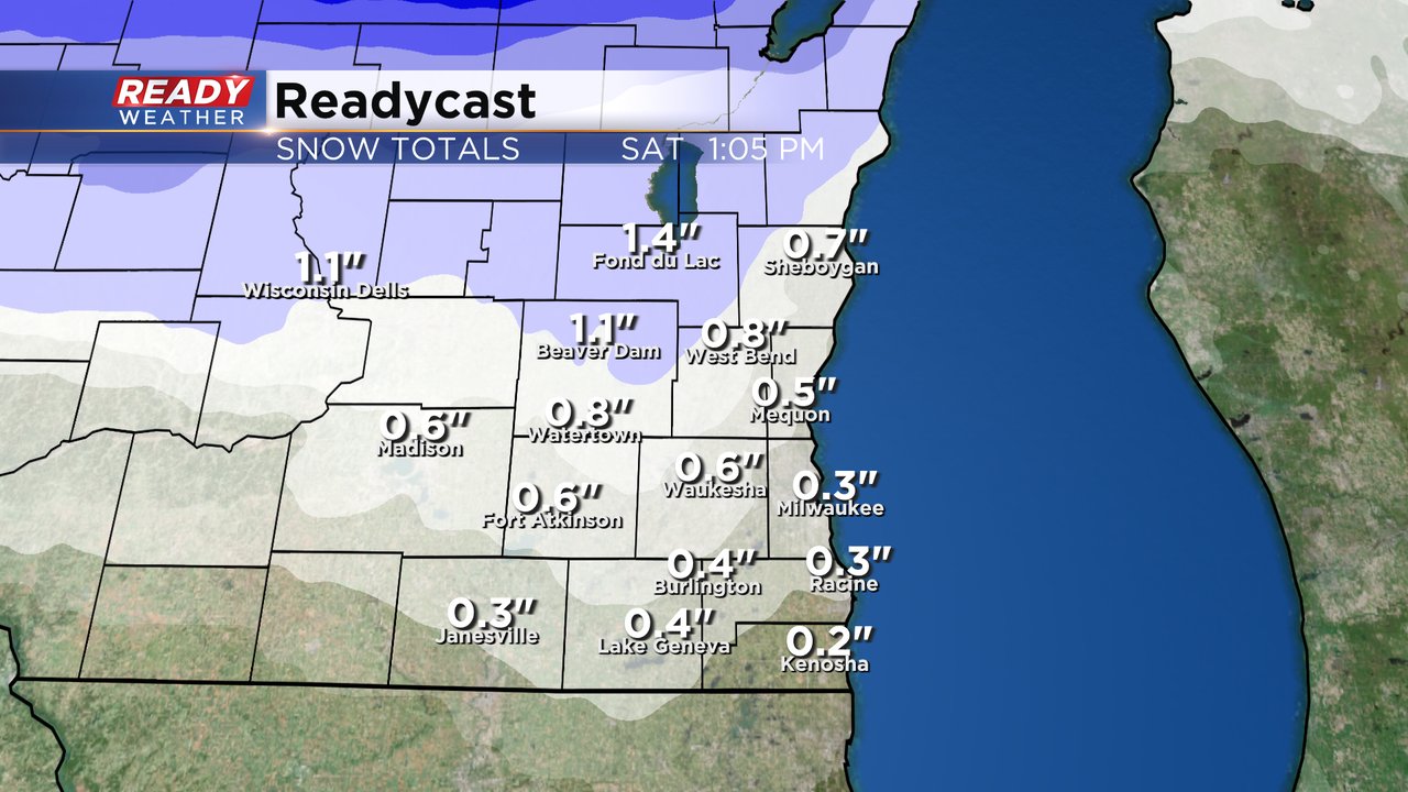
As this storm system wraps up we see a round of wet snow Saturday morning ending around noon. Anywhere from a dusting to 1.5" of new snow is possible. Most of that snow will melt Saturday afternoon as sunshine returns so don't bother shoveling.
Download the CBS 58 Ready Weather app to get warnings, track changes in the forecast and see when the severe threat ends.