4 PM Update: Isolated severe threat continues well northwest of Milwaukee
Updated: 4:00 pm Sunday August 8th:
Storms have thankfully been disorganized so far this afternoon in southeast Wisconsin, while a more organized cluster of strong to severe storms is tracking northeast through central Wisconsin. This cluster of storms has even produced a funnel cloud in Waushara county near Coloma.
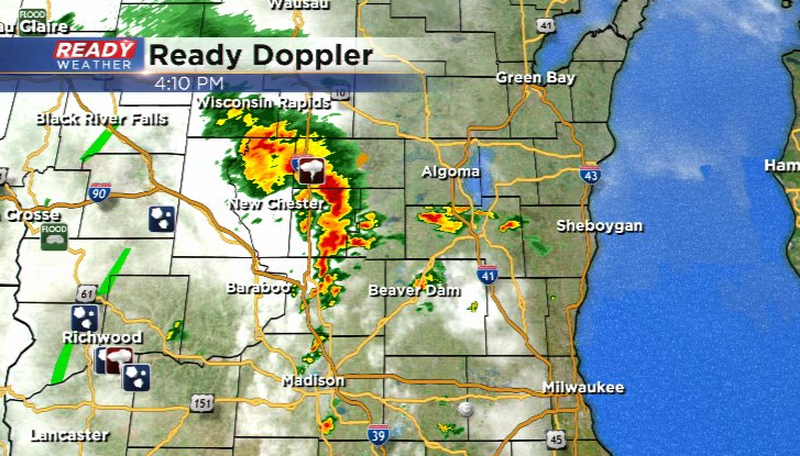
Will be watching the southern end of this line as it tracks near western Dodge and Fond du Lac counties over the next hour for any potential severe weather.
-------------------------------------------------------------------------------------------
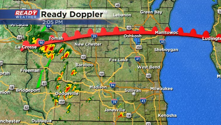
Updated: 2:00 pm Sunday August 8th:
A Severe Thunderstorm Watch has been issued for Dodge, Fond du Lac, and Sheboygan counties until 8 pm.
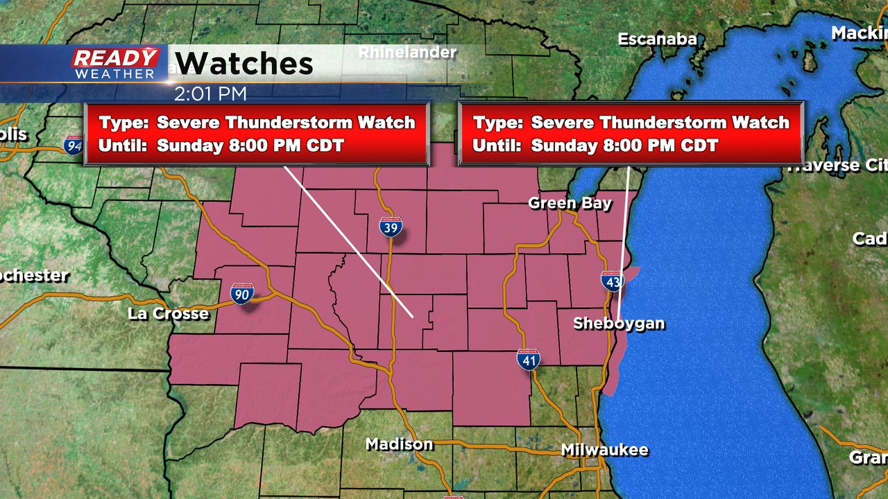
Scattered storms are beginning to fire in southwest and south central Wisconsin and will continue to intensify as they track northeast.
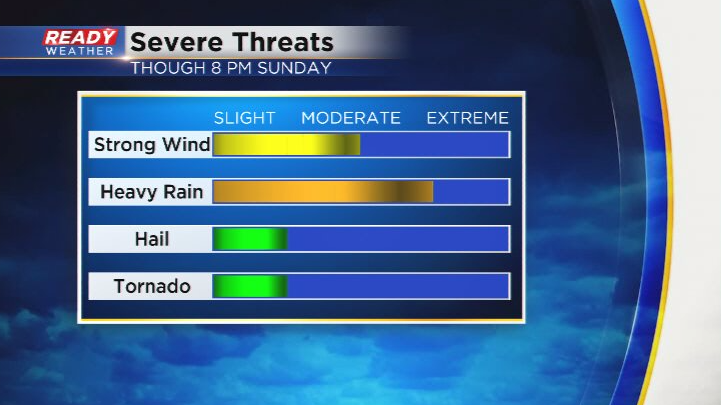
Damaging winds will be the main threat in storms, along with torrential downpours. However, there is a small tornado risk closer to the warm front.
Download the CBS 58 Ready Weather App to get any warnings sent to your phone.
------------------------------------------------------------------------------
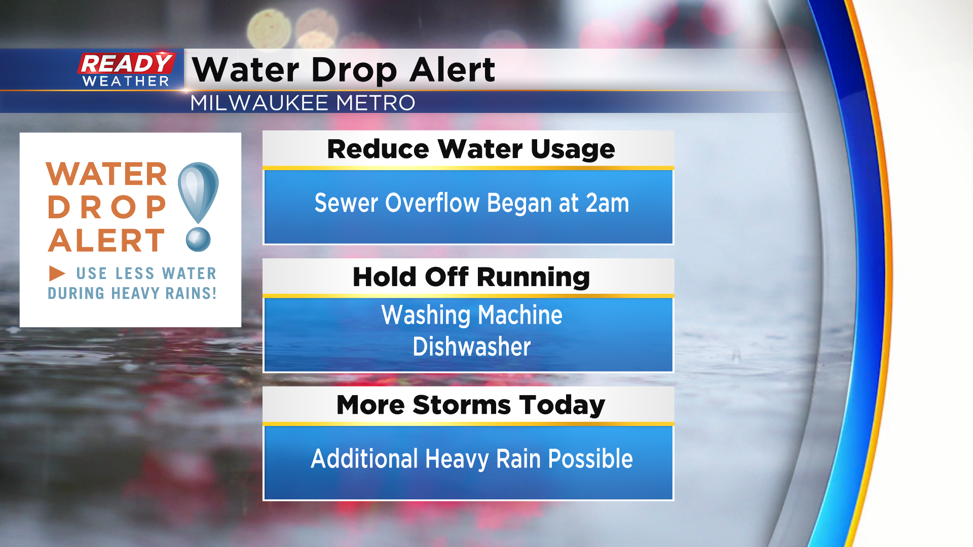
The training thunderstorms overnight provided a drought busting rain for Milwaukee, Ozaukee, and Washington counties! Between 3-6" of rain fell in these areas, which lead to flooding.

The heavy rain lead to a combined sewer overflow in the Milwaukee Metro, so MMSD has issued a Water Drop Alert. Please conserve water today to help with this overflow, especially since more scattered storms are expected later today.
We'll be dry, hot, and humid for most of the morning into early afternoon before scattered storms begin to develop to our west mid afternoon. Best chance of scattered storms in southeast Wisconsin is from late afternoon through the evening.
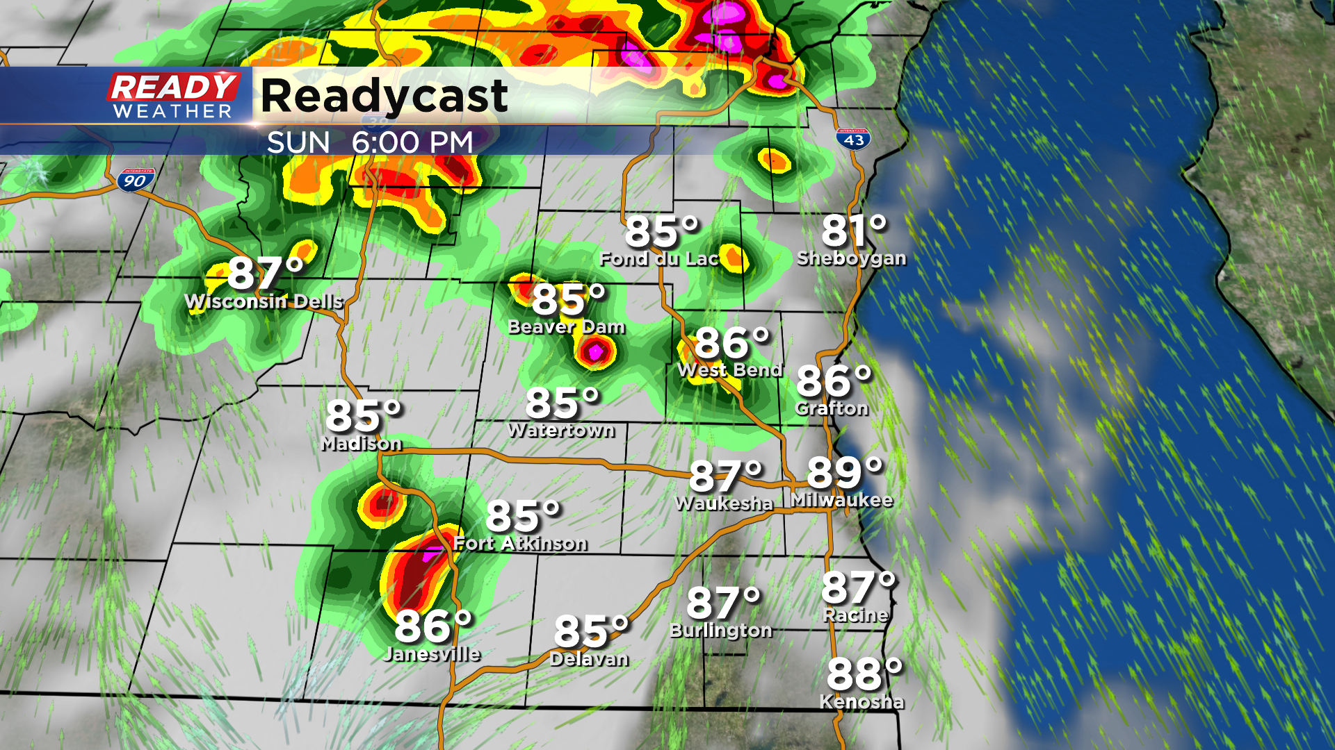
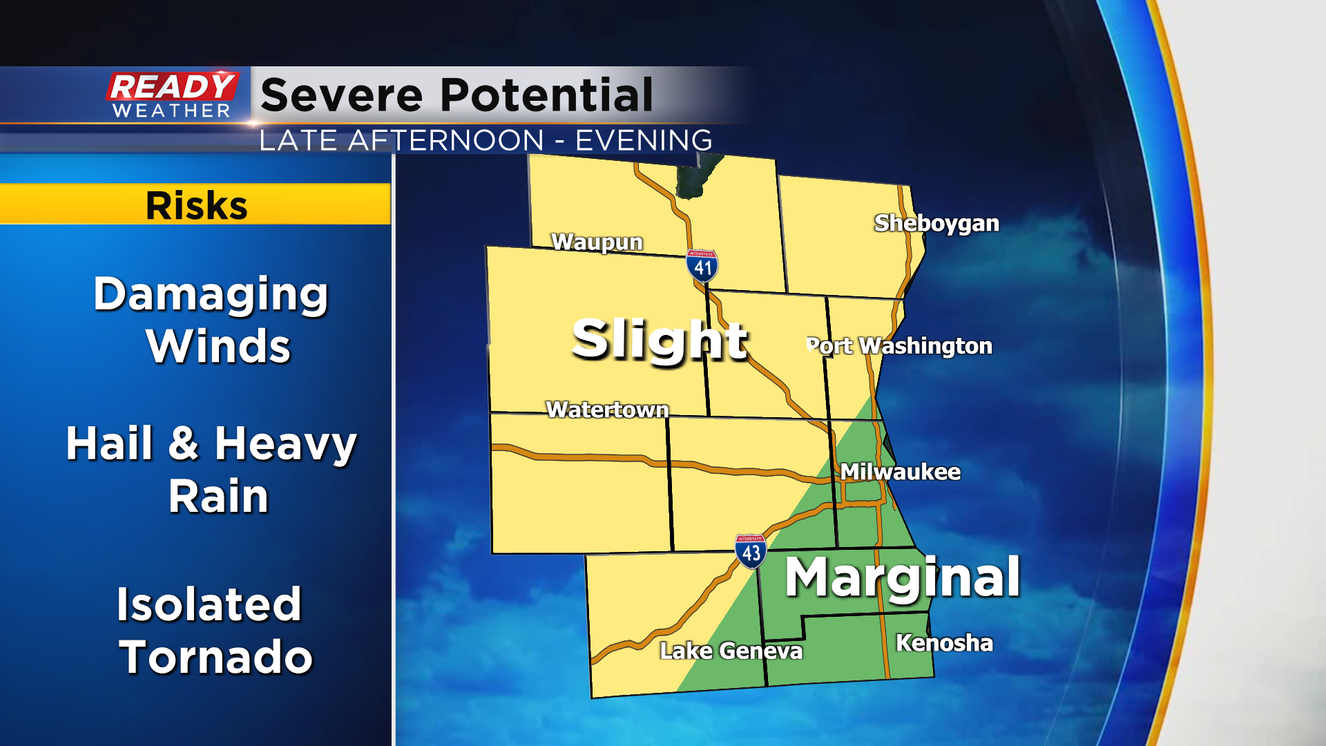
With all of the heat and humidity in place, storms could be strong to severe. Damaging winds and large hail are the main threats, but isolated tornadoes are also possible. A level 2 of 5, Slight Risk, is in place for most of southeast Wisconsin besides Milwaukee to Kenosha.
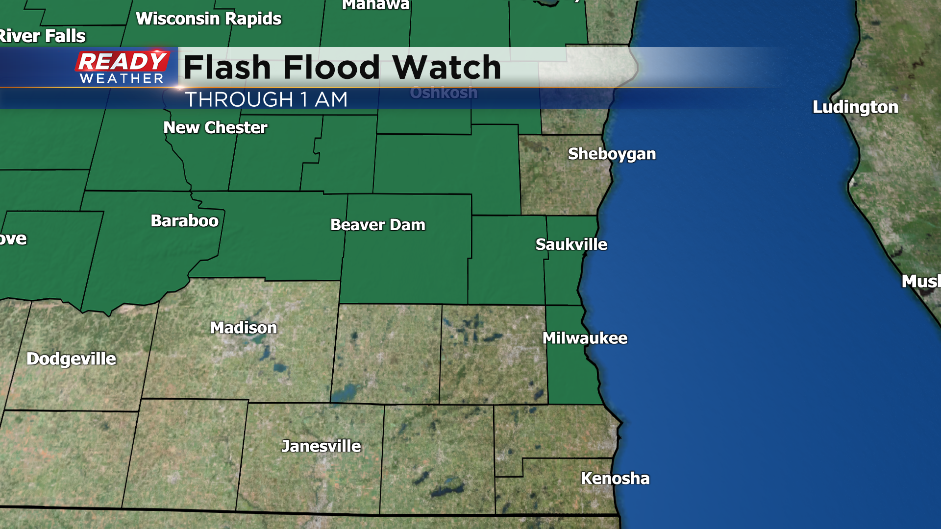
Storms will be efficient rain producers once again today, which could lead to flooding on our now saturated soils. A Flash Flood Watch is in place through 1am for Milwaukee, Ozaukee, Washington, Dodge, and Fond du Lac counties.
Download the CBS 58 Ready Weather App to get any watches or warnings sent directly to your phone!
