Scattered rain and isolated storms developing this afternoon
Updated: Wednesday, July 7th 1:00 pm:
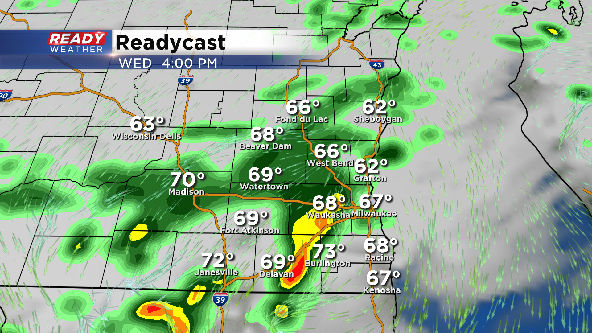
A few isolated storms are starting to pop in Racine and Walworth counties just south of the stalled out front.
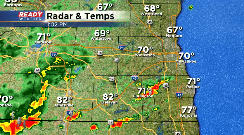
Storms are producing torrential downpours and lightning and have also shown small hail potential. Additional storms will fire this afternoon as the low pressure system and front slide through SE WI. Storms in Walworth county or right along the WI/IL border in Kenosha will have the potential to produce gusty winds.
-------------------------------------------------------------------------------------------------------
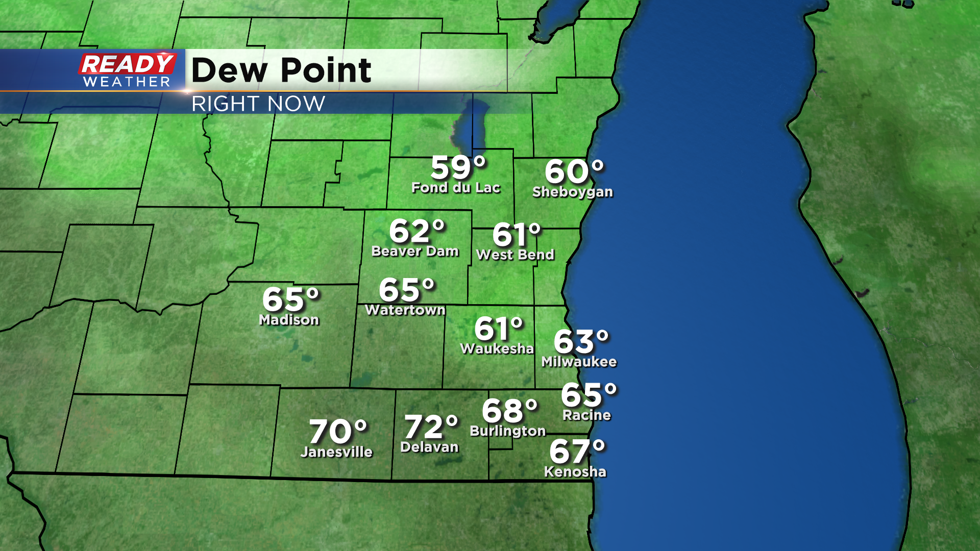
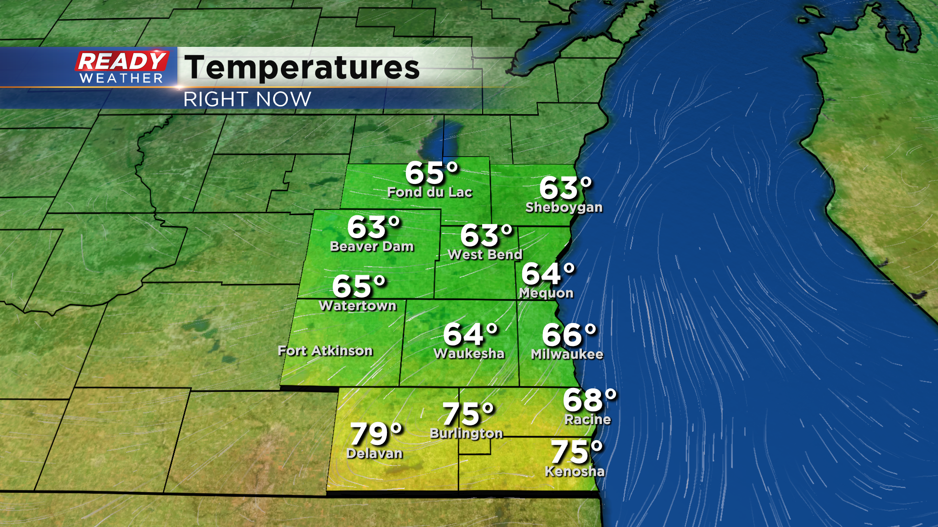
The cold front made it through a majority of southeast Wisconsin before stalling out just south of I-94. So while most of us are enjoying a break from the heat and humidity, it's still a bit muggy near the WI/IL border late this morning.
Rain and a few embedded thunderstorms have been ongoing north of the front since early this morning, with between 1-2.5" of rain falling in Sheboygan and Fond du Lac counties over the last 24 hours.
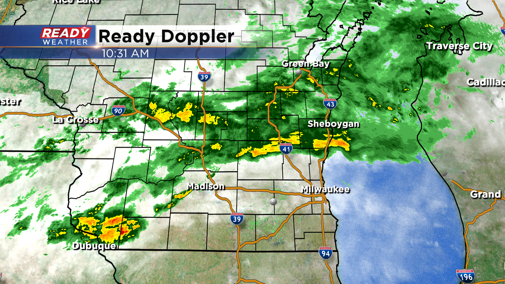
A wave will ride along the front this afternoon, generating more scattered rain and thunderstorms across the rest of southeast Wisconsin.
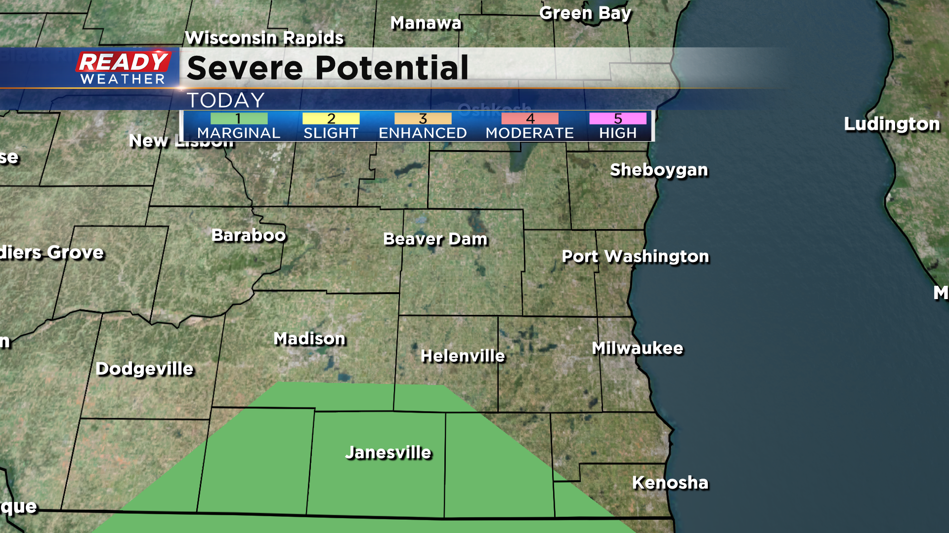
There's a small chance a few storms could become strong and produce gusty winds near Walworth county where there's lingering heat and humidity. A level 1 of 5 Marginal Risk is in place due this threat.
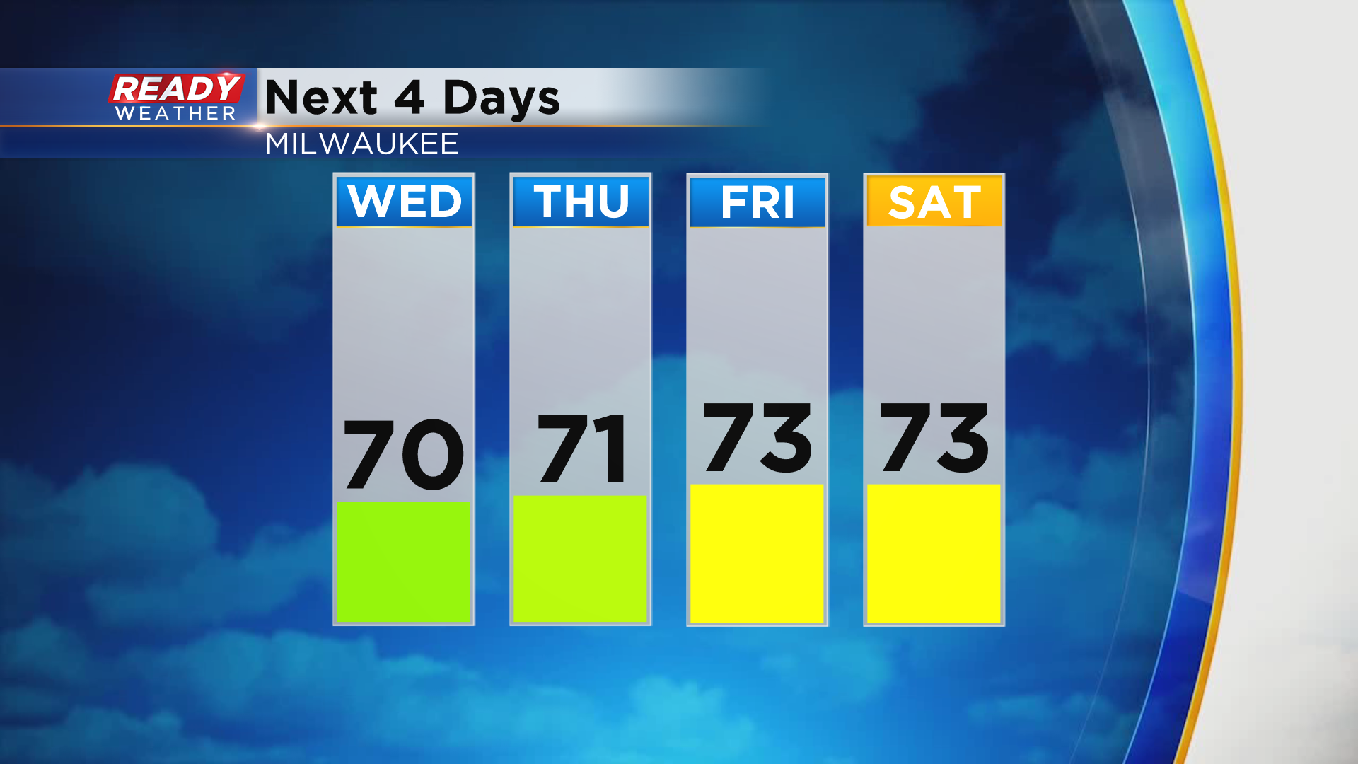
Any storm threat will end around dinner time as the front pushes south of the state, but spotty showers will likely linger into the evening before tapering off overnight. We'll be cooler and less humid behind this front for the rest of the week with highs generally in the low to mid 70s.
Download the CBS 58 Ready Weather App to see if there are any more rain chances heading into the weekend.
