Round of snow looking likely for Tuesday night


10:30pm Monday Update:
Our first widespread decent snowfall is still on track to reach the area by early evening Tuesday. As this storm kicks out of the deep south it will pull plenty of moisture and milder temps into our area. The onset of this storm may feature some sleet but any wintry mix should quickly changeover to snow by mid evening. Temperatures will continue to hold around freezing and by Wednesday morning temps will rise to the mid 30s so the tail end of this storm may go back to a wintry mix. Also keep in mind that a breezy southeast wind will be in place so visibility will likely be poor as the storms unfolds.
2:30 pm Monday Update...
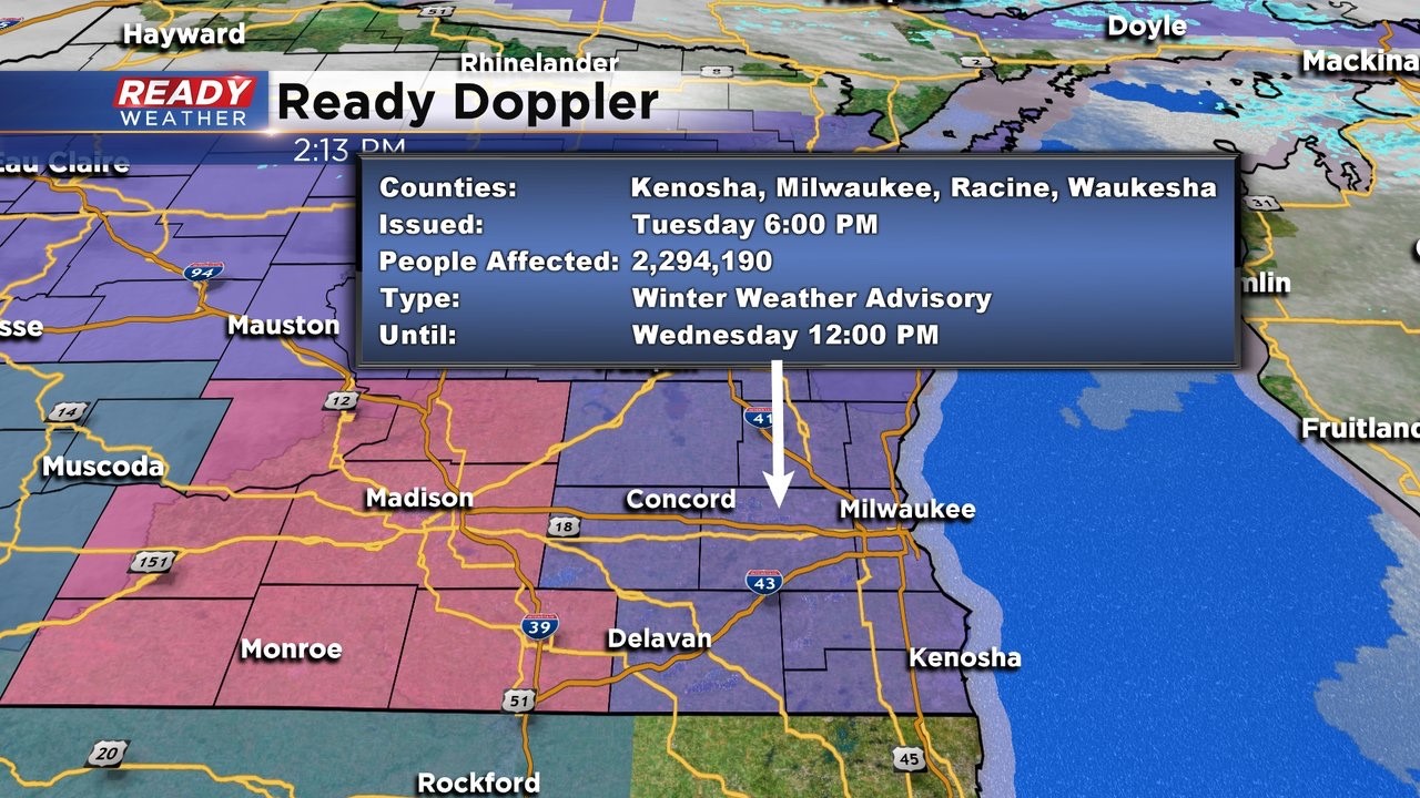
The National Weather Service has issued a Winter Weather Advisory from 6 pm Tuesday until noon on Wednesday. Meantime, a Winter Storm Warning is in place for the same time just west of us. This is where we'll probably see higher amounts. But locally, 4-6"+ looks to be a good range. Again, this will be heavy, wet snow since we're not expecting an arctic intrusion. So please be very careful shoveling. Roads could become hazardous into Tuesday night and early Wednesday. Keep in mind any kind of icing Wednesday morning will make it even more slick ______________________________________________________________________________________________________________
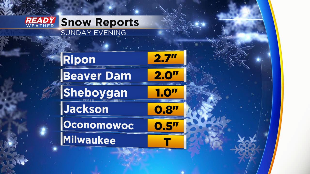
As soon as our last round of snow finished our sights were set on our next one. Parts of southeast Wisconsin saw a couple inches of snow Sunday evening. Fond du Lac and Dodge Counties saw the most with 1-3" there. Milwaukee only picked up a trace so no measurable snow there but it was enough to make roads slick so watch out for icy spots Monday morning.
With no measurable snow Sunday morning Milwaukee is running almost exactly 11" below-average on snowfall for the season and is the second least snowy start to the season on record. But a chunk of that deficit could be made up later this week.
Snow is likely Tuesday evening lasting through most of Tuesday night, heavy at times, and wrapping up Wednesday morning. The Tuesday evening commute should be ok unless you don't get out of work until late. One of the questions in the forecast is how much sleet, freezing drizzle and rain mix in Wednesday morning.

Winter storm watches and warnings and winter weather advisories have been issued ahead of this storm for areas to our west. Nothing has been issued for southeast Wisconsin yet but at least an advisory is likely for part of southeast Wisconsin.

The latest trend with weather models over the last 24 hours has been to shift the track of the storm south a little bit. If that trend continues, we may see less snow across our northern counties and more in our southern counties. Right now 3-6" of snow is a good bet for most of us with the least amounts expected south of a line from Milwaukee to Lake Geneva. There is the possibility for up to 10" of snow. The exact placement of that is uncertain but our far western areas towards Madison stretching down into NE Iowa look to have the best chance right now.

Download the CBS 58 Ready Weather app to track any changes to the forecast and track the snow as it arrives.