


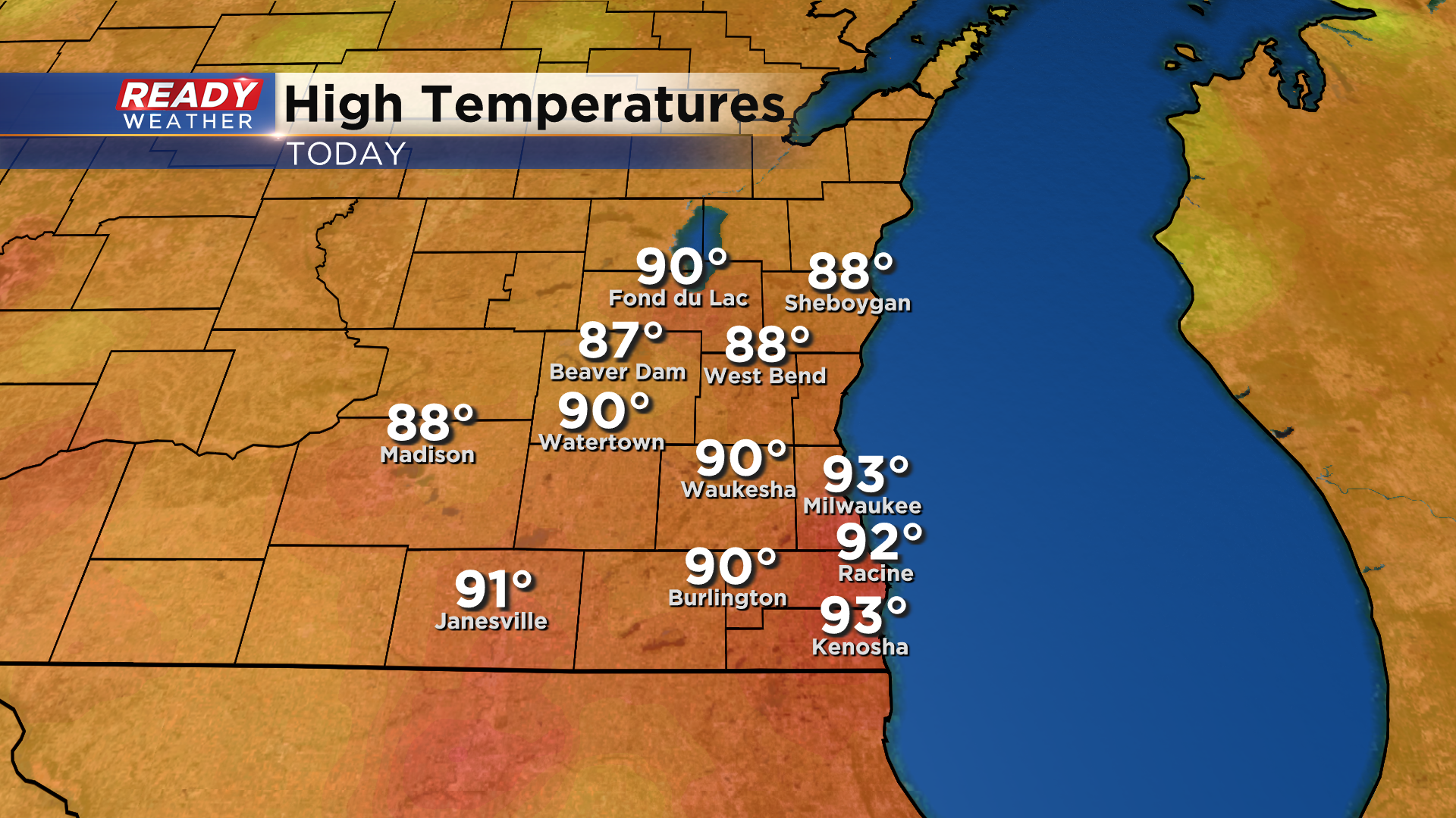
It was another hot day across southeast Wisconsin with temps climbing into the upper 80s to low 90s. However, it felt a lot better than Saturday thanks to dew points sitting in the 40s and 50s instead of lower 70s.
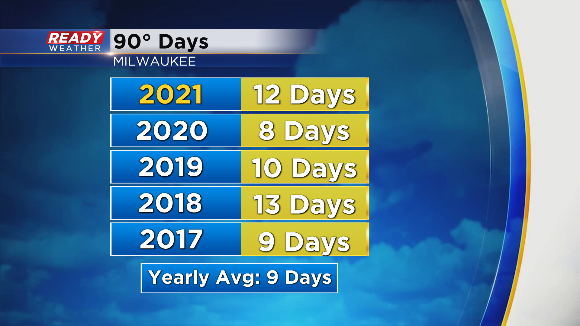
It was already our 12th day in the 90s this year! On average, Milwaukee typically experiences nine 90 degree days each year.
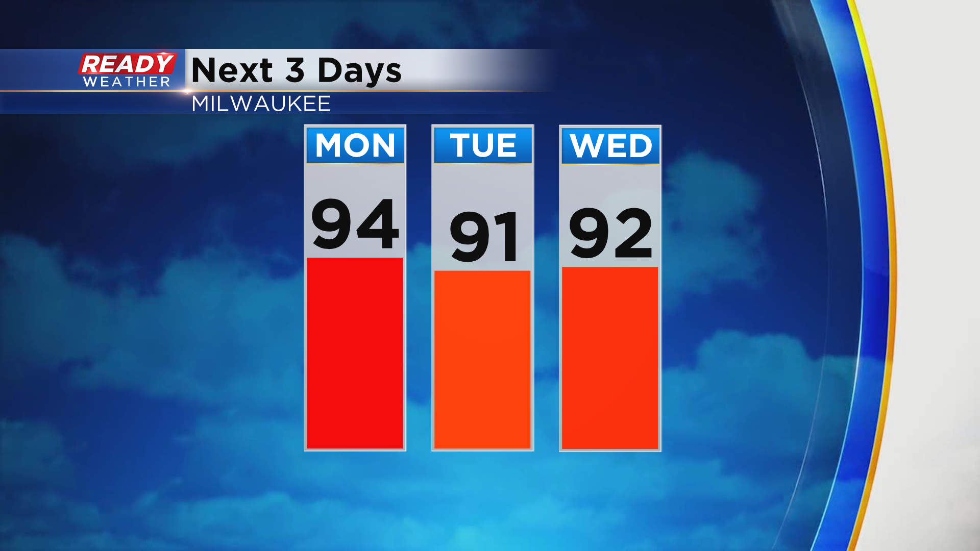
We aren't done with the 90s quite yet either. Temperatures remain in the low to mid 90s on Monday and will make a run at 90° both Tuesday and Wednesday.
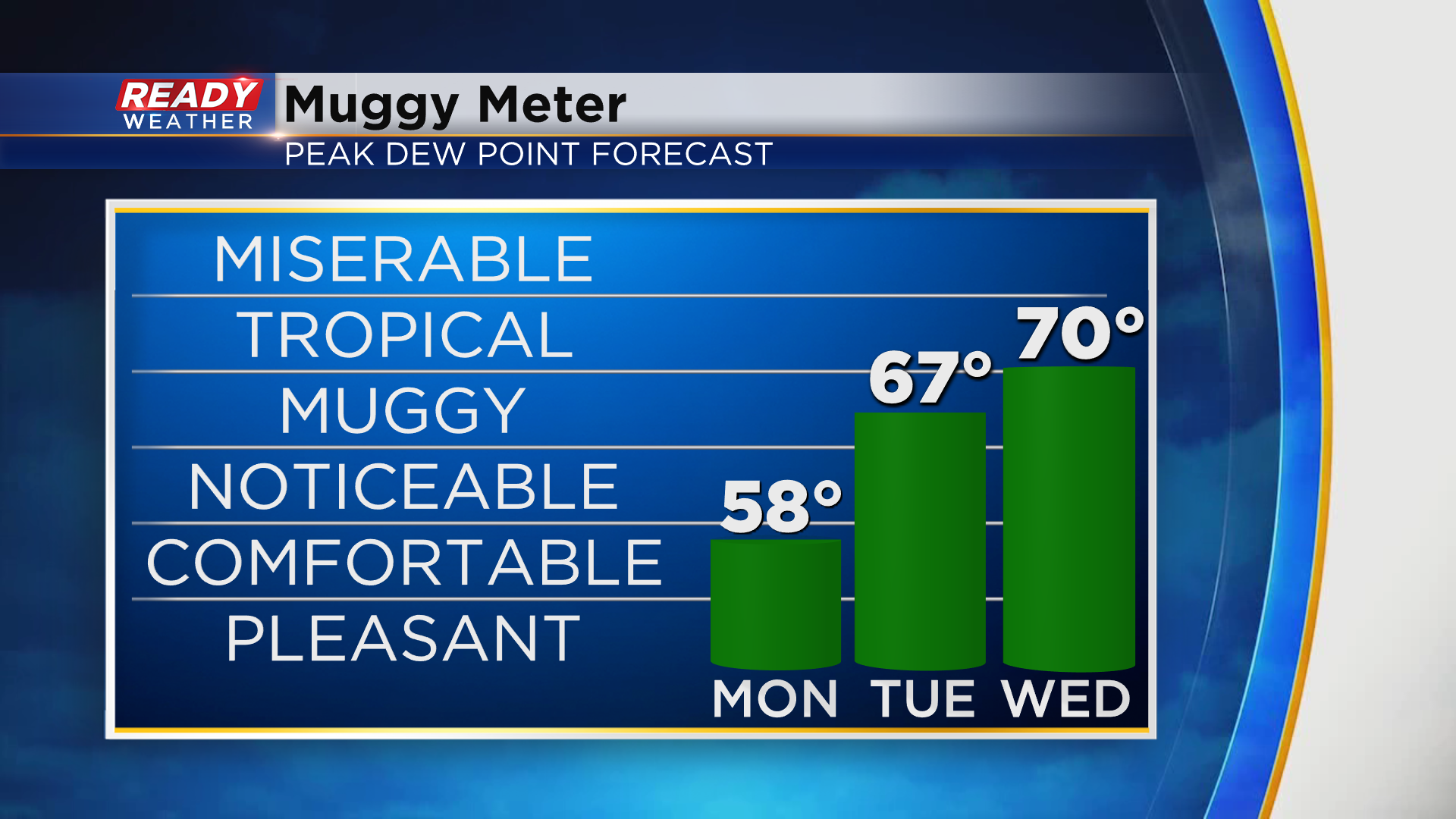
While humidity will remain in check again on Monday, it'll start to feel quite muggy on Tuesday and Wednesday as they climb back into the upper 60s to low 70s.
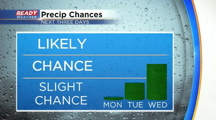
After another dry and sunny day on Monday, we'll have a slight chance for a few showers and storms on Tuesday. A round of strong to severe storms will track across the Northwoods Monday night, as a few of these may clip southeast Wisconsin. However, they will be falling apart as they move into our neck of the woods so most spots will likely stay dry.
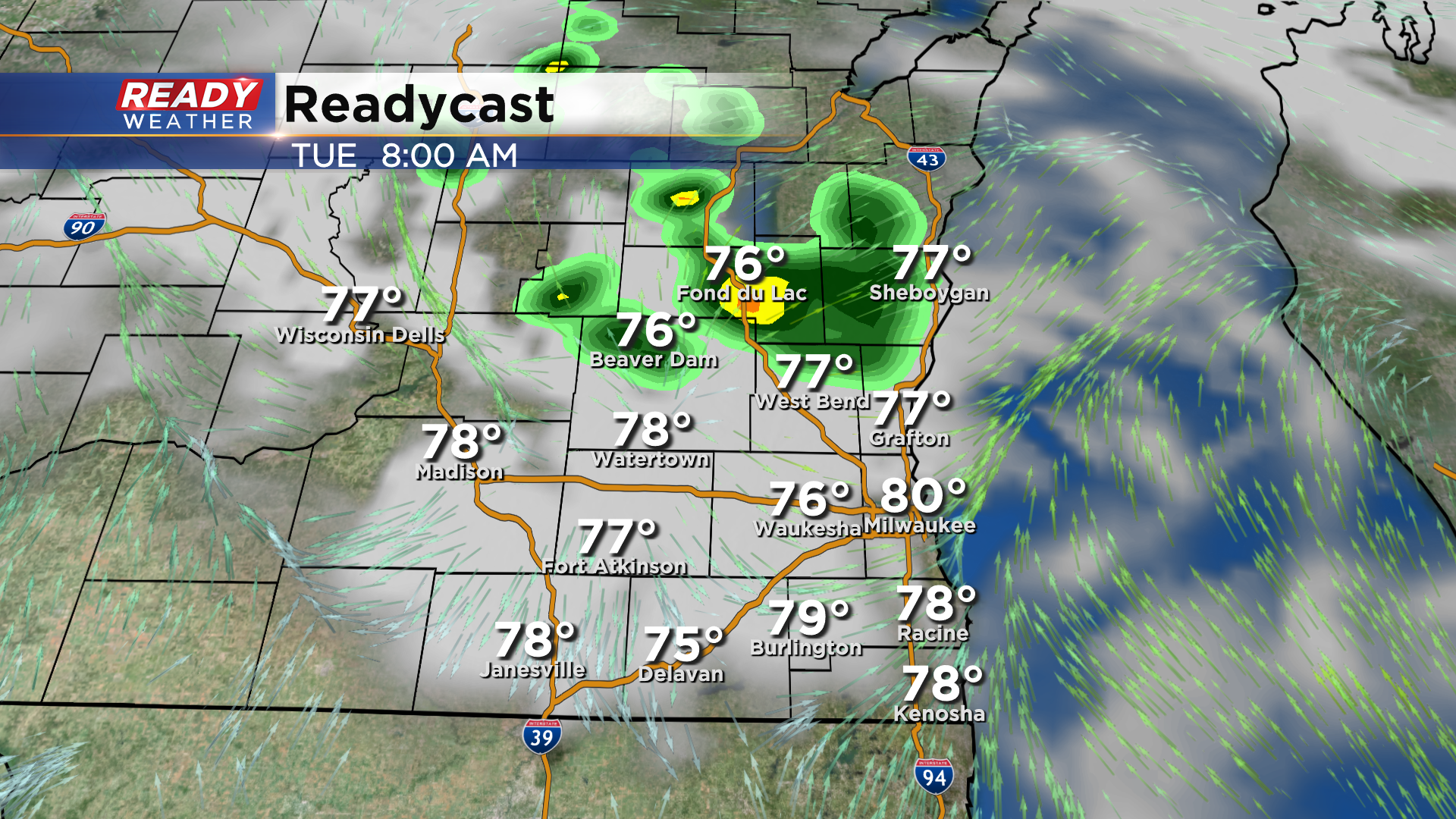
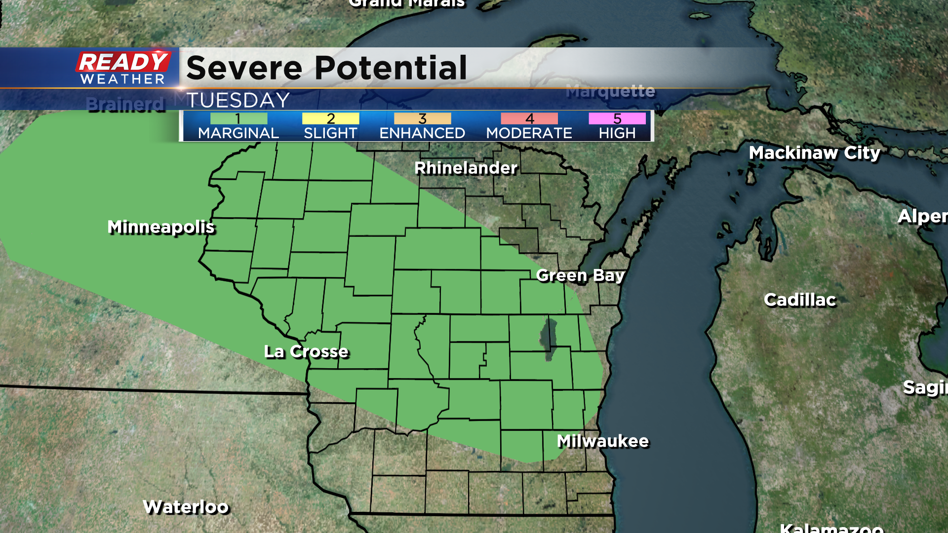
This morning round will lay a NW to SE oriented boundary across southeast Wisconsin Tuesday afternoon, which could serve as a focus for more isolated storms later in the day Tuesday. However, it looks like we may remained capped due to the hot air in place, and there's also some drier air that the rain would have to fight through. *If* storms are able to fire, they could be on the stronger side. A level 1 of 5 Marginal Risk is in place for portions of the state for Tuesday.
A little better chance of storms arrives late Wednesday into Wednesday night as a cold front moves through.
The heat and humidity will finally leave behind the cold front. Download the CBS 58 Ready Weather App to see how cool temps will be to end the week.