Mid Evening Update: Storm potential still exists but severe weather threat dwindling


Updated 8:30 pm Oct. 11, 2021
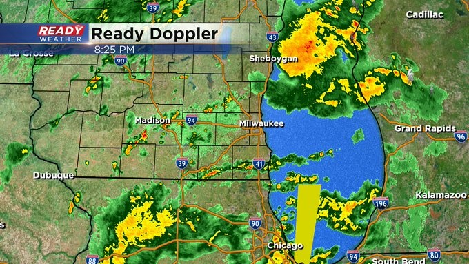
Rain and some thunder are beginning to push in from the south. All the volatile weather across Illinois is beginning to dwindle. So the threat for us is dying down as well. However, we can't rule out scattered showers and thunder into the overnight. We still have another chance of storms on Wednesday, especially afternoon into the evening. So stay tuned.
-----------
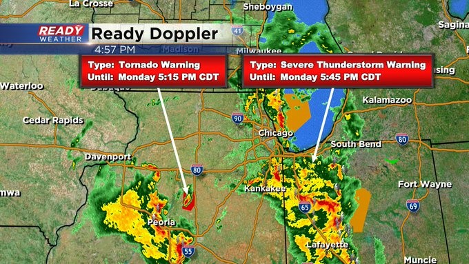
Updated 6:30 pm Oct. 11, 2021
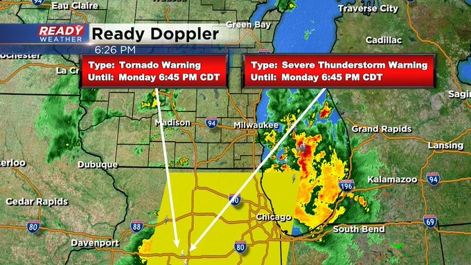
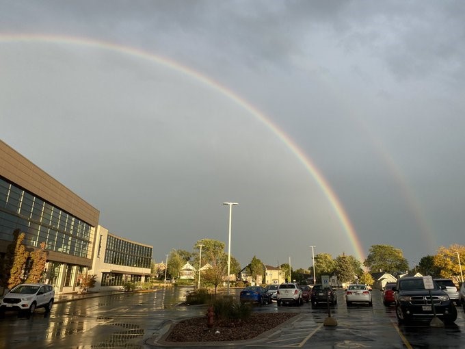
Still playing a wait and see game with storms just to our south. A Tornado Watch remains in place until 9 pm for most of Illinois. A few stronger storms could find there way across southeast Wisconsin a little later this evening, say after 7:30 pm. Stay tuned. In the meantime, we've been getting great photos of double rainbows across the area from late in the day. We'd love to see your photos as well. Please send to [email protected]. Or you can send them via our free CBS 58 weather mobile app.
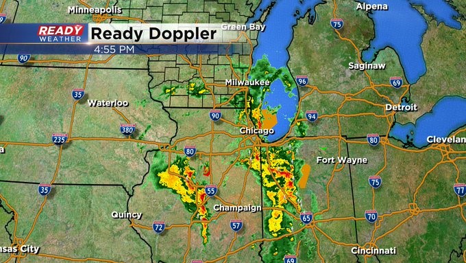
Updated 5:00 pm Oct. 11, 2021
We're still watching and waiting what's coming our way this evening from the south in Illinois. It's here we have some active weather warnings. The best window of opportunity looks to be between 7 and 10 pm. Heavy rain, hail, and damaging winds are all possible. Even isolated tornadoes. Again, keep it tuned to CBS 58 on air or online for the latest.
-------------
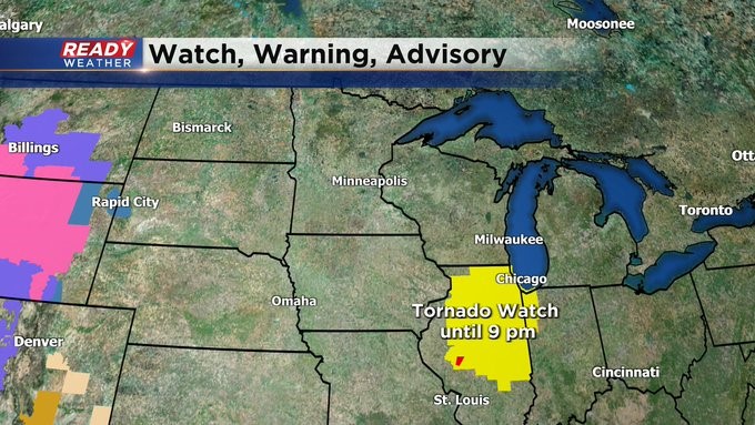
Updated 3:15 pm Oct. 11, 2021
A Tornado Watch is now in effect until 9 pm for a good chunk of Illinois. We're still waiting to see what crosses the state line into this evening. Keep it here, and we'll let you know as the time gets closer. Meantime, the chance for storms with heavy rain will continue into the early morning hours of Tuesday.
---------
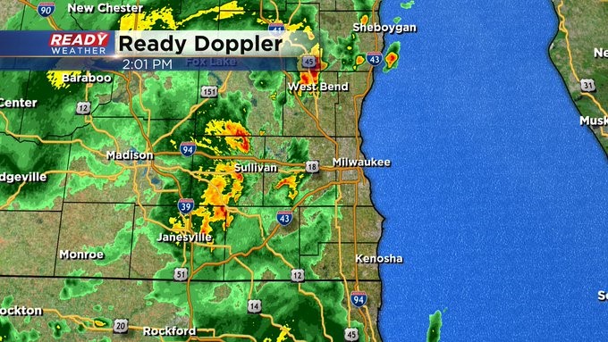
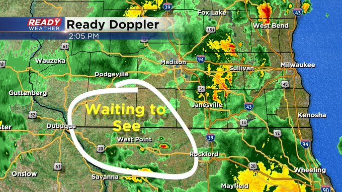
Updated 2:00 pm Oct. 11, 2021
All quiet, still, on the weather front. Most of what we're seeing on the radar now is just heavier rain, especially in western Jefferson County toward Janesville. We're waiting on possible development across western Illinois and Iowa for later in the day. The Storm Prediction Center has stated there's a 40% some kind of watch will be issued later this afternoon for our region. So keep tuned to CBS 58 both on air and online for the latest information.
------
Updated: 12:03 p.m. Oct. 11, 2021
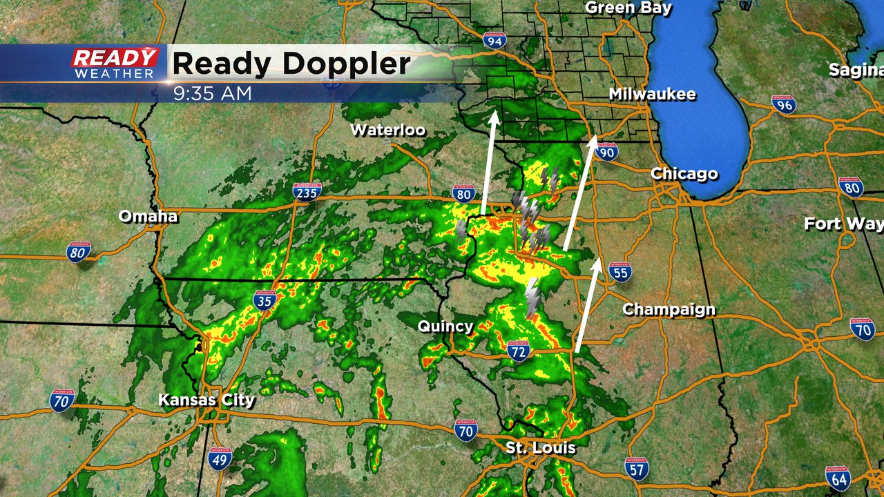
A few showers and a few storms have started to roll in to southeast Wisconsin. Right now the best storm is in Walworth County moving north into Waukesha County but it is not strong nor severe. There are more storms around the Rockford area that will move north into south central Wisconsin through the early afternoon.

Expect more waves of these storms as the low pressure moves closer to southeast Wisconsin. As we get deeper into the afternoon and evening our chance for strong to severe storms will start to increase. All types of severe weather, including tornados, are possible.
------
Updated: 9:41 a.m. Oct. 11, 2021
A tight low pressure system in northern Missouri continues to move north this morning. It will make a beeline for Wisconsin and move from south to north across our state later Monday evening. As that low pressure gets closer, we will have a few waves of scattered showers and storms that will be possible. As mentioned below, some of these storms could be strong to severe with all types of severe weather possible, including tornadoes. A few showers may be possible this morning but the better chance for stronger or severe storms won't arrive until the afternoon/evening.
------
Posted: 6:58 a.m. Oct. 11, 2021
We had some decent showers and storms over the weekend including one stronger storm early Sunday morning. Rain totals over the weekend weren't too impressive with most in the 0.10-0.25" range but a few spots saw around a half inch. The rain and storm chance continues on Monday with another low pressure storm system moving in bringing a chance for scattered showers and storms, especially in the afternoon and evening.

Some of the storms could be strong to severe. There's limited fuel in the atmosphere with some clouds but there is a lot of spin which could generate some severe storms. All of southeast Wisconsin is in the slight risk (level 2 of 5) for severe weather but all types of severe weather are possible. Strong wind and some heavy rain are probably the bigger threats but some hail and even a few tornadoes are also possible.

Timing for the storms on Monday looks as early as noon in some communities all the way through the late evening. A nice soaking rain is possible for most with 0.25-0.75" of rain possible. But, training thunderstorms are possible which is when storms repeatedly go over the same area. If that happens rain totals over an inch or two are definitely possible.

Make sure you have a way to get alerts if a watch or some warnings are issued. Download the CBS 58 Ready Weather app which will give you those alerts.