Next chance for rain and snow arrives Monday afternoon


We’ll have a dry and seasonal end to the weekend with highs around freezing, but clouds will be on the increase Sunday night and Monday morning ahead of our next low pressure system.
As the system moves in, precipitation will likely start out as snow or a rain/snow mix.
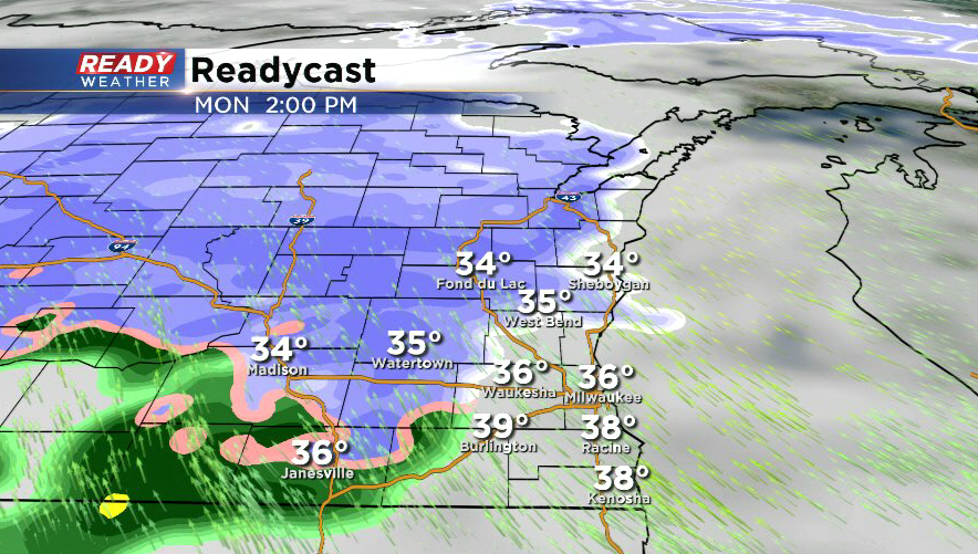
This will change over to all rain from Milwaukee southward during the evening as the warm front moves through.
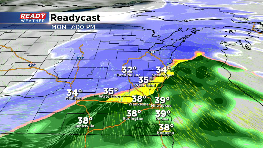
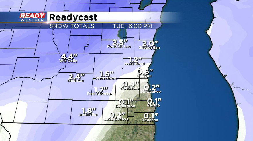
There’s quite a bit of uncertainty as to the exact track of the system and how far north the warm front will get. This will impact when and where snow will change over to rain and how much snow may accumulate. Right now, little to no snow is expected in Milwaukee, but up to 3-4" will be possible in Fond du Lac county.
This forecast will likely change over the next 24 to 36 hours as we get a better idea of where this system will exactly track.