Snow will continue overnight into the morning.


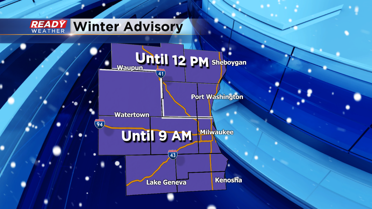
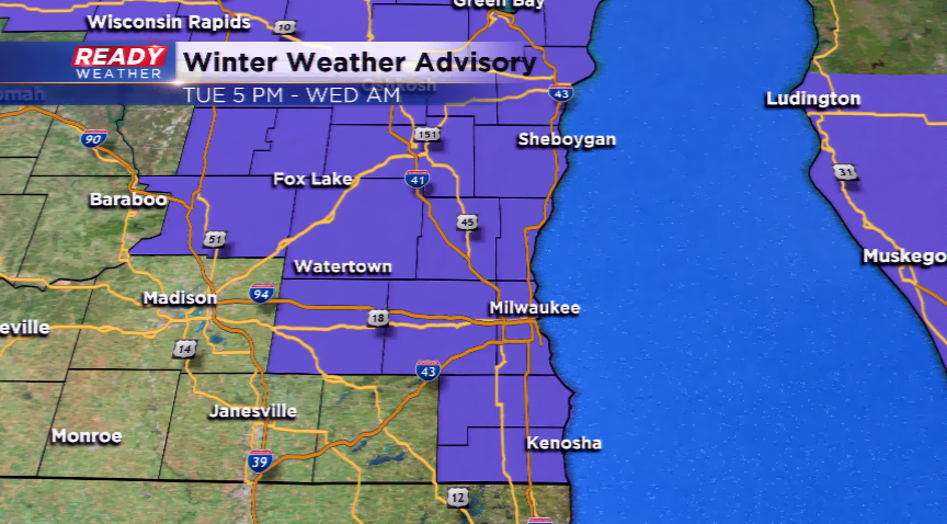
Walworth has been added to the winter weather advisory. After a break in the snow earlier this evening, more snow is redeveloping across Washington and Ozaukee county. This will expand back across the area with a few more inches possible overnight into Wednesday morning.
Roads will continue to be slick and hazardous. Some freezing drizzle is also possible.
Roads will continue to become slick this evening. Temperatures in the teens and 20s will continue to keep the snow sticking to the roads. Some areas have already reported accumulation around an inch. Scattered snow showers are expected to continue overnight into the Wednesday morning commute.
4:00 PM Update:
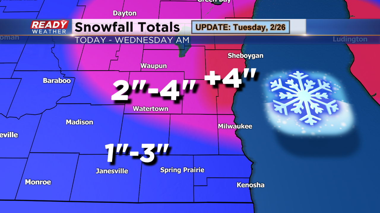
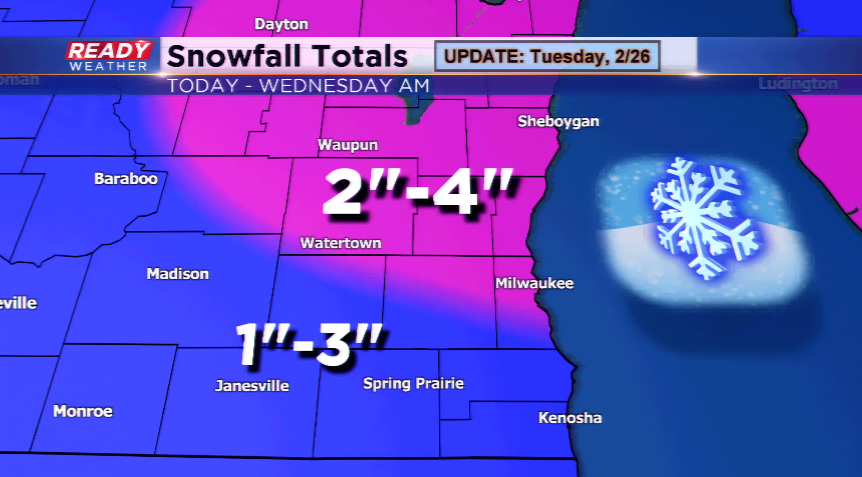
Not many adjustments to the overall snowfall map. The models continue to bulls eye a swath of +4" totals from Sheboygan county to Ozaukee county. Roads will become slick tonight into Wednesday morning.
2:30 PM
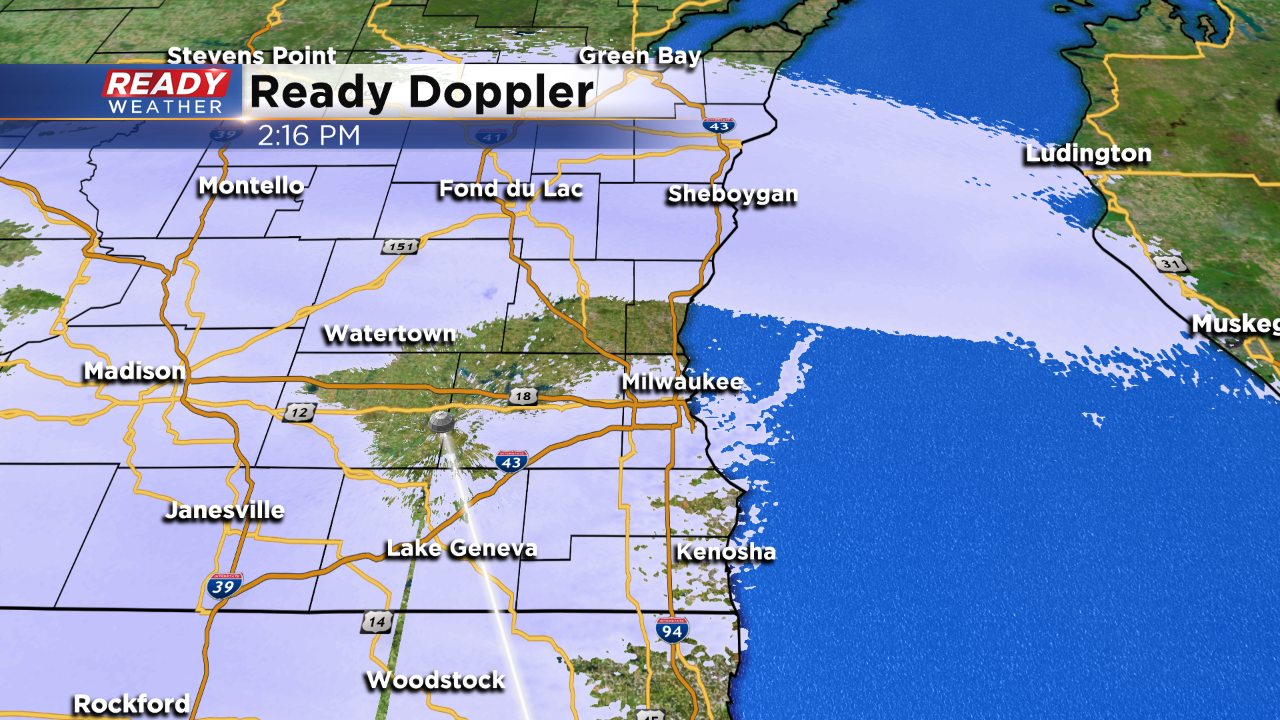
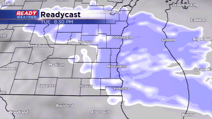
Most of the afternoon has been quiet west of Lake Michigan. Light lake enhanced snow has been falling along the lakefront since this morning. Now the snow is starting to fill in from west to east.
Expect snow to continue throughout the evening and overnight into Wednesday morning. Most areas will pick up between 2" to 4" of snow. The winter weather advisory starts at 5 pm!
Another round of light snow will impact Wisconsin on Tuesday into Wednesday. We’ll see plenty of cloud cover this morning with snow developing from west to east, especially the afternoon. Due to the threat of snowfall, a Winter Weather Advisory has been posted for all of southeastern Wisconsin except Walworth County.
Snow showers or light freezing drizzle could continue for the morning commute on Wednesday. However, most of the snowfall will be over. Totals will range from 2”-4” from Milwaukee north, with lighter amounts south of I-94. Thursday, Friday, and Saturday could feature threats of light snowfall, but don’t expect anything major from this system.
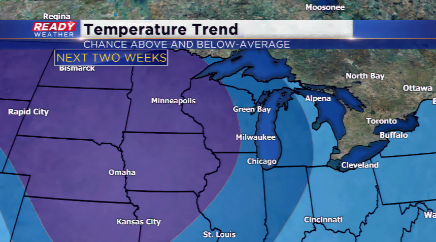
The big story heading into March will be the temperatures well below average. Our highs for the first week could be 15-20 degrees below average and stuck in the teens. Lows could fall below zero for several nights.