Light rain tonight followed by sunshine for the weekend
A slow moving cold front is just making its way into western Wisconsin, triggering showers ahead of it and freezing rain, sleet, and snow behind it.
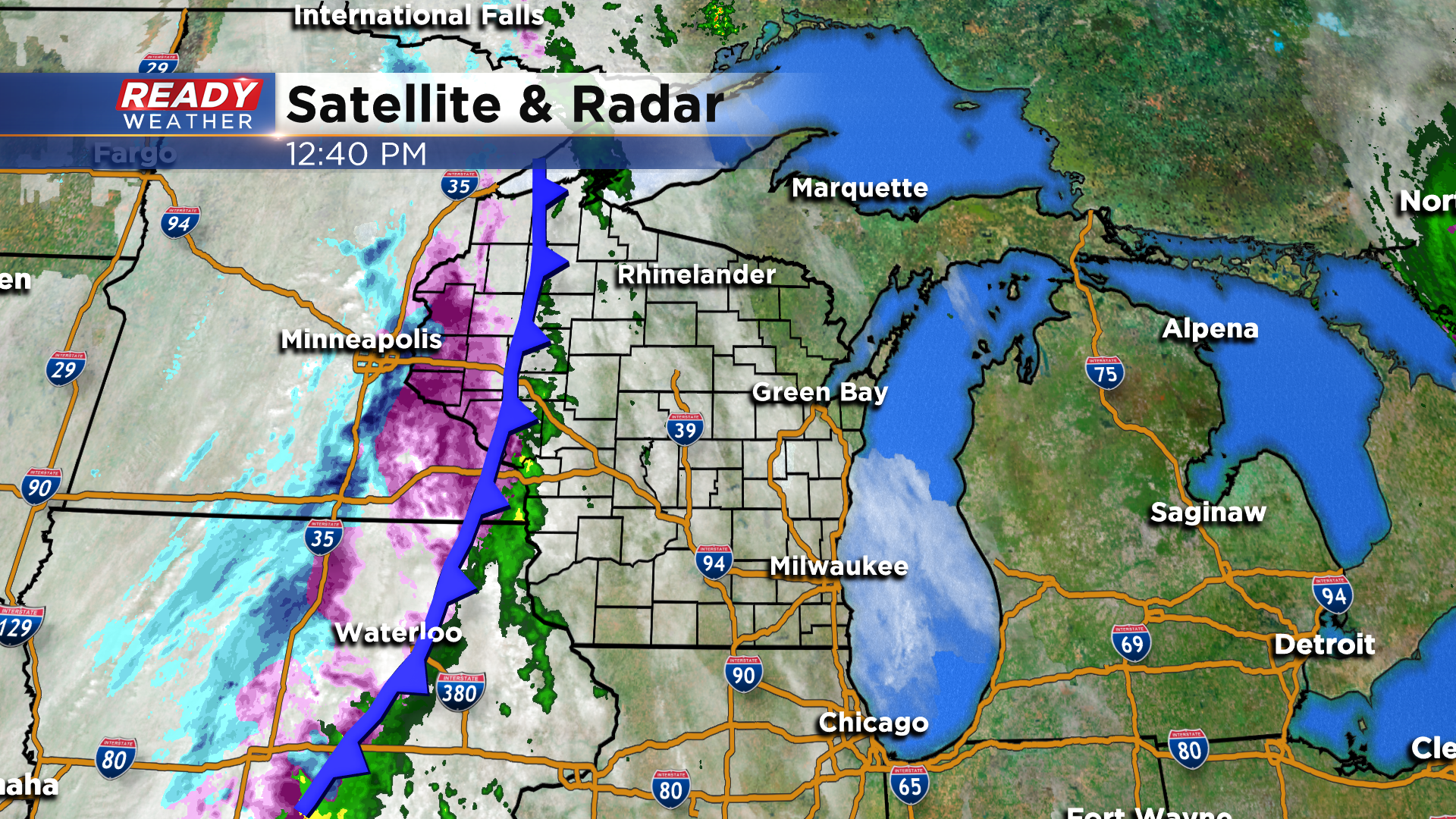
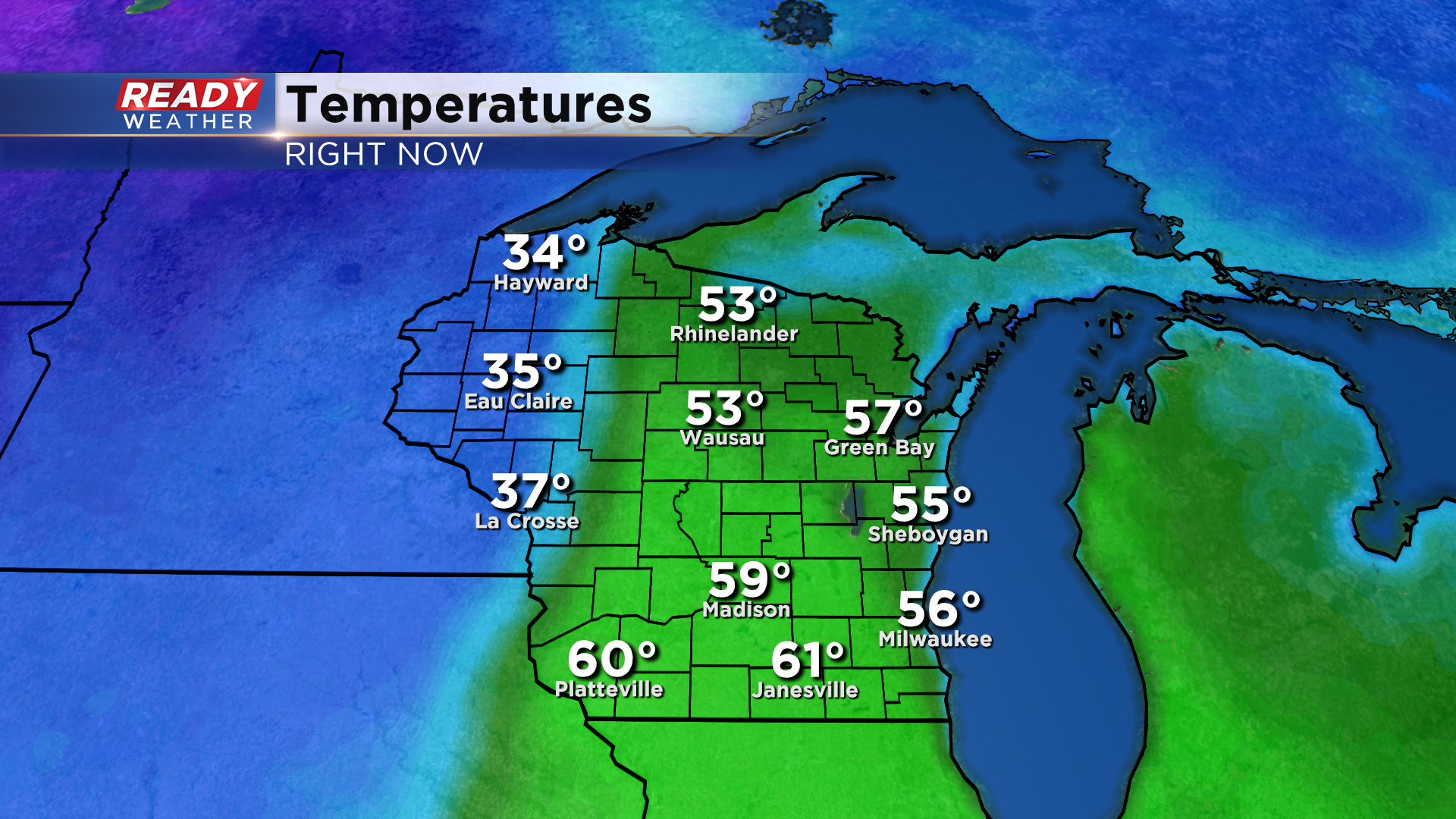
Expect dry and mild conditions through the afternoon, with a few light showers moving into western parts of the area by mid evening.
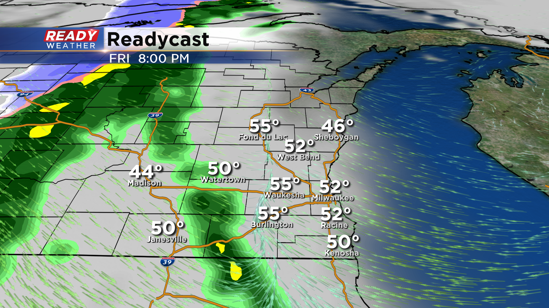
Rain will move into the Milwaukee area after 11 p.m. and continue throughout the night as the front moves through.
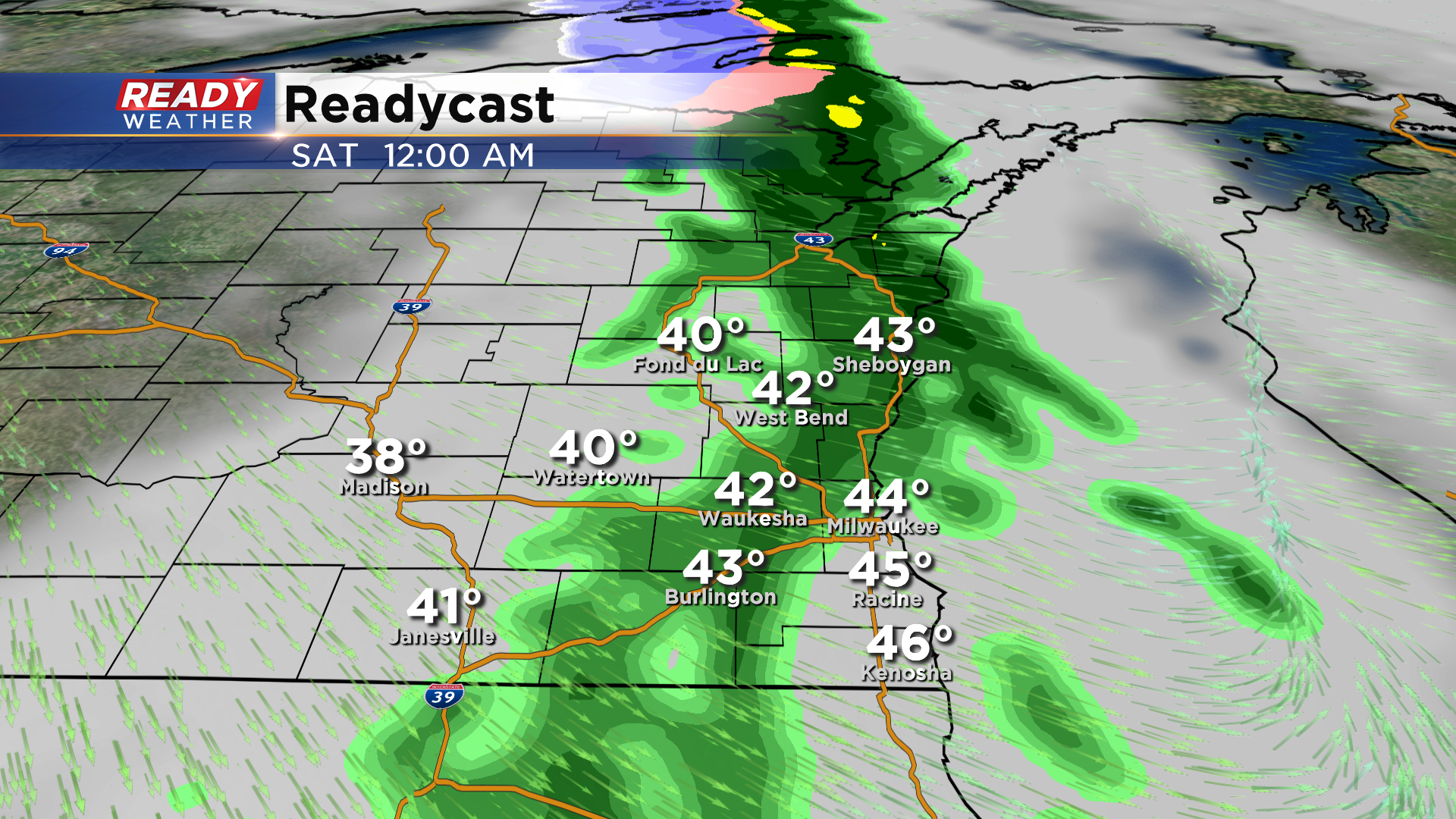
Rain totals will be fairly light with only .10-.20" expected.
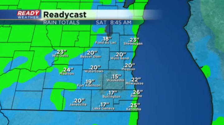
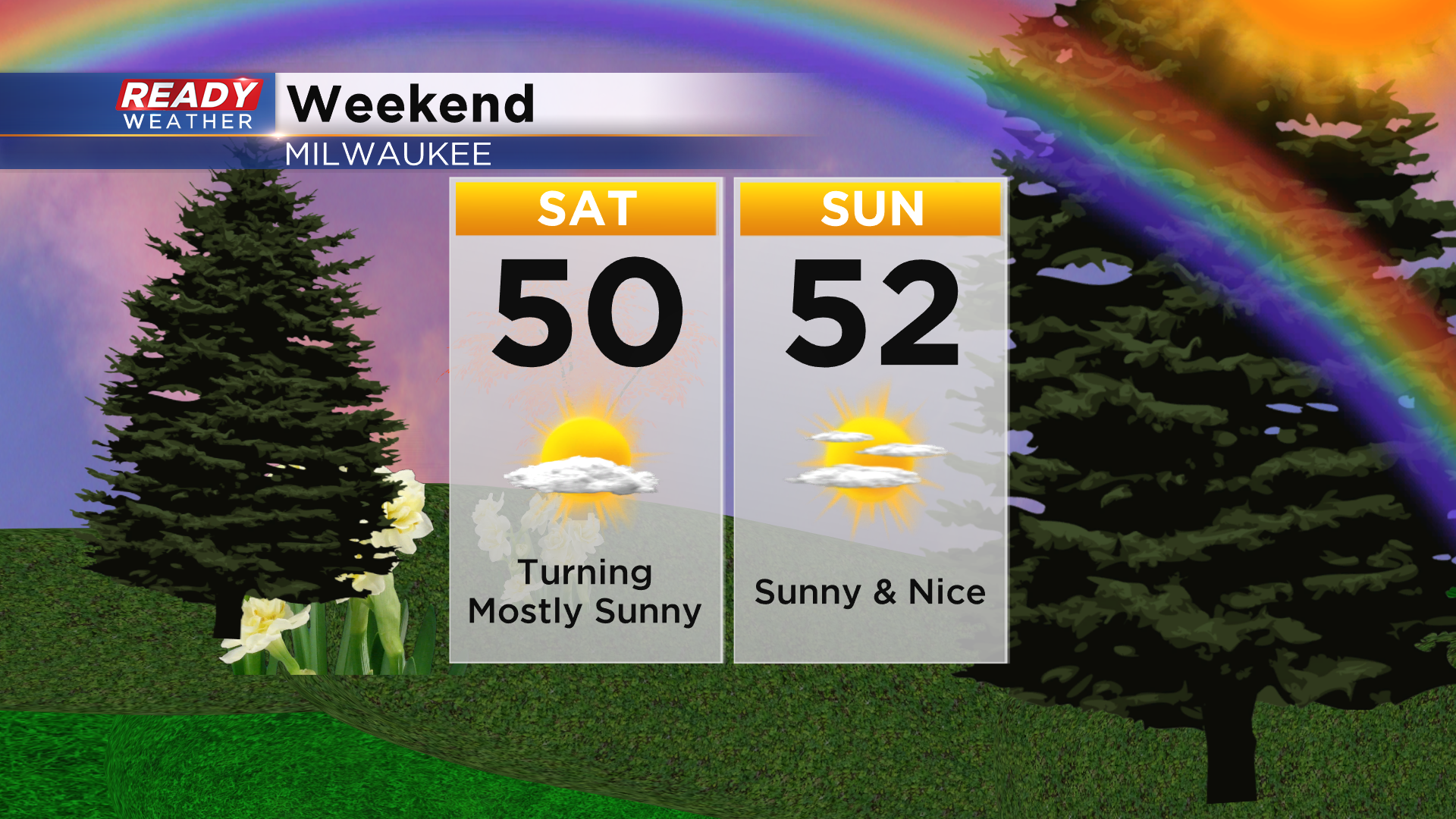
Rain will move out of southeast Wisconsin around sunrise Saturday morning, with sunshine developing for the remainder of the day as high pressure slides into the area. High pressure will keep skies mostly sunny to partly cloudy through Sunday as well. After topping out in the 50s and 60s today, temps will be a bit cooler behind the front on Saturday with highs in the upper 40s lakeside and 50s inland, but southerly winds will boost temps back into the 50s with some 60s inland on Sunday.
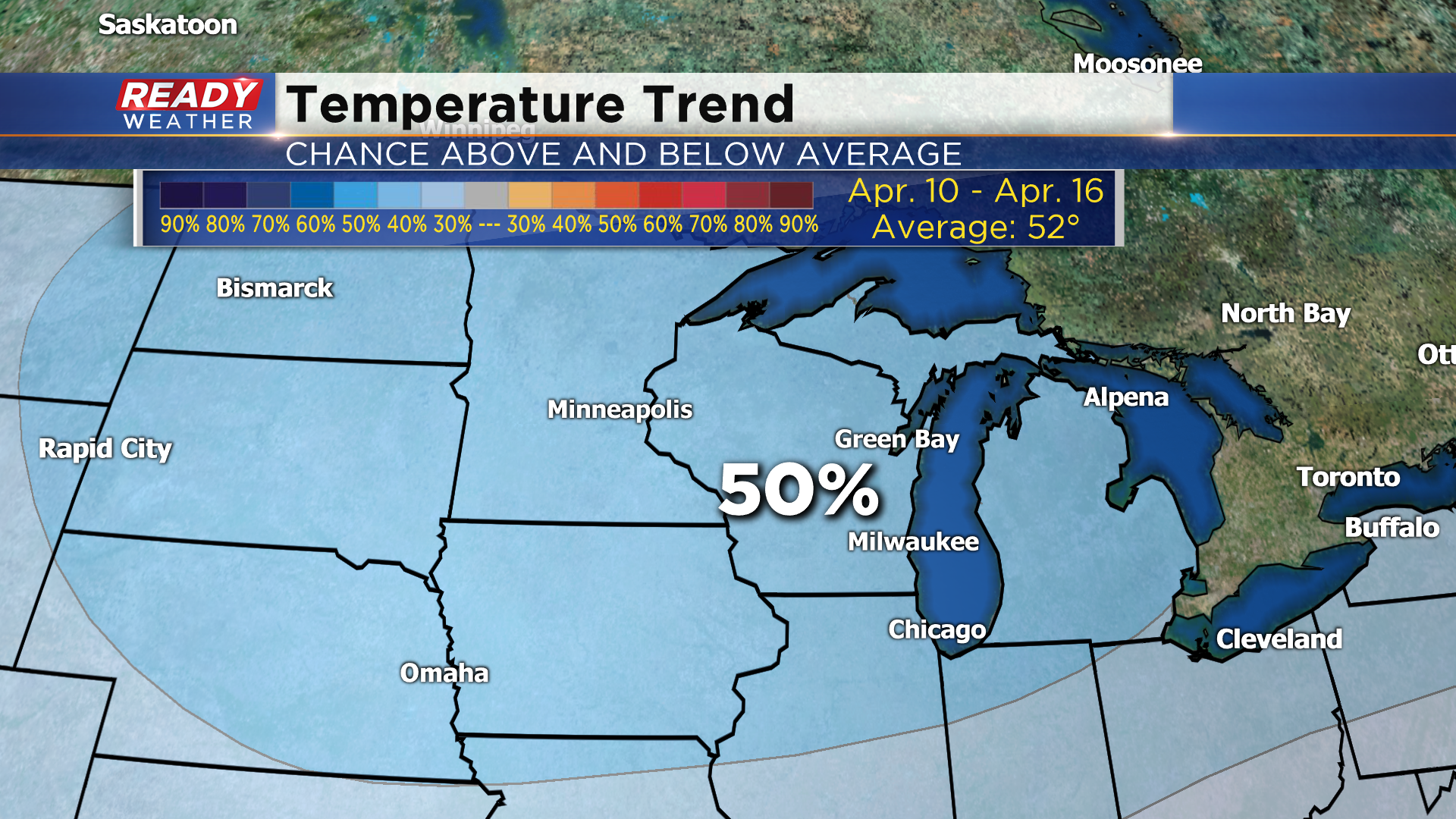
Upper 50s and 60s will be with us through the first half of the week along with a chance for storms Monday and Tuesday, but then temps will cool a bit as we head into Easter weekend. The 8 to 14 day temperature outlook gives us a 50% chance for below normal temperatures Easter Weekend into the first half of the following week. By then normal high temps are in the low 50s.