Labor Day will be warm with isolated showers, much cooler the rest of the week.
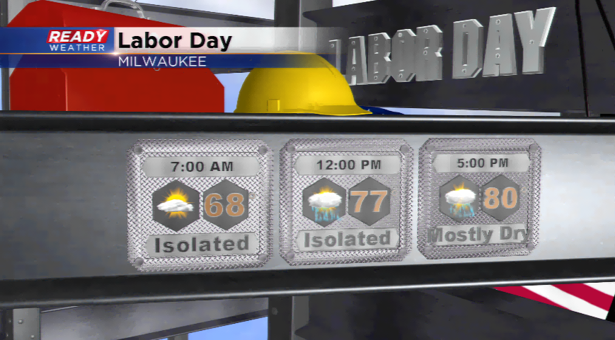
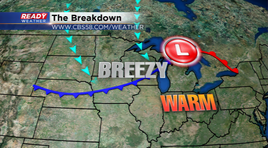
A frontal boundary is separating warm, moist air from a fall like weather pattern. That cooler air will start to filter in behind a cold front today. The changes will be noticeable; breezy conditions will develop as well as showers popping up. The coverage won’t be widespread, but the chances will remain in place until later today once the front is all the way through. Highs ahead of the front make it back into the 80s today.
Once the front passes, the rest of the week will feature highs in the 60s. Yes, the 60s return. With this plunge of Canadian air, overnight lows in the city could drop into the 40s with inland spots into the 30s. Don’t be quite concerned about frost for your plants and garden, but keep a close eye on the forecast midweek.