Humidity sticks around for the second half of the week
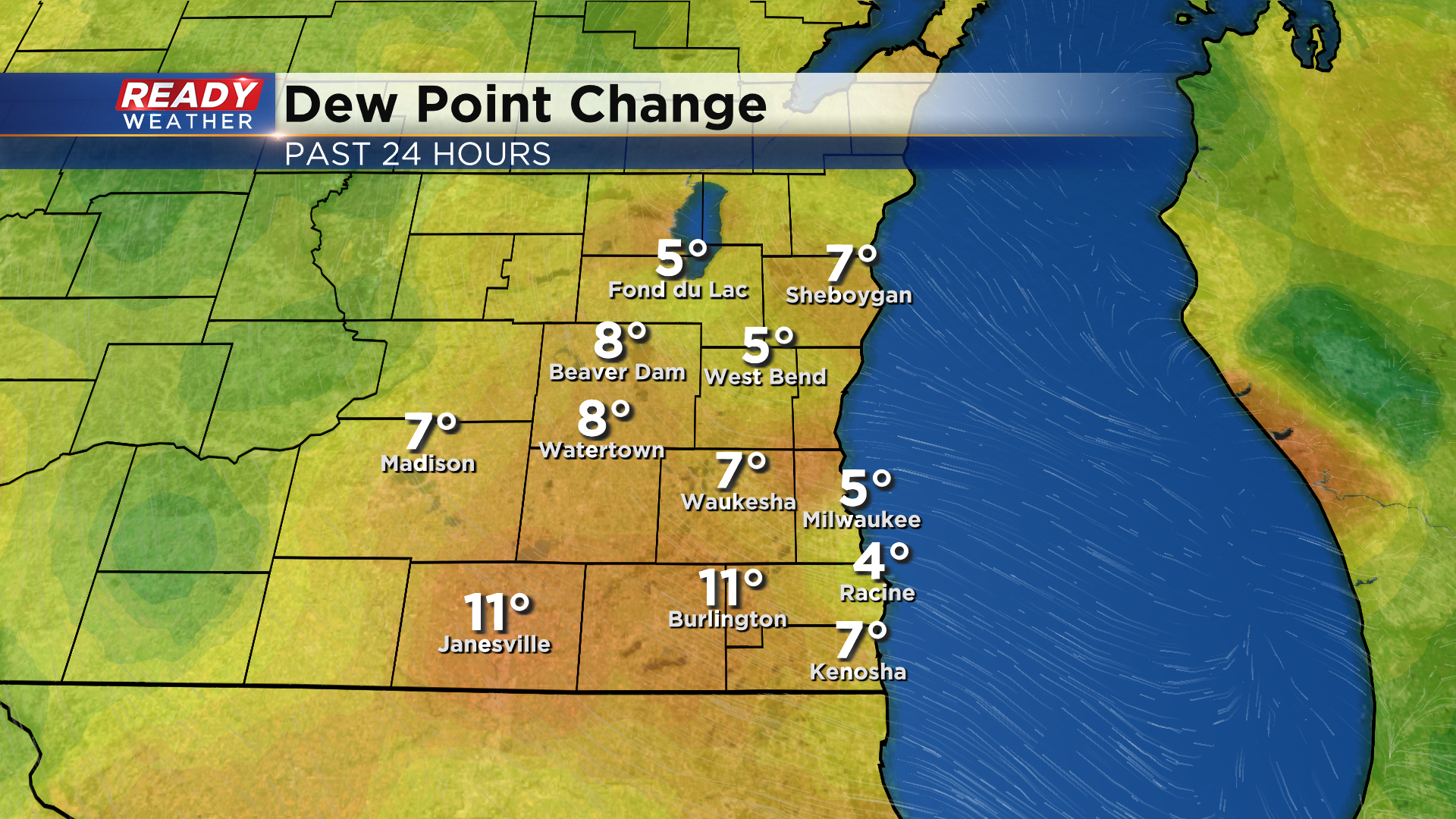
We've had a well deserved break from the humidity over the last 4-5 days across southeast Wisconsin, but it is still August, so we aren't done with the humidity quite yet. Dew points are running 5-10 degrees higher than this time yesterday, now sitting in the upper 60s to low 70s.
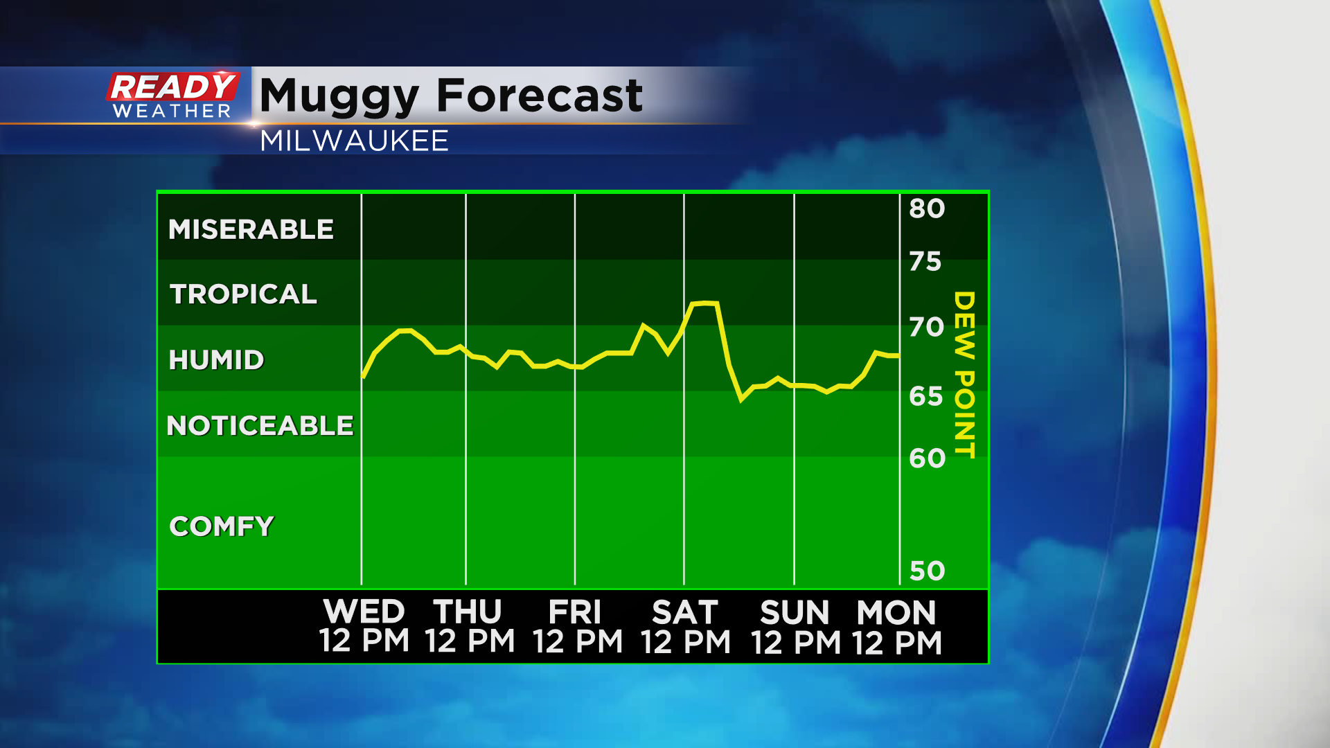
Unfortunately it'll be pretty muggy for the rest of the work week and into Saturday before a cold front knocks the humidity down a bit for the second half of the weekend.
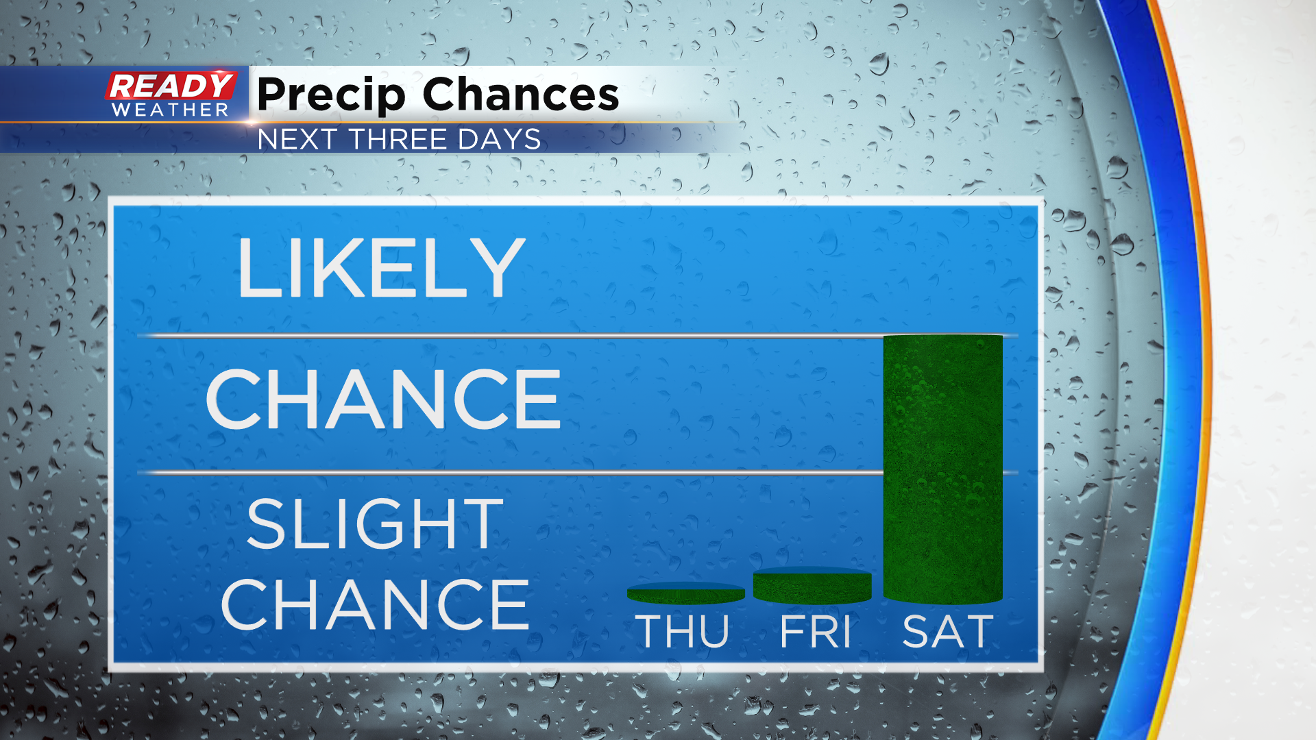
While there's a very small chance of a lake breeze shower today and Friday, our next best chance for showers and storms will come on Saturday with the cold front.
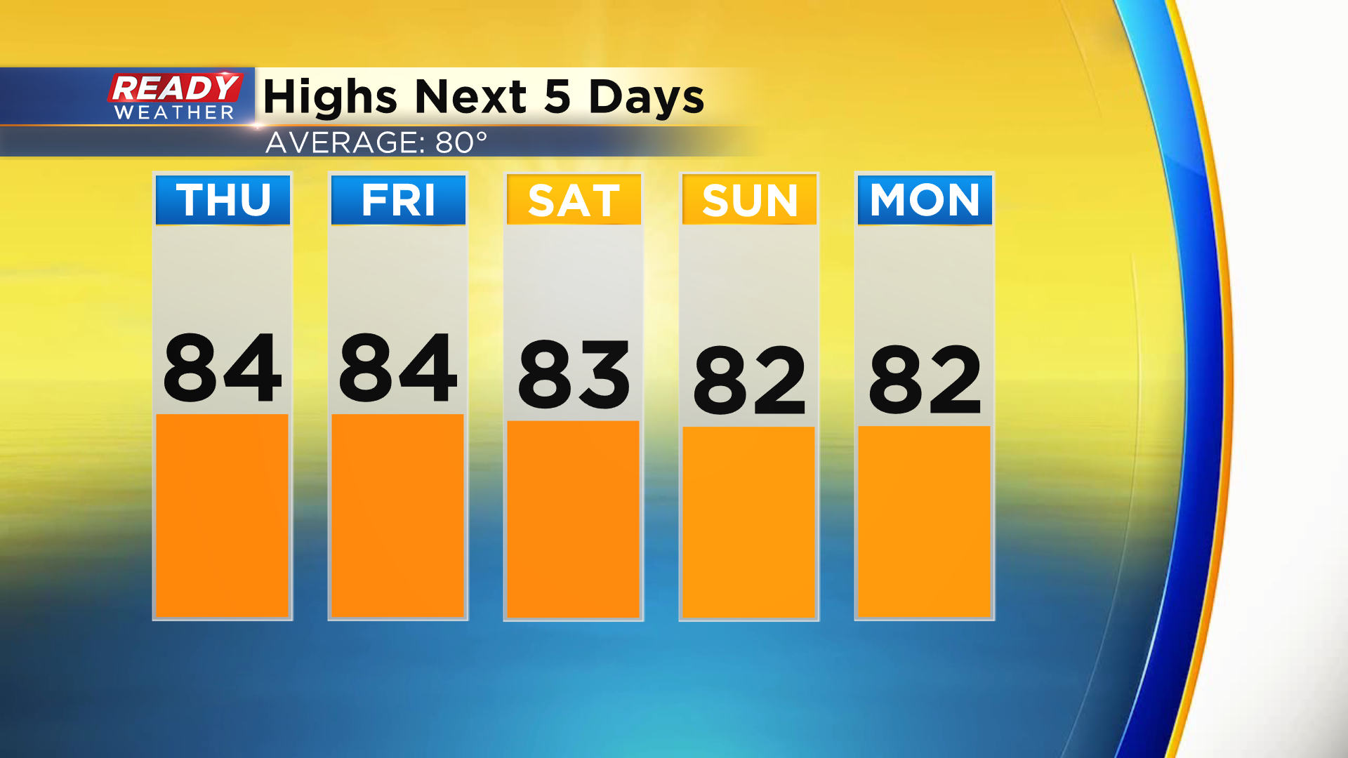
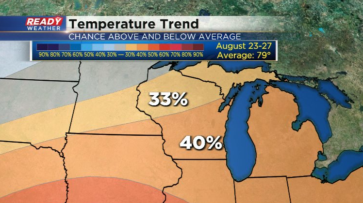
The cold front won't bring any cooler air, though, as temperatures will remain in the low to mid 80s into next week. This is now slightly above normal as our average high has slipped to 80°.
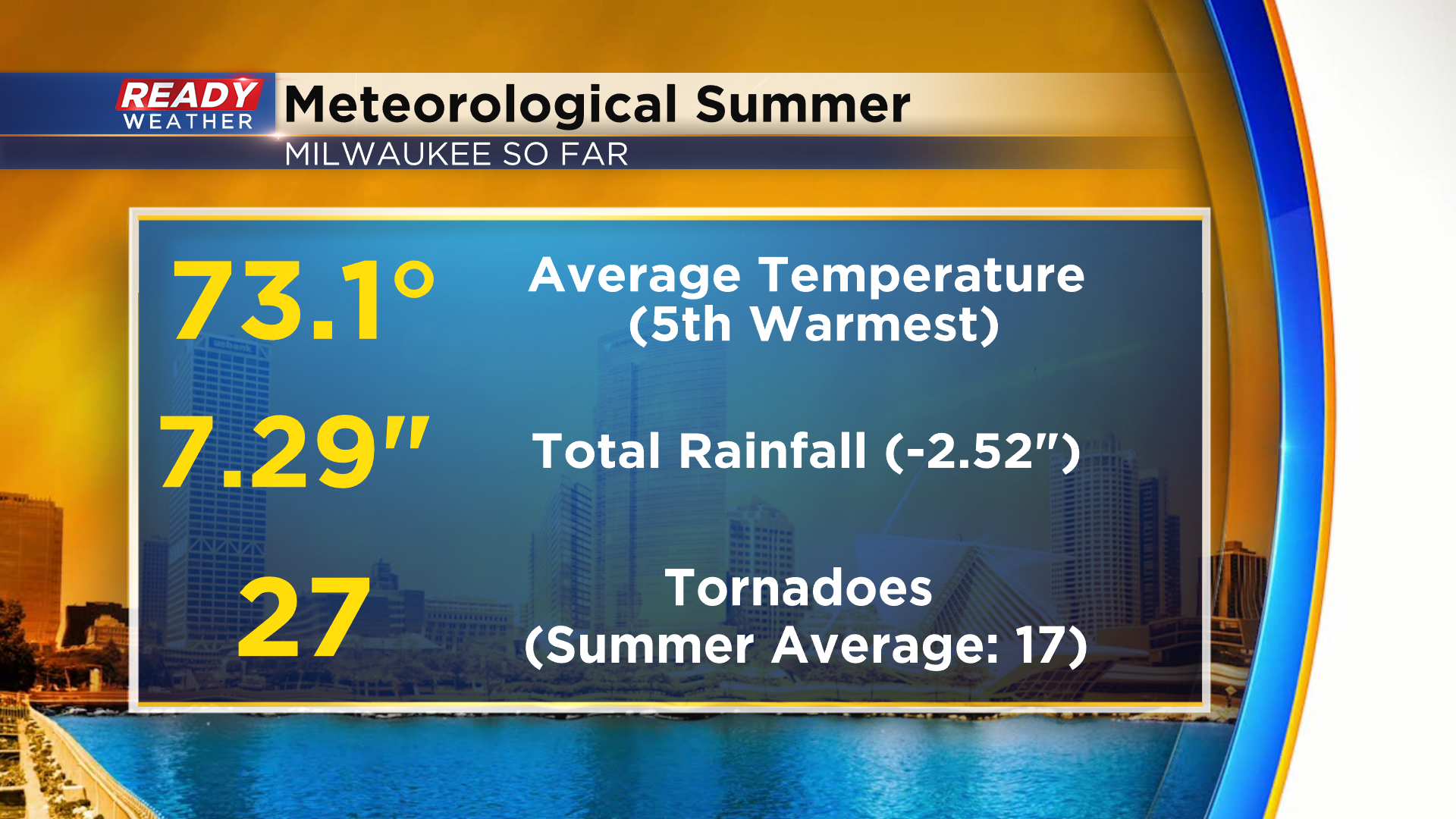
Despite some of the cool stretches we had earlier this summer, this has still been Milwaukee's 5th warmest meteorological summer on record.
Above normal temps are also favored as we head through the next 6 to 10 days.
Download the CBS 58 Ready Weather App to see the full 7 day forecast.
