Hard to keep up with the forecast this week. The CBS 58 Ready Weather team is here to help!

-
3:18

St. Francis’ Buddy Squirrel celebrates 110 years of traditions,...
-
2:43

’Movement is medicine:’ Wisconsinites with Parkinson’s...
-
3:56

Milwaukee boy uses art to carry on dad’s legacy, after losing...
-
2:57

A quiet Easter but on/off shower activity much of this week
-
0:56

People gather at the Bear Moon Pow Wow in celebration of culture...
-
1:07

Milwaukee County Zoo hosts pre-Easter celebration filled with...
-
2:30

Kewaskum police chief, lieutenant could face discipline after...
-
2:04

Big races in Wisconsin’s upcoming spring election Tuesday
-
1:10

Schlesinger’s Saturday Showcase (4/4)...Lots of Easter fun...
-
2:57

Easter holiday weekend starts on a wet note but major improvements...
-
1:12

Wisconsin AG Kaul, Gov. Evers join lawsuit challenging Trump...
-
2:44

Bodycam video shows chaos ensue at Bayshore Mall during ‘teen...

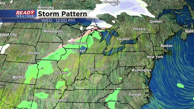
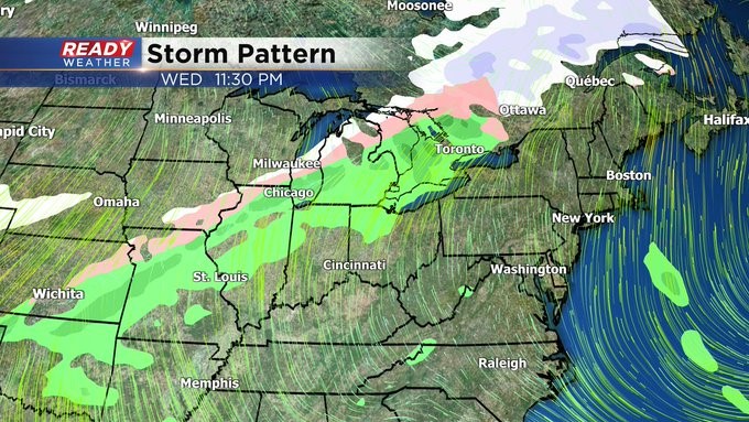
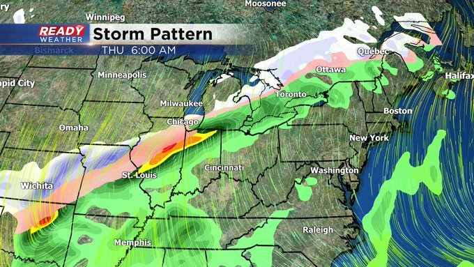
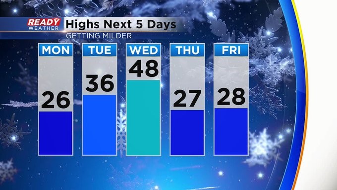
MILWAUKEE (CBS 58)--Lots of changes expected this coming week. We'll go from the 20s for highs to near 50 on Wednesday and then back to the 20s for late in the week. This is not great for ice fishing. These crazy fluctuations mean less stability on the ice. Please keep this in mind. Make sure to measure the thickness before venturing out to the shanties.
In terms of weather, we should be quiet until the middle of the week. With the warmer air in place, we're talking rain. But then a strong cold front moves through later Wednesday evening, switching the rain to snow. One reliable computer model is hinting at a quick burst of snow while other models say the snow will linger longer into Thursday morning. So still some forecasting to do between now and then. So stay tuned. We'll keep you updated.