Getting out of the freezer with a bout of light snow around the edges
Posted: Dec 25, 2020 3:29 PM CDT

-
2:03

CBS 58’s Hometown Athlete: Mark Murphy’s lasting legacy
-
0:37

American journalist abducted in Iraq is from Wisconsin
-
3:06

In wake of teen takeovers, community leaders focusing on positive...
-
2:17

’It just needs to stop’: Milwaukee continues to crack down...
-
0:39

4Seasons Skate Park closes its doors after 26 years
-
2:21

Family seeks closure as Kenosha PD makes arrest in decades-old...
-
3:15

First witnesses called in trial of man accused of fatally shooting...
-
3:28

Agreements, addiction and lawsuits: As Gov. Evers decides whether...
-
1:39

Seats dedicated to fallen police officers at American Family...
-
4:34

UWM planetarium director discusses NASA’s Artemis 2 mission...
-
1:18

Man arrested in quintuple shooting that left 1 dead on Milwaukee’s...
-
0:50

Buckle Up Phone Down: WisDOT, West Bend team up to promote safe...

MILWAUKEE (CBS 58)--After a chilly Christmas, it looks like the numbers will start to rebound as we work into the last weekend of 2020. Expect highs near freezing on Saturday and well in the 30s on Sunday.
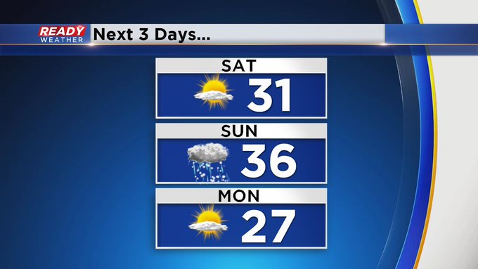
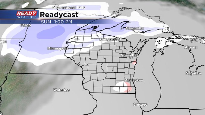
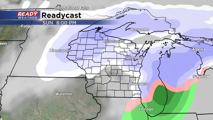
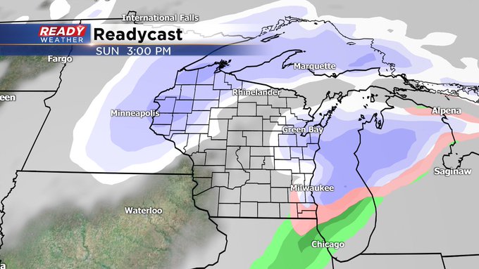
But as we get warmer, we get a bit wetter, especially Sunday afternoon and evening. This is when we could see some wintry mix, mainly snow and rain. Don't look for any significant accumulation at all.
There looks to be another similar storm system by the middle of next week with wintry mix on Wednesday switching to snow showers by Thursday. Stay tuned for further updates. In the meantime, enjoy your holiday weekend.
Sign up for the CBS 58 Newsletter