


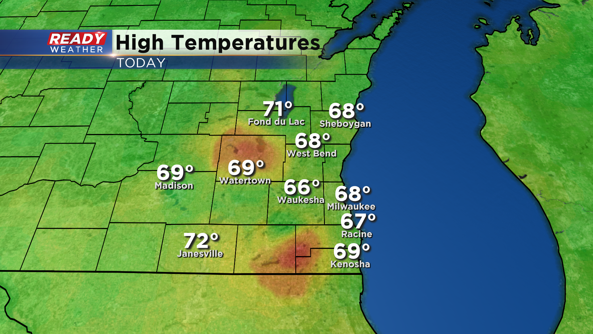
Despite the breezy southeast wind, temperatures were a few degrees warmer than Saturday with highs in the upper 60s for most of southeast Wisconsin.
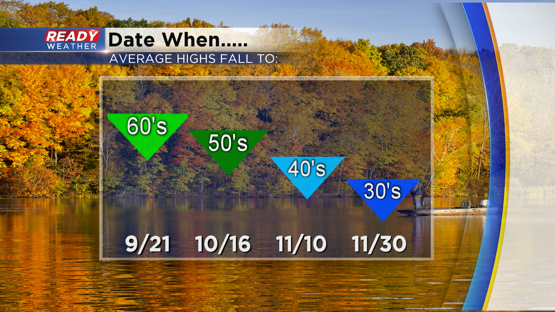
That was still a couple of degrees below our average high of 70°, but today was the last day Milwaukee's average high will be in the 70s until May 30th. Our average high drops into the upper 60s tomorrow and will drop into the upper 50s in three weeks.
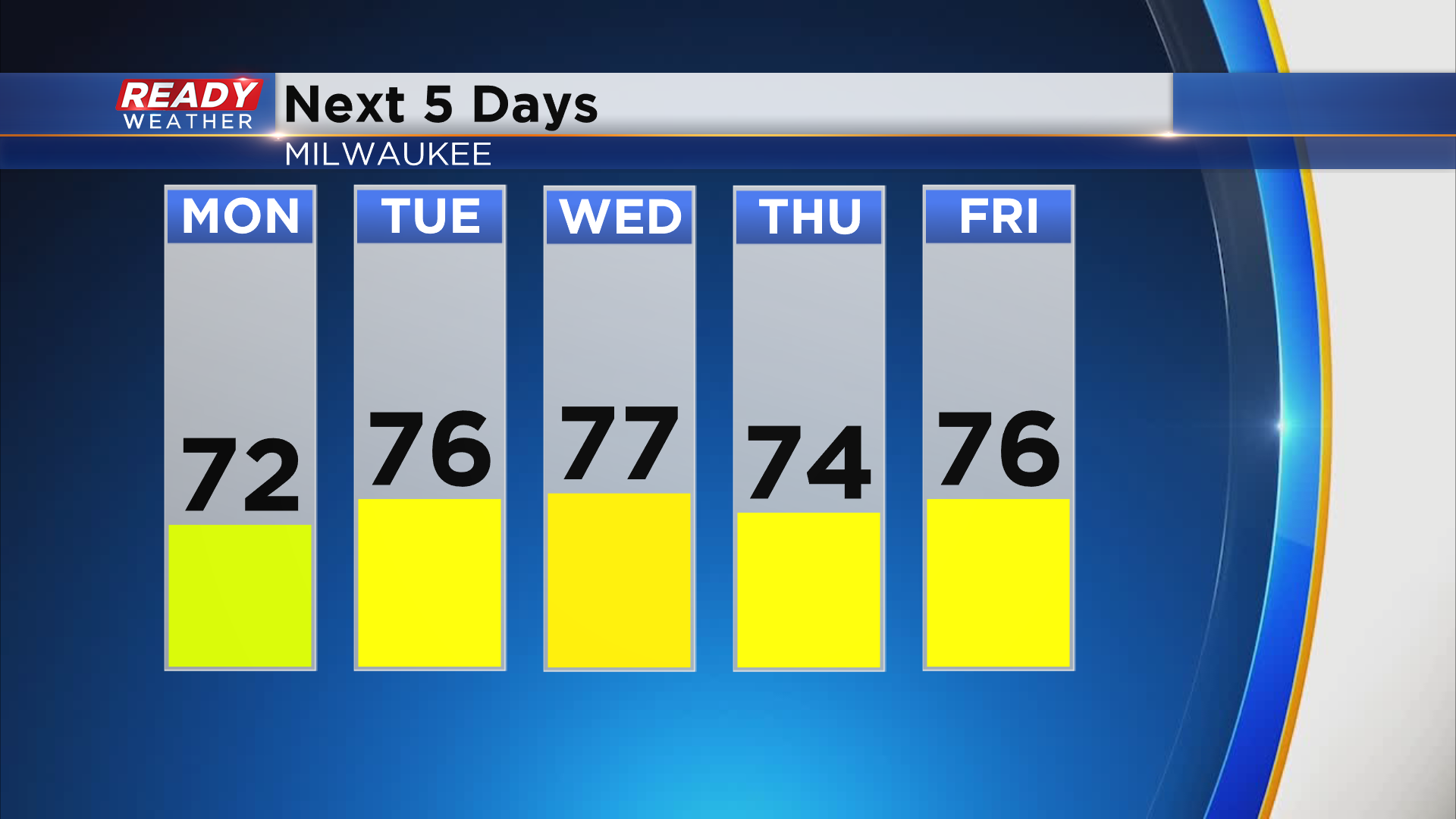
Even though Milwaukee's average high officially drops into the upper 60s tomorrow, temps are going to be in the 70s all week with mainly dry weather! We can't rule out a sprinkle on Thursday, but most of us will be dry through the work week.
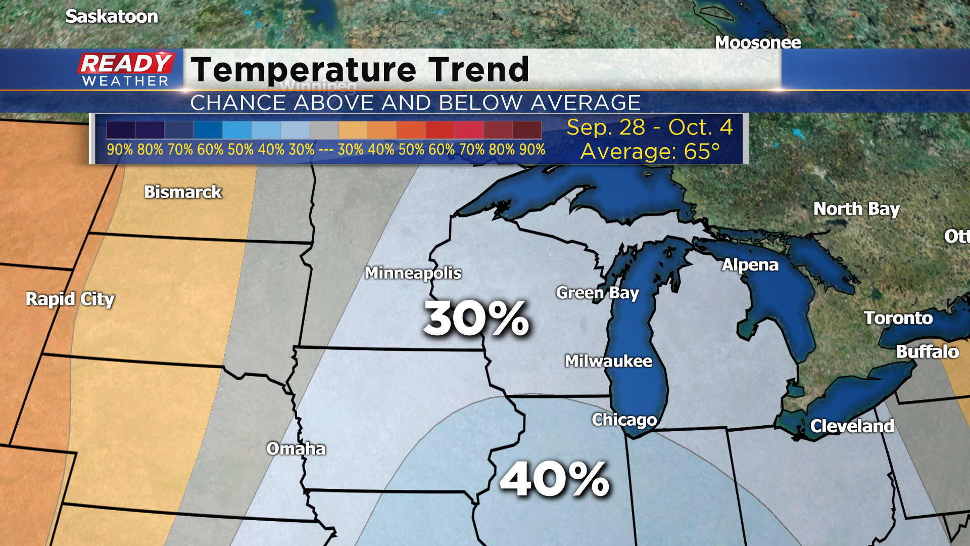
A stronger system may bring rain back into the area by next Sunday, and cooler temps may follow. The 8 to 14 day temperature outlook shows a 30-40% chance for below normal temps the last few days of September and the first couple days of October.
See how cool temps may be by downloading the CBS 58 Ready Weather App.