Becoming increasingly unsettled to start the work week


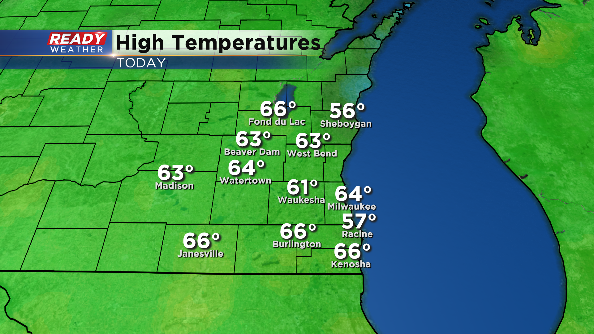
The first weekend of spring was spectacular across southeast Wisconsin (especially if you were away from the lake). Temperatures rose into the low 60s everywhere today besides the lakefront.
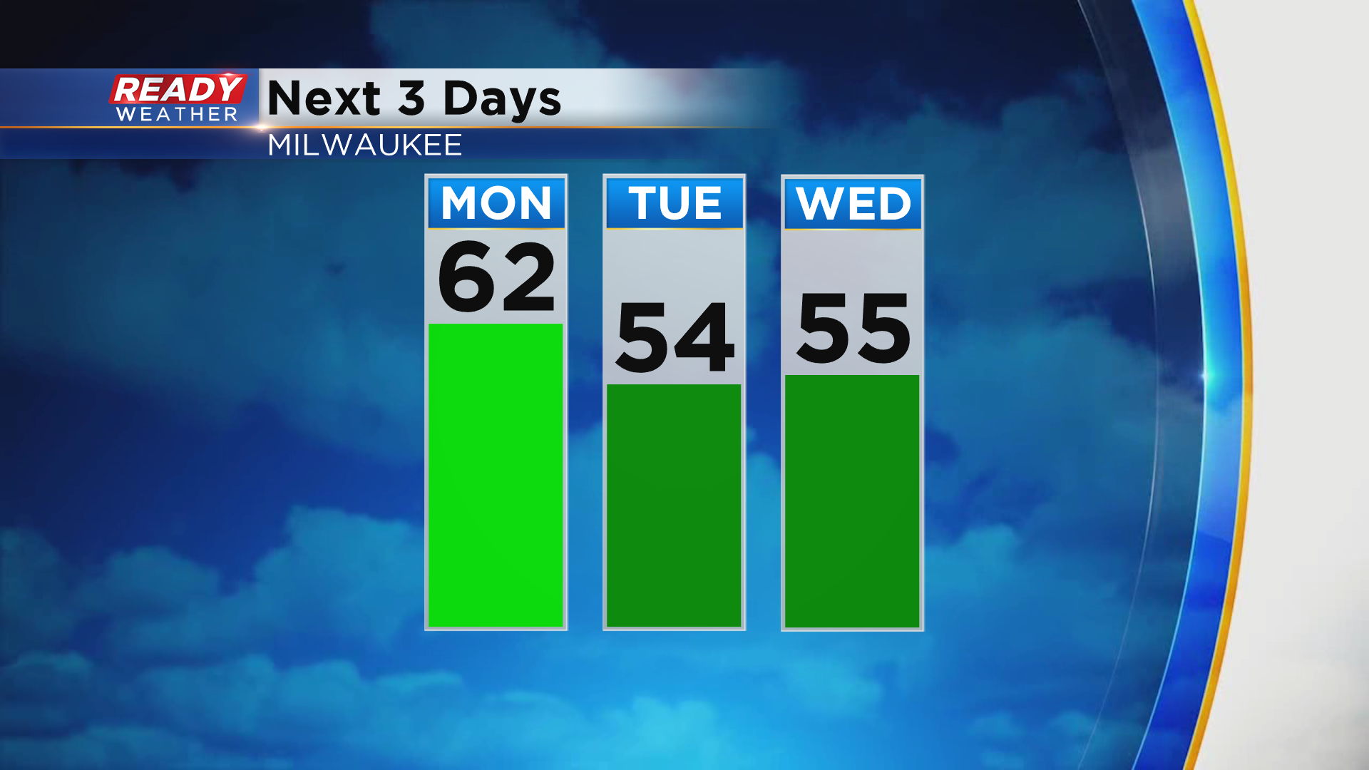
We'll have one more day in the 60s before rain and a few thunderstorms move in for the middle of the week and cool temps back into the 50s.
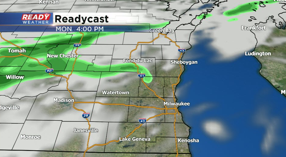
A cold front will move into the state overnight and stall just northwest of the area Monday morning. While we can't rule out an isolated shower late in the afternoon well north of Milwaukee near the front, most of southeast Wisconsin will stay dry on Monday.
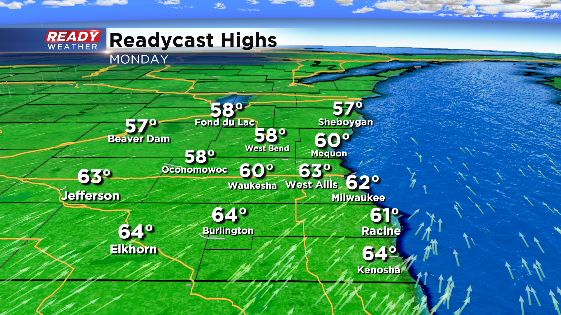
Areas that see a few peeks of sunshine Monday afternoon could easily warm into the low 60s. Best chance of that occurring will be south of I-94 away from the front.
That stalled front will lift northward Monday night as a low pressure system develops to our west. Scattered showers will start to roll into the area early Tuesday morning and continue off and on into the early afternoon.
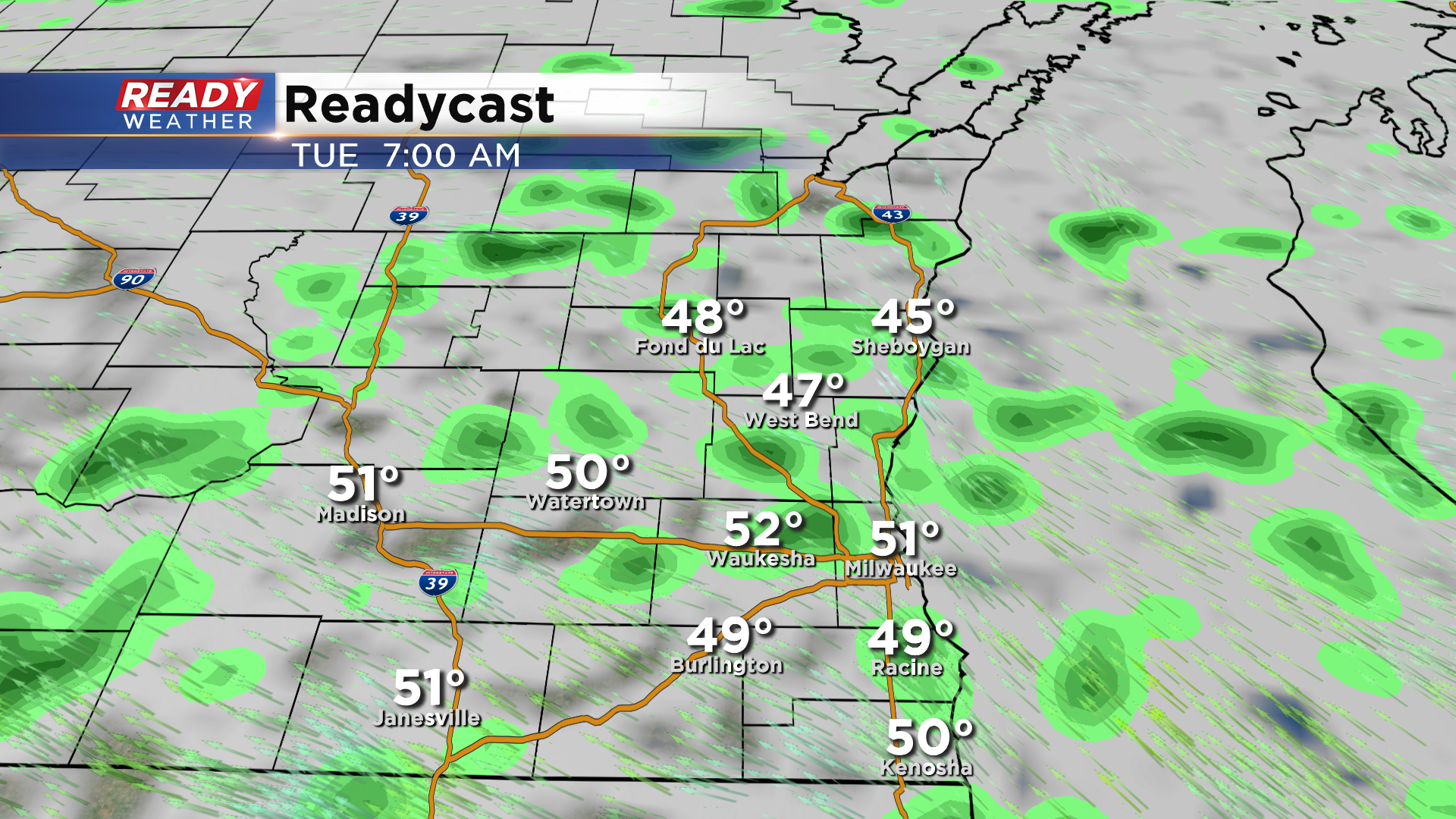
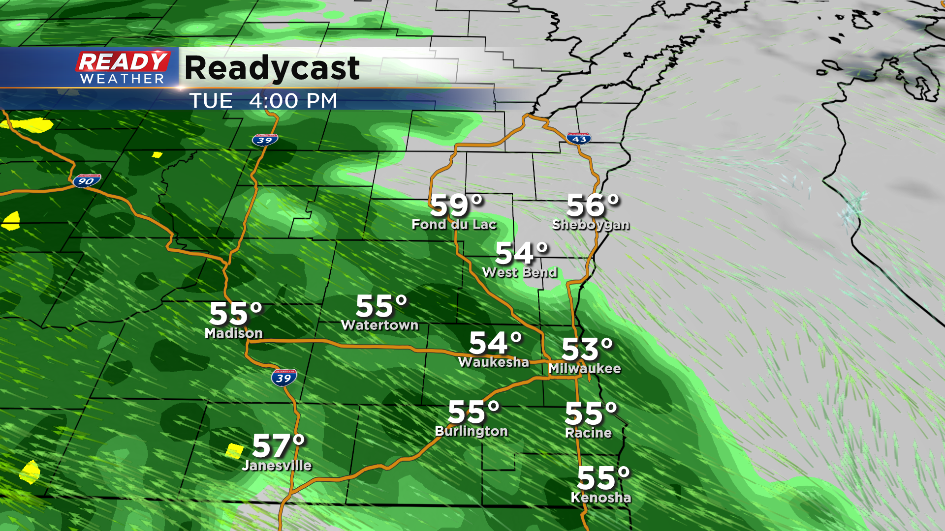
A more widespread swath of rain will move in Monday afternoon and evening with a few imbedded thunderstorms possible as well. Rain could fall fairly moderately during this time before we dry out overnight Tuesday night.
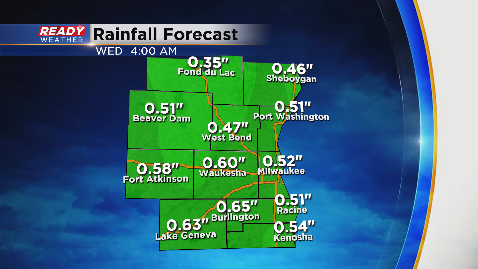
A few more spotty showers are possible on Wednesday as the cold front swings through. Current data suggests a solid half inch of rain is possible on Tuesday, with isolated higher totals in spots.
Another system may impact the area late Thursday into Friday, but there is a LOT of uncertainty in the track and strength of that system. Download the CBS 58 Ready Weather App to track the rain this week.