Beautiful today before much needed rain arrives this weekend


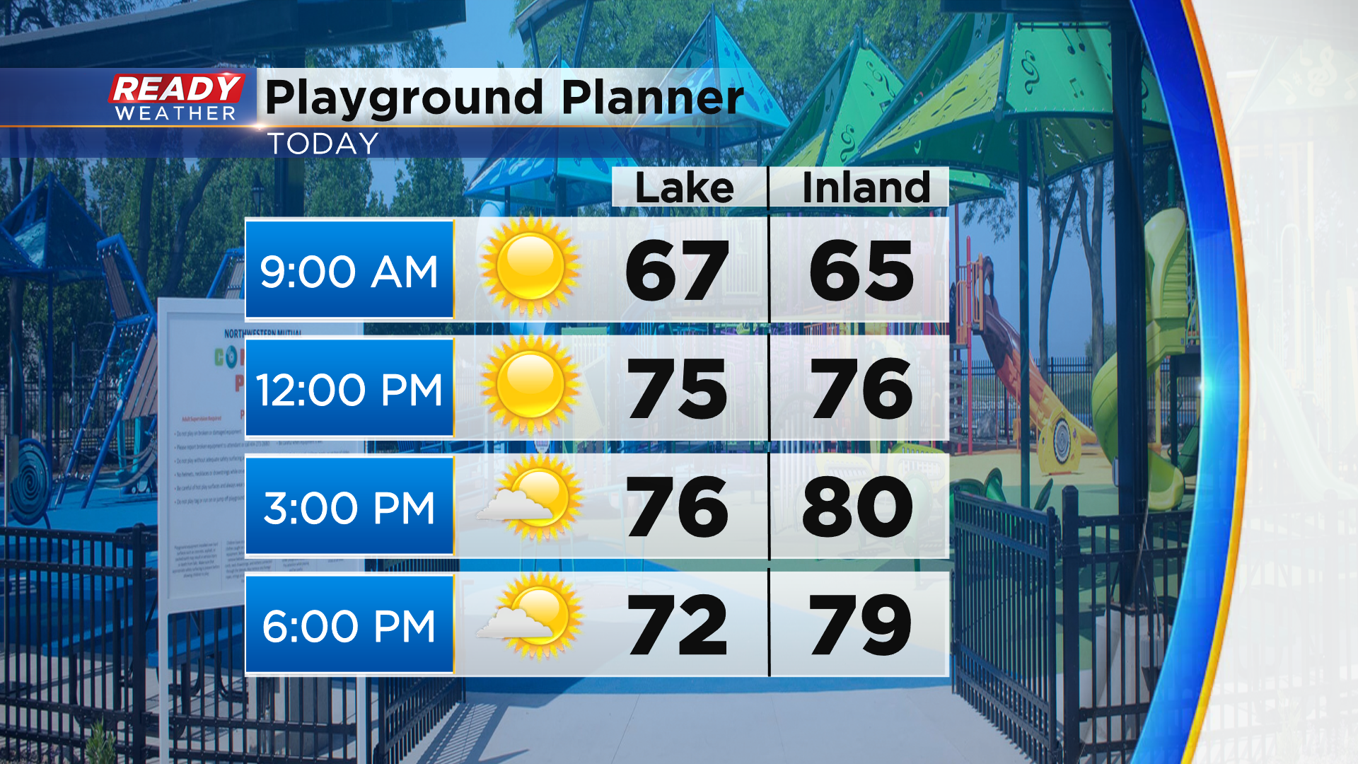
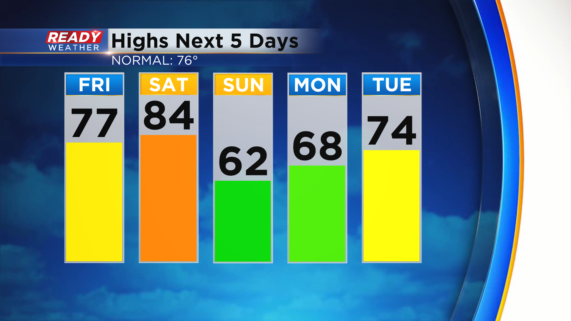
Southeast Wisconsin will end the work week on a mostly sunny and pleasant note with highs in the upper 70s to around 80°. A lake breeze will develop this afternoon, which will drop temps near the lakefront, but it won't push too far inland.
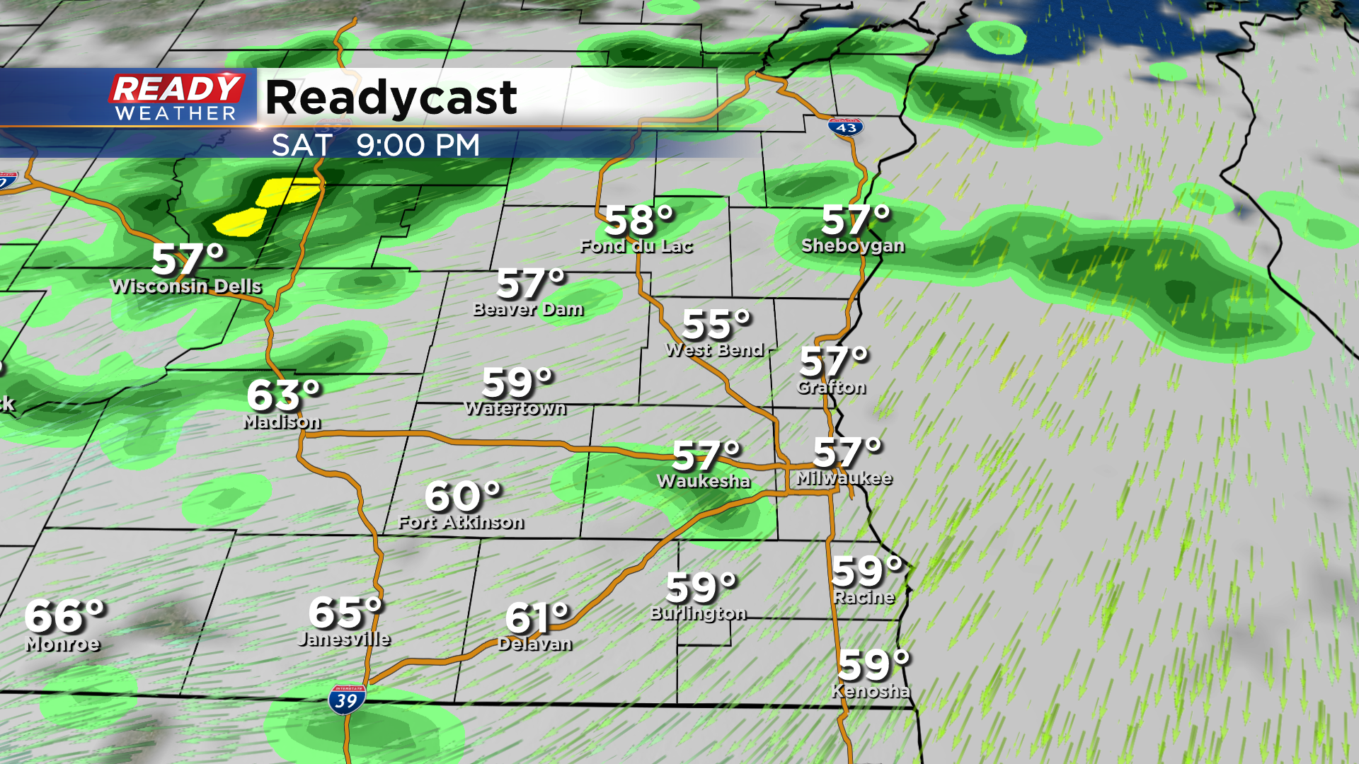
Winds turn to the southwest heading into Saturday which will help boost temps into the low to mid 80s ahead of a cold front. This front will gradually drop in from the north on Saturday, bringing scattered showers and isolated storms into areas north of Milwaukee by late afternoon or early evening.
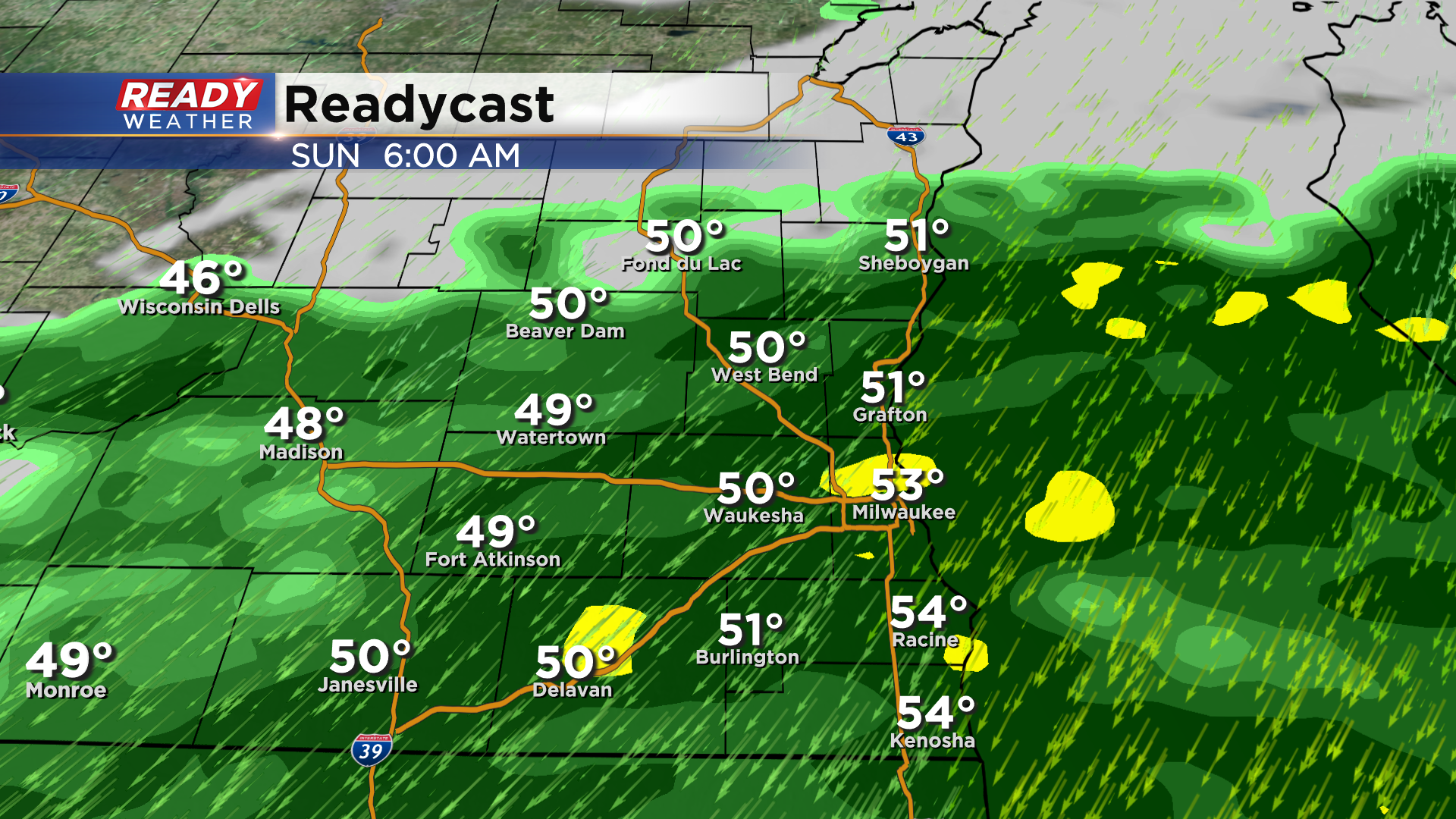
The light rain will become widespread overnight Saturday into Sunday morning. Steady light rain is expected throughout Sunday morning, turning more isolated in the afternoon.
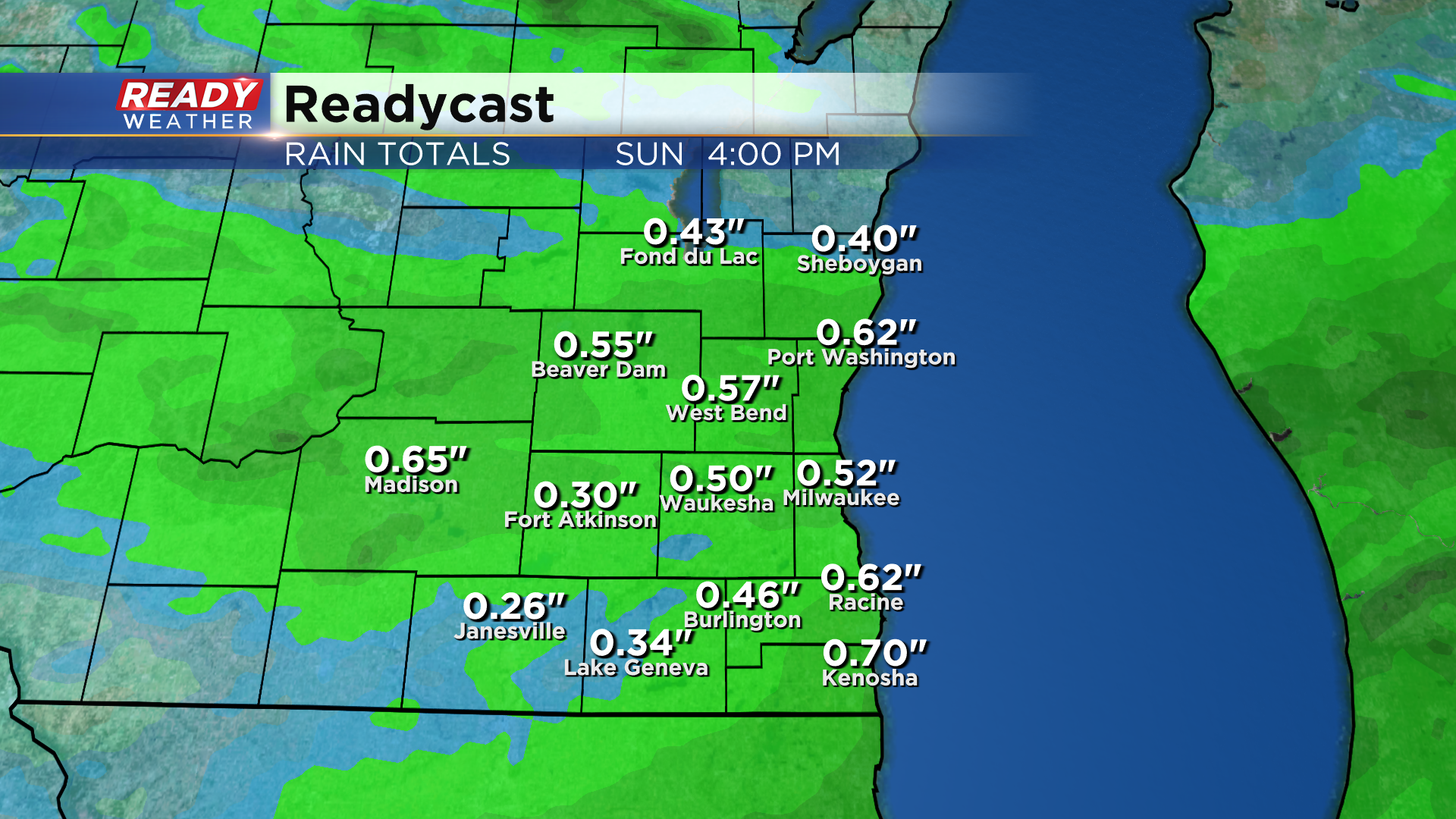
Additional wrap around showers are possible Monday afternoon into Tuesday morning. A solid .40-.80" of rain is expected through Sunday with highest totals where we see thunderstorms.
The combination of rain, temps in the low 60s, and NE winds gusting between 25-35 mph will make Sunday feel pretty cool. Temps will rebound back into the 70s during the middle of the week as this system finally pushes east.
Download the CBS 58 Ready Weather App to track the weekend rain chances.