Tornado Watch is canceled.


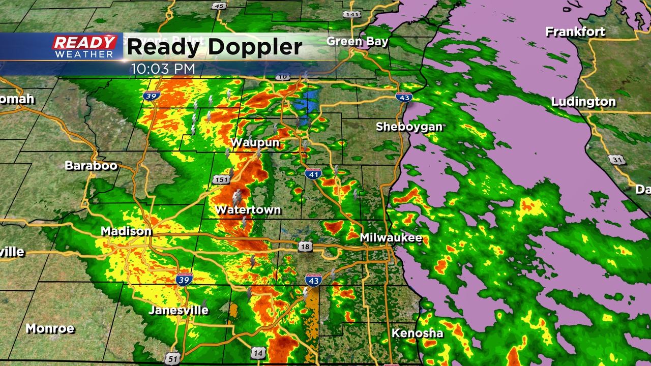
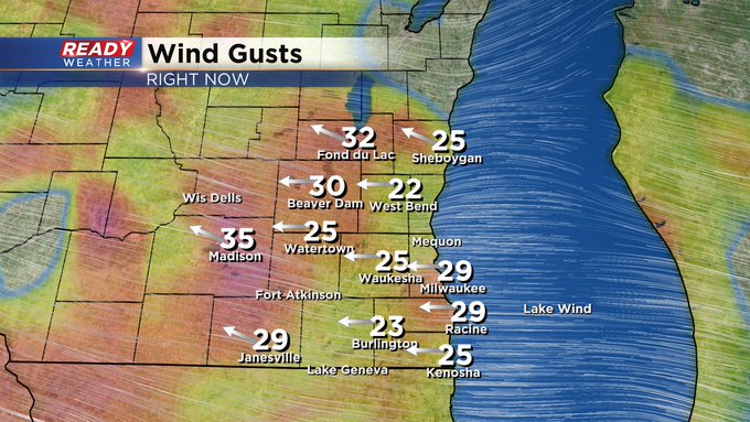
The tornado watch is canceled! While this line of showers and storms will provide some gusty winds, the overall severe weather risk will weaken as the storms move toward the lakefront. The severe thunderstorm warning for Walworth county is set to expire at 10:30 pm.
The storms moving east will encounter more of a stable airmass and move out around 11 pm.
______________________________________________________________________________________________________________
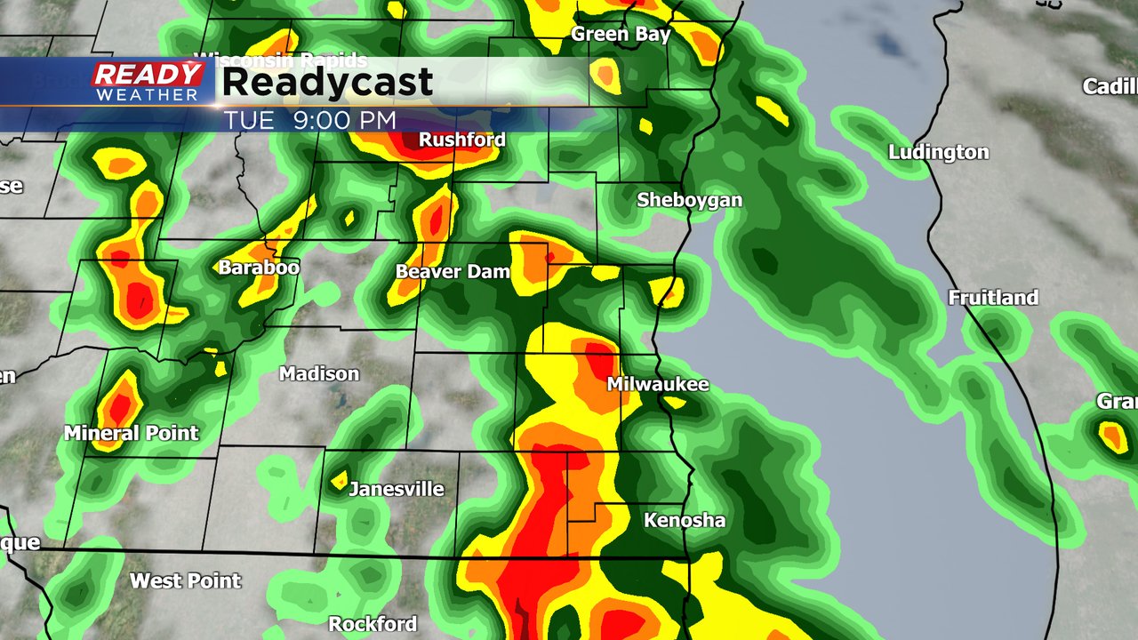
9:00 PM Update:

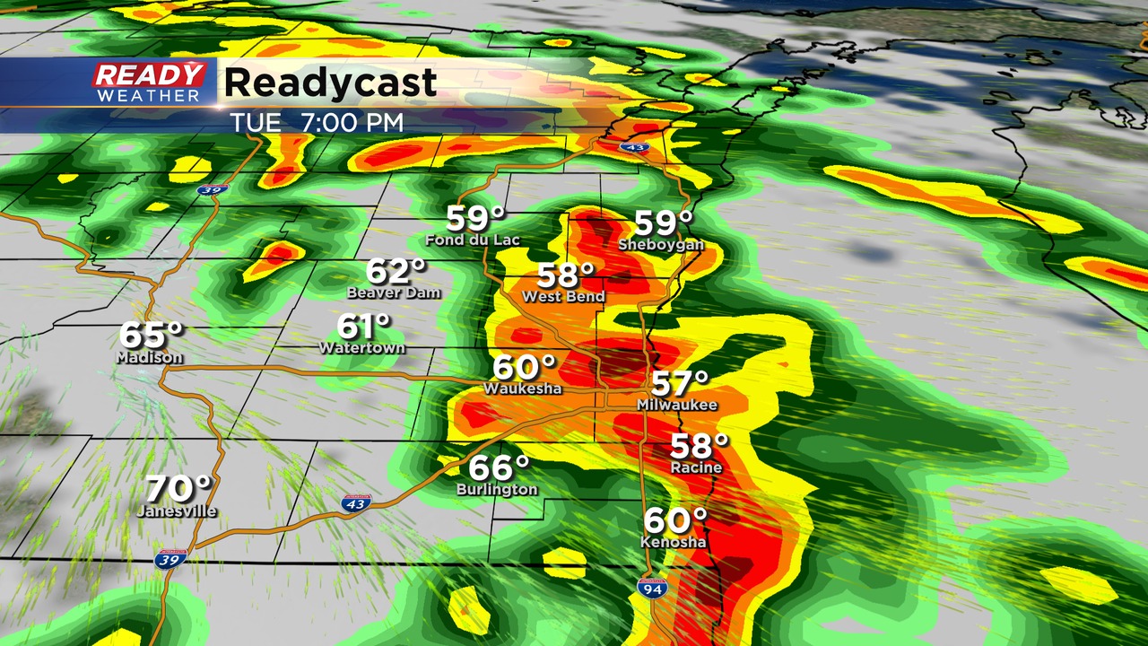
The tornado watch has been extended to include Jefferson and Walworth counties out of an abundance of caution with the line of storms. The overall tornado threat will continue to weaken as it moves east; however, over the next hour we will need to watch the line closely.
______________________________________________________________________________________________________________
8:00 PM Update:
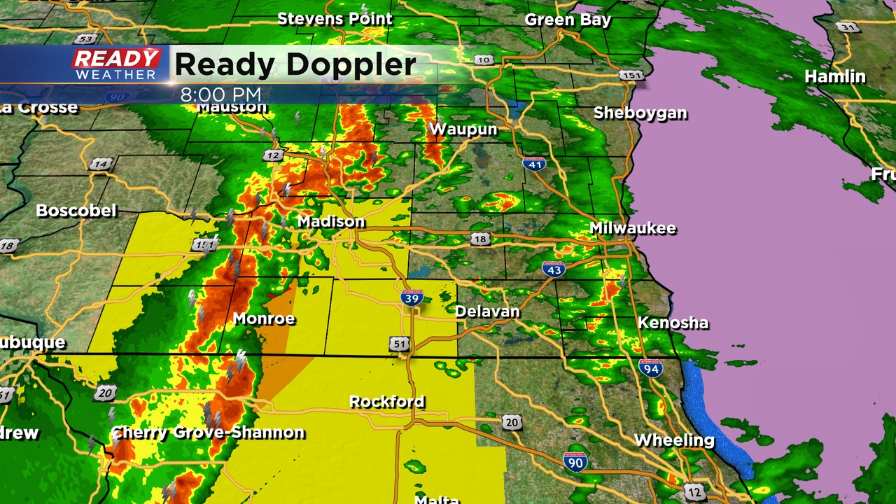
No watches or warnings have been issued for our area. There are scattered showers and storms moving toward the lakefront; however, the main action remains to our west.
The SPC has shifted most of our area under a slight risk with the uncertainty of that line moving east.
That line of strong to severe storms remains in a more favorable environment. We do expect those storms to slowly weaken as they move east. An isolated strong to severe storm can't be ruled out through 10 pm.
________________________________________________________________________________________________
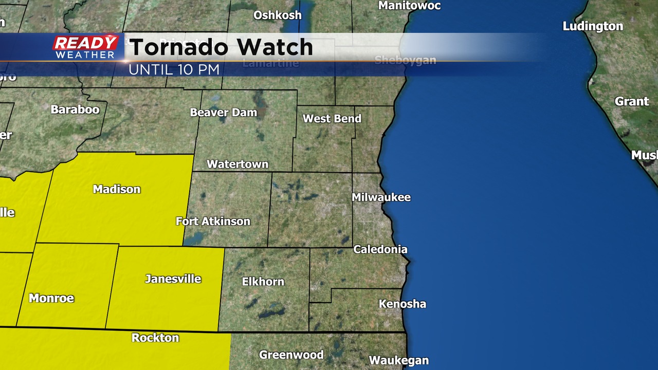
6:00 PM Update: A tornado watch has been issued just to our west until 10:00 pm. The better ingredients for severe weather remain confined across western Wisconsin. The watch was issued in anticipation of the line coming out of Iowa.
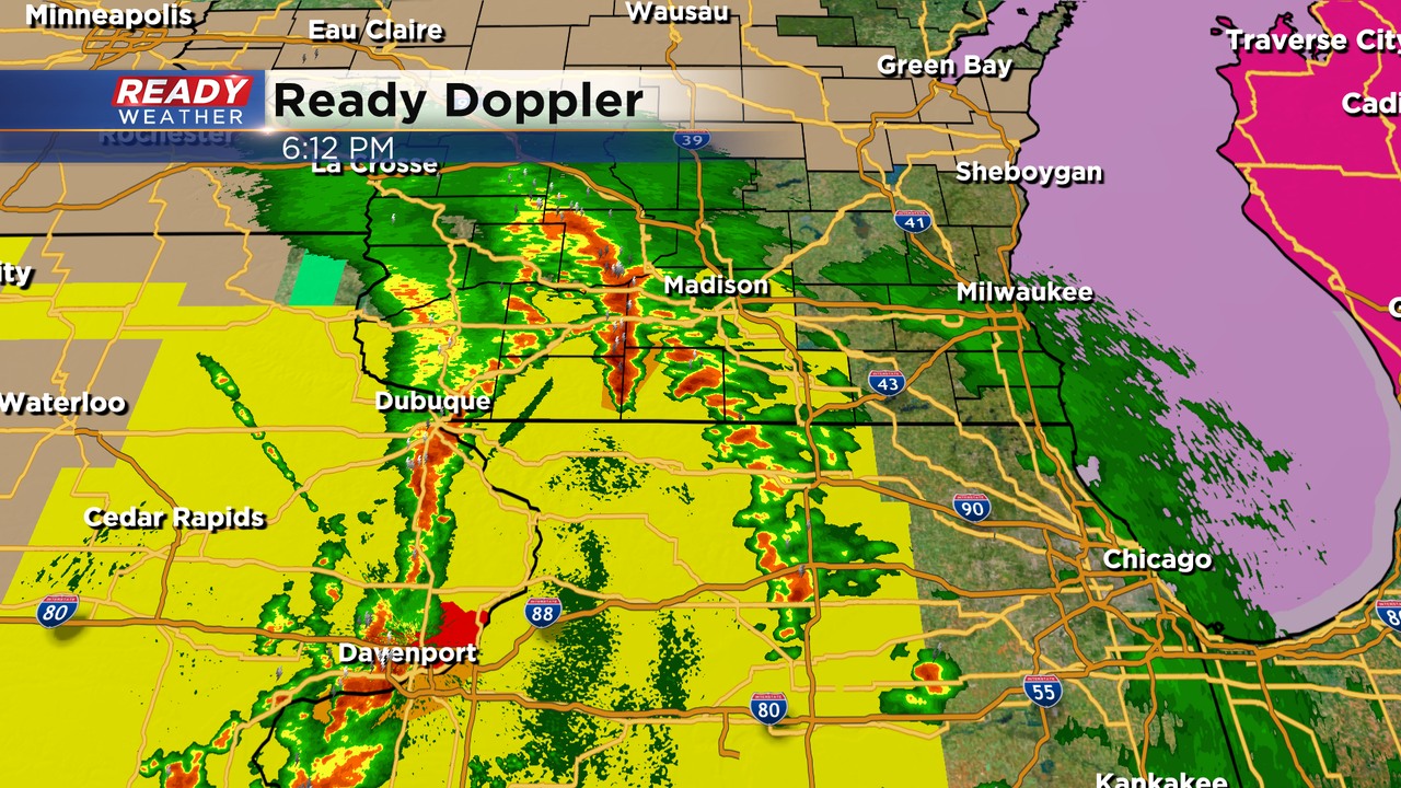
We are watching additional storms popping across northern Illinois that will move north over the next several hours. We do expect scattered rain and storms to move through from now until 10 pm.
______________________________________________________________________________________________________________
5:30 PM Update:
At this time there are no watches or warnings across our area. There is a tornado watch for the southwestern part of the state.
We are expecting widespread scattered showers and storms to arrive between now and 10 pm. The severe weather risk is highly conditional. The warm front will have a tough time moving north thanks to that stout easterly wind off the lake.

If the front nudges north, we will need to watch that area for an isolated tornado threat. The best chance for severe weather is across our southwestern counties. Hail and damaging winds remain the primary threats. Rainfall over an inch remains possible.
______________________________________________________________________________________________________________
Afternoon Update: All is quiet at this time. But the wind is kicking off the lake.

It's another beautiful start to the day with a gorgeous sunrise Tuesday morning but rain chances will increase as we go throughout the day. A few isolated showers or storms might be possible during the afternoon. The best chance for rain including some stronger storms will be after 6 PM through midnight.
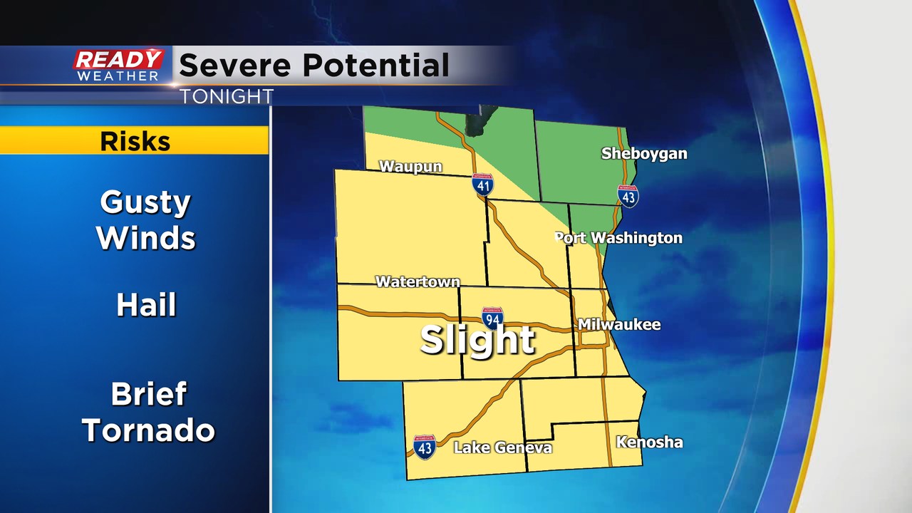
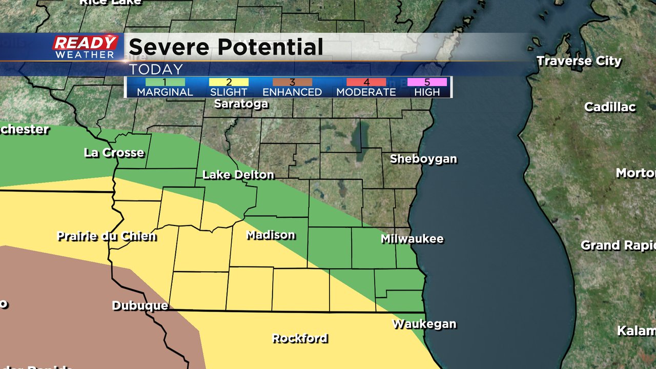
Any storms that develop, especially in our southwestern counties could be on the stronger to isolated severe side. The southwest half of Walworth County along with a sliver of Kenosha and Jefferson Counties are currently under a Level 2 Slight Risk for the possibility for severe storms. Areas north of there are under a Level 1 Marginal Risk.
With any strong to severe storms that develop, strong wind and hail will be the main threats. However, an isolated tornado cannot be ruled out.

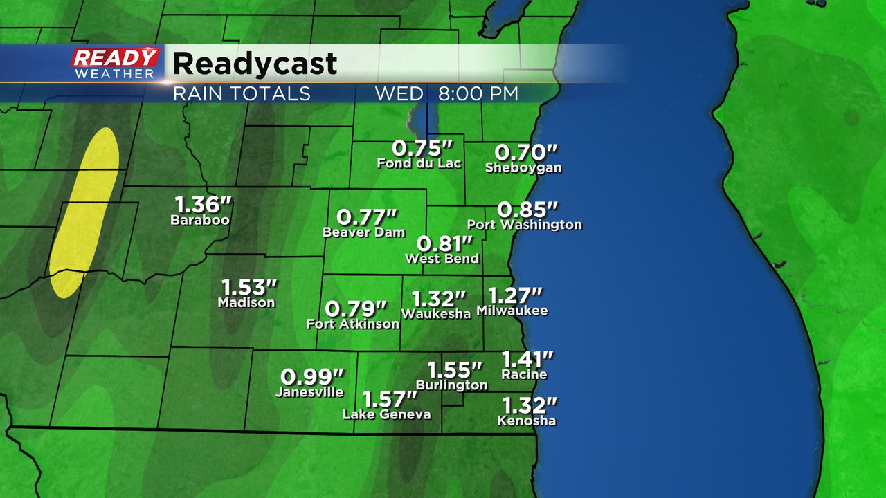
Heavy rain will also likely accompany any storms that develop. Most of southeast Wisconsin will see 0.75-1.50" of rain with some isolated totals over 2". Most area rivers are still running high after all of the rain over the last month so some minor river flooding as well as street flooding may be possible.
Download the CBS 58 Ready Weather app to track the storms Tuesday evening.