Another chance for light snow on Wednesday

-
0:33

Black bear spotted roaming around driveway in Waukesha County
-
4:36

CBS 58’s Theater Thursday: ’Kingdom of the Planet of the...
-
4:03

Life Time Brookfield helping golfers prepare to hit the course
-
3:38

Milwaukee Mitchell International Airport ✈️
-
1:29

MPD honors officers at semi-annual Merit Awards
-
2:34

Waukesha breaks ground on newest, largest parade memorial
-
1:24

Novak Manor permit approved to return this Halloween season
-
2:20

Racine County results show why Biden seeks to secure Black voters’...
-
2:03

Families spending more on child care than housing, study finds
-
1:55

Organizers roll out summer plans for the City of Festivals
-
1:53

Police motorcycles head to Washington D.C to honor fallen officers,...
-
0:53

Souls to the Polls calls for investigation into alleged disruption...

It's really turning out to be a very active week ahead in the weather department. Late December into January was fueled by unseasonably warm highs across the area and very little snowfall. Over the last week the pattern has broken down and more disturbances continue to move across the Midwest.
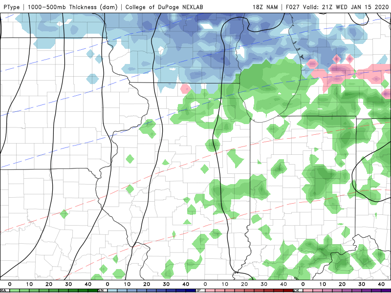
Our next chance for snow will arrive Wednesday morning into the afternoon. Light snow will overspread the area between 8 am and 10 am. The peak of the snow will be around Noon before moving out by the late afternoon. Winter weather advisories have been issued west of our area for tomorrow morning.
Overall snow accumulation will be between a dusting to an inch. An inch will be closer to our northern counties. This is not a big event and surface temperatures will limit problems on the roads for Wednesday.
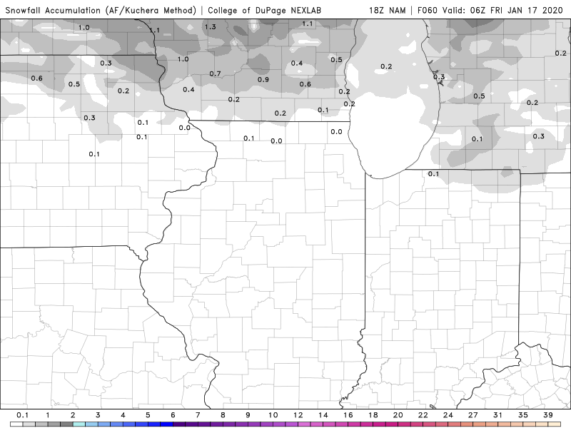
A much stronger system arrives Friday into Saturday. The chance for several inches of snow continues to go up.