Update: Strong storms possible Saturday night
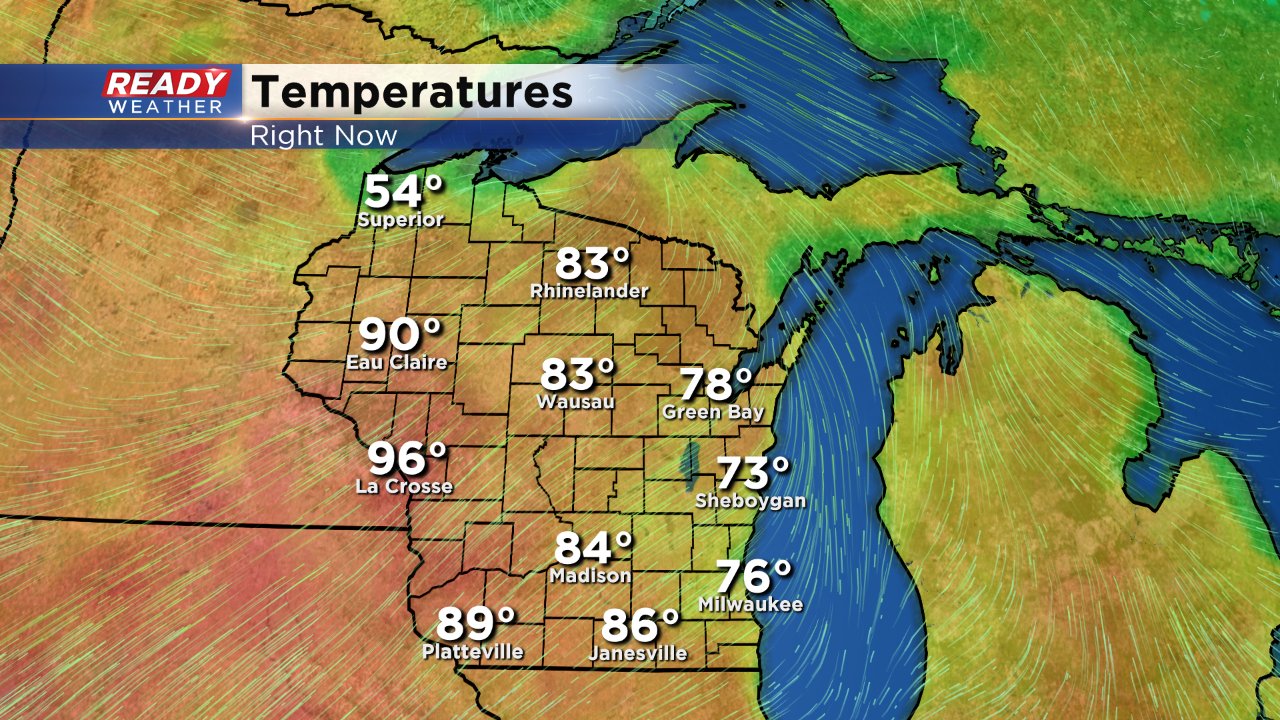
After some Saturday morning thunderstorms another round may be possible Saturday night. After the morning rain the clouds cleared and the temperatures soared into the 80s. Here were the temps around 3 PM:
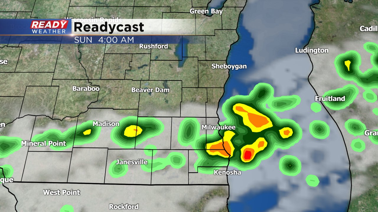
A weak cold front will push through Wisconsin Saturday night and storms are expected to fire upon it. There are a few weather models that have the line weakening and nearly dissipating before it reaches southeast Wisconsin, but consensus is that the storms will stay with us overnight and through Sunday morning. The earliest storms could move through is around 10 PM but most won't see any rain until after midnight.
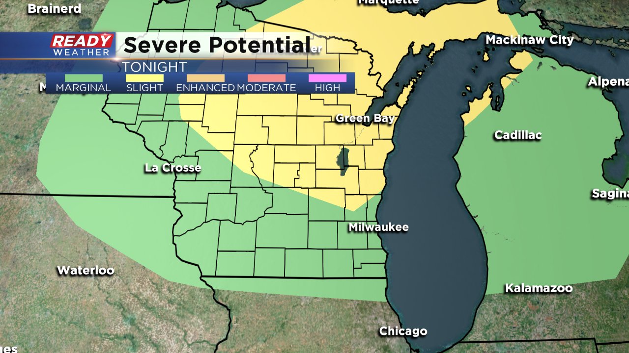
The National Weather Service has some of our northern counties in the "slight" risk for severe weather. The rest of southeast Wisconsin is in the "marginal" risk. Although widespread severe weather is not anticipated a few strong to severe storms will be possible with gusty wind as the main threat.
Download the CBS 58 Ready Weather App to track the rain as it moves across the area.
