Strong Storms and Heavy Rain Possible Starting Early Wednesday
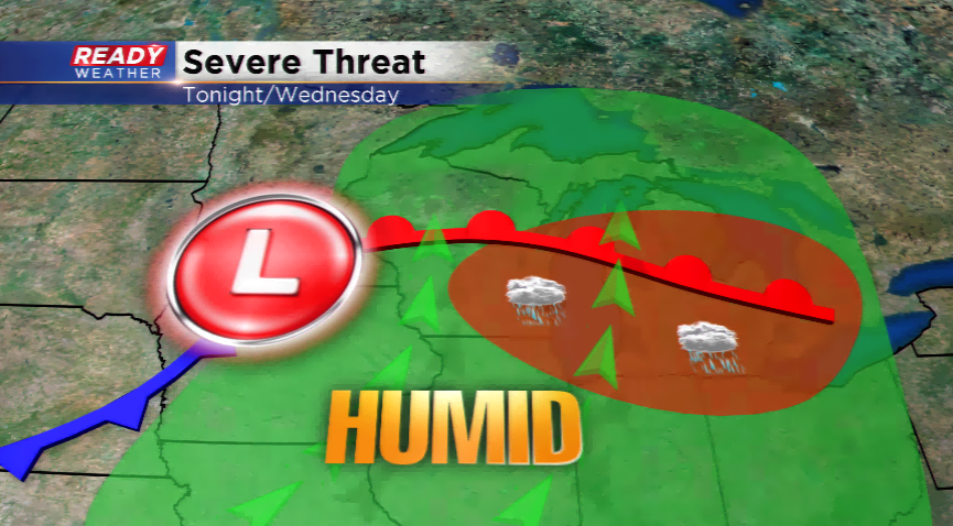
The weather pattern turns active once again for Wednesday with a couple rounds of showers and thunderstorms in southeastern Wisconsin. Round one will slice through later tonight and early Wednesday while round two will generate thunderstorms tomorrow afternoon and evening. Both rounds could contain strong to severe storms. The main threats will be strong winds and heavy downpours.
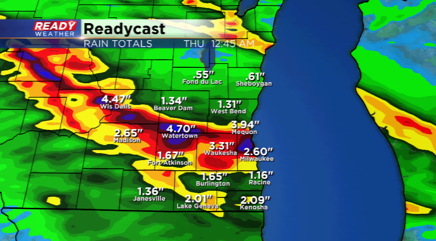
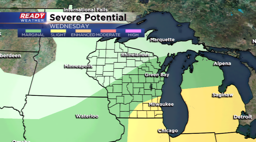
The Storm Prediction Center has put portions of the viewing area under a *slight* risk of severe weather. Like Monday morning, a chunk of the area could see heavy rain. Rainfall totals could exceed 2” with some thunderstorms. Some of our models, including our in-house computer model, are showing a few spots with 3”-5” of rainfall.
We are expecting better organization with storms tomorrow morning, and the storms tomorrow afternoon to be more scattered along the front. With strong to severe storms in the forecast, make sure you have ways of get