Lake effect remains possible overnight for Racine, Kenosha, and Milwaukee counties.


A backdoor front has arrived! What a big change in our weather from the last several days. Winds chills are now in the single digits and teens. It won't be any better overnight.


There's a chance that a lake effect band of snow develops overnight into Saturday morning. Racine, Milwaukee, and Kenosha counties could be impacted by that band with additional accumulation. Up to 1" is possible.
Expect more sunshine and highs in the middle 30s for Saturday.
______________________________________________________________________________________________________________
Updated: Friday, February 23rd 11:20am:
A west to east oriented band of snow has just developed across the Northwoods of the state. This is forming just behind a cold front that will drop south through our viewing area as the afternoon unfolds.
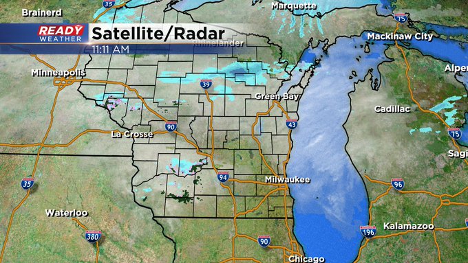

Updated: Friday, February 23rd 9:20am:
The cold front has made it through the Northwoods and is accelerating down the lakefront. The front has just reached Sheboygan and will continue to push south and southwest over the next few hours.

The previous forecast details remain unchanged.
------------------------------------------------------------------------
Temps are starting off mild this morning, but they won't stay mild all day as a strong cold front will drop in from the north, causing temps to drop from the upper 30s to low 40s this morning to below freezing by later afternoon.

Snow showers will develop behind this cold front and impact southeast Wisconsin through the afternoon, ending early this evening.

30 mph winds will accompany these snow showers that'll likely reduce visibility during the afternoon and evening commutes. There won't be a lot of accumulation, generally less than an inch, but slushy roads may turn icy later this evening as temps continue to plummet into the 20s.

While the snow tapers off for most of SE WI by 7-8pm, a band of lake effect snow may develop and brush Racine and Kenosha into tonight.

The colder air behind the cold front will only last through Saturday. Temps warm back to around 50° Sunday and into the low 60s by Tuesday.

Download the CBS 58 Ready Weather App to keep track of the incoming snow showers.