Snow for parts of Wisconsin on Wednesday
November first will continue to feel like early winter with another disturbance moving across Wisconsin. The jetstream will deliver the lift needed for scattered rain across southeastern Wisconsin Wednesday afternoon and evening. Snow showers are expected to develop for the northern part of the state.
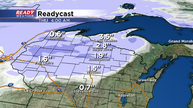
A warm front should keep highs across southern Wisconsin in the lower 40s. The atmospheric column will remain warm enough to support rain; however, north of the boundary, the cold air should be in place for snow to develop from Wausau to the northwoods.
While this fast moving wave won't cause huge headaches, a swath of 1" to 3" will be likely. You can see the highest totals are expected to occur across the northwoods.
Travel in those areas could become slick with a wet slushy snow.
