Tracking snow overnight into Saturday morning

-
4:36

CBS 58’s Theater Thursday: ’Kingdom of the Planet of the...
-
4:03

Life Time Brookfield helping golfers prepare to hit the course
-
3:38

Milwaukee Mitchell International Airport ✈️
-
1:29

MPD honors officers at semi-annual Merit Awards
-
2:34

Waukesha breaks ground on newest, largest parade memorial
-
1:24

Novak Manor permit approved to return this Halloween season
-
2:20

Racine County results show why Biden seeks to secure Black voters’...
-
2:03

Families spending more on child care than housing, study finds
-
1:55

Organizers roll out summer plans for the City of Festivals
-
1:53

Police motorcycles head to Washington D.C to honor fallen officers,...
-
0:53

Souls to the Polls calls for investigation into alleged disruption...
-
0:44

UWM chancellor on campus protests: ’If the encampment doesn’t...

The active snow pattern continues across the area tonight and into Saturday! Another fast moving wave will create more snow across southeastern Wisconsin.
The snow will be light and fluffy thanks to the arctic air in place. Snow will likely hold off until after 3 am. It will take some time for the atmosphere to saturate.
Most areas by Saturday afternoon will have picked up 1" to 3" of snow. The snow will taper off by early Saturday evening.
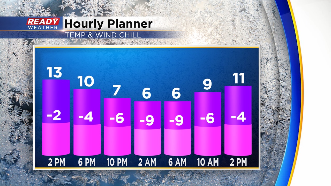
Roads will be impacted once again due to the very cold air. Please use caution early Saturday morning. Another shot of arctic air is coming for Sunday. Wind chills Sunday and Monday morning will be -20 to -30. We anticipate more wind chill advisories to be issued.
Finally, by the end of next week the arctic air will retreat as temperature get closer to normal.