More snow and arctic air arrive Thursday into Friday

-
1:29

MPD honors officers at semi-annual Merit Awards
-
2:34

Waukesha breaks ground on newest, largest parade memorial
-
1:24

Novak Manor permit approved to return this Halloween season
-
2:20

Racine County results show why Biden seeks to secure Black voters’...
-
2:03

Families spending more on child care than housing, study finds
-
1:55

Organizers roll out summer plans for the City of Festivals
-
1:53

Police motorcycles head to Washington D.C to honor fallen officers,...
-
0:53

Souls to the Polls calls for investigation into alleged disruption...
-
0:44

UWM chancellor on campus protests: ’If the encampment doesn’t...
-
1:02

Spring wind
-
1:29

MATC’s annual plant sale returns Saturday, proceeds to support...
-
2:38

Confirmed tornadoes from Tuesday’s Severe weather outbreak

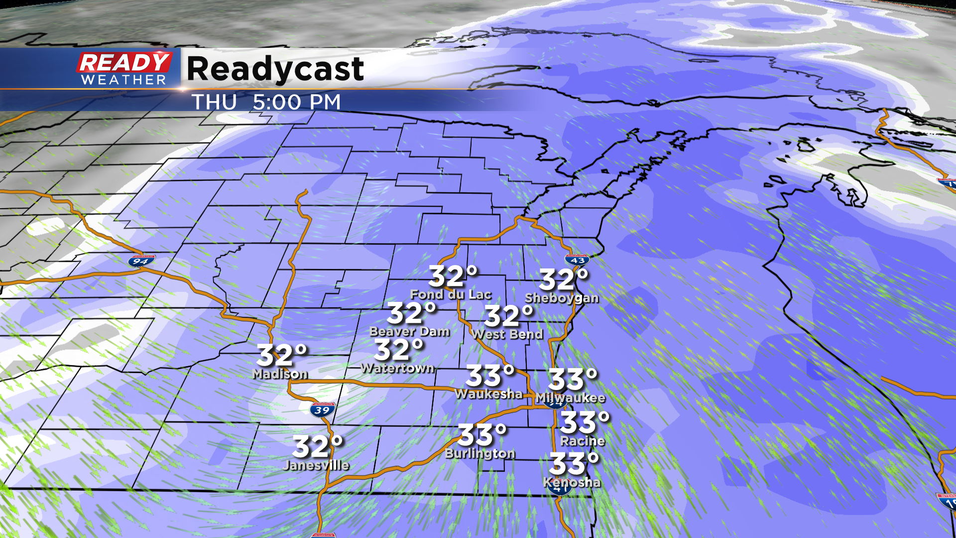
Another round of snow is set to arrive across southeastern Wisconsin on Thursday. Between 6 am and Noon expect a wintry mix before it turns over to all snow by lunchtime.
The Thursday evening commute looks very snowy across the entire metro. The snow will linger overnight into early Friday morning. Snow should be done by the morning commute on Friday. Roads Thursday evening will be slick and snowy.
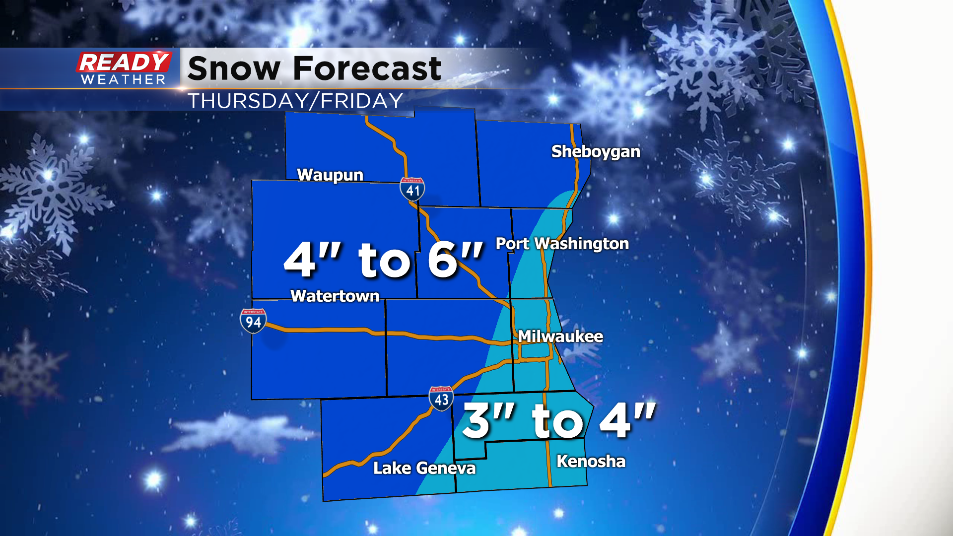
Most of the area will receive 3" to 6" of snow. The highest totals will be across our northern and northwestern areas. Some spots there could be over 6".
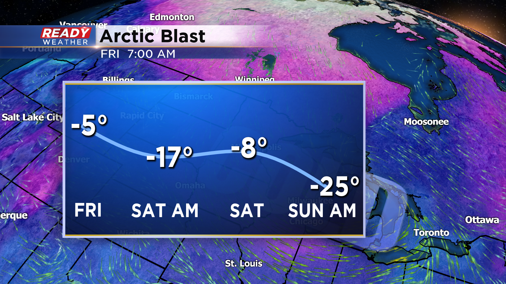
The coldest air of the season is set to arrive on Friday into the weekend as arctic air invades the Midwest. Take a look at the forecasted wind chill graphic above. Wind chills will be subzero for several days creating very dangerous conditions!