Heavy rain still possible Friday night before 90° on Sunday
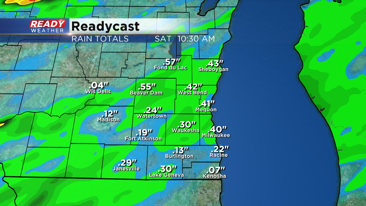
Most of southeast Wisconsin has stayed dry Friday, with those seeing rain only picking up a few hundreths of an inch. Despite the dry start, rain is still expected Friday night and some of it could be heavy. The best chance for rain is from 10 p.m. Friday through 5 a.m. Saturday. A few lingering showers may persist Saturday morning before clearing out Saturday afternoon.
Overall rain totals have gone down a bit with most of southeast Wisconsin expecting 0.25 to 0.50" of rain. Which lakes and rivers should be able to handle without any additional flooding issues, even in Madison.
Temperatures warm 10° Saturday from Friday's high of only 70°. The temperature will warm another 10° of Sunday with most reaching at least the upper 80s if not all the way to 90°.
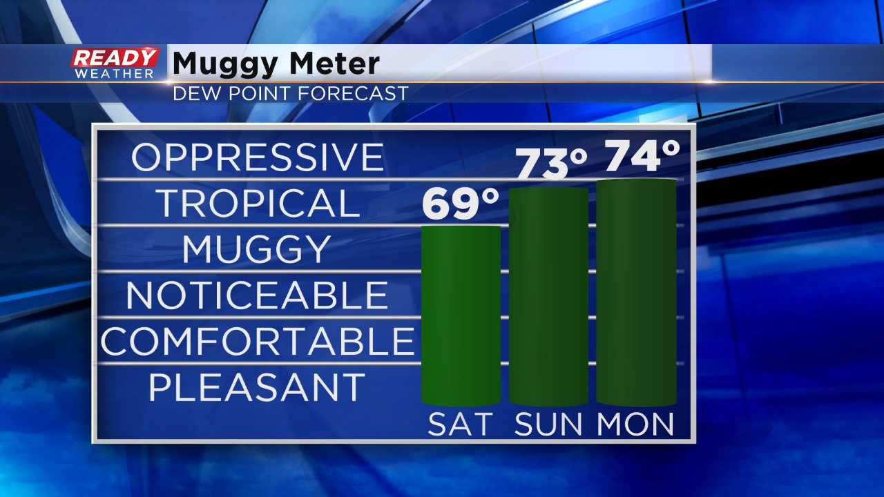
With high humidity surging in, heat indices will feel as warm as 95° at times Sunday afternoon. Humidity will stick around to begin the new work week with dew points in the tropical category and low 70s.
The heat and humidity also bring more storm chances with strong to severe storms possible Sunday evening and heavy rain possible Monday and Tuesday. To track the rain download the CBS 58 Ready Weather App.
