Heat and humidity return Sunday with strong storm potential at night
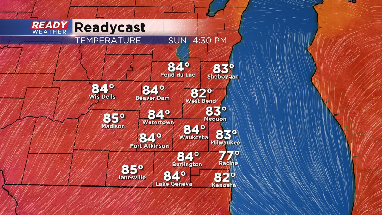
After a very pleasant Saturday the heat and humidity return for Sunday. Saturday we had a lake breeze which kept highs in the middle 70s. Saturday night the wind shifts to the southwest bringing in some warmth that will rise temperatures into the middle 80s.
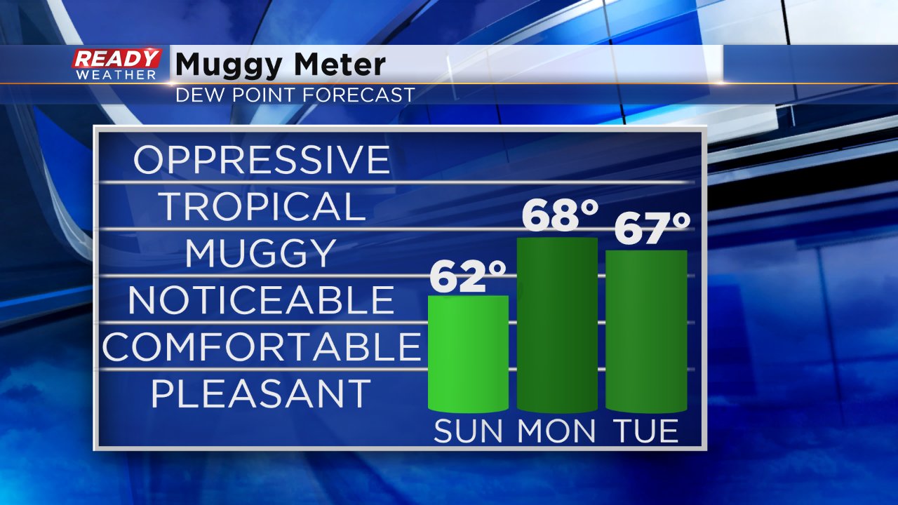
Humidity levels will also start to increase as dew points rise into the lower 60s for Sunday and the upper 60s by Monday and Tuesday.
All of that heat and humidity is going to start to bring in some storm chances, especially for the second half of Sunday. The chance for storms starts around 5:00 PM but really starts to increase after 10:00 PM. If you're going to Summerfest I would suggest the umbrella, but the storms may not arrive until most of the crowd has left the lakefront.
Most weather models have an area of strong to severe thunderstorms sweeping across Wisconsin from north to south Sunday night into Monday morning. A slight majority of those models have the cluster impacting western Wisconsin but some do have southeast Wisconsin in the bullseye. Although the timing of storms is not perfect for severe weather, all of the heat and humidity from the day should increase the strong to severe storm potential. Right now the Storm Prediction Center has southeast Wisconsin in the "marginal" or lowest risk for severe weather and favors western Wisconsin with a "Slight" risk.
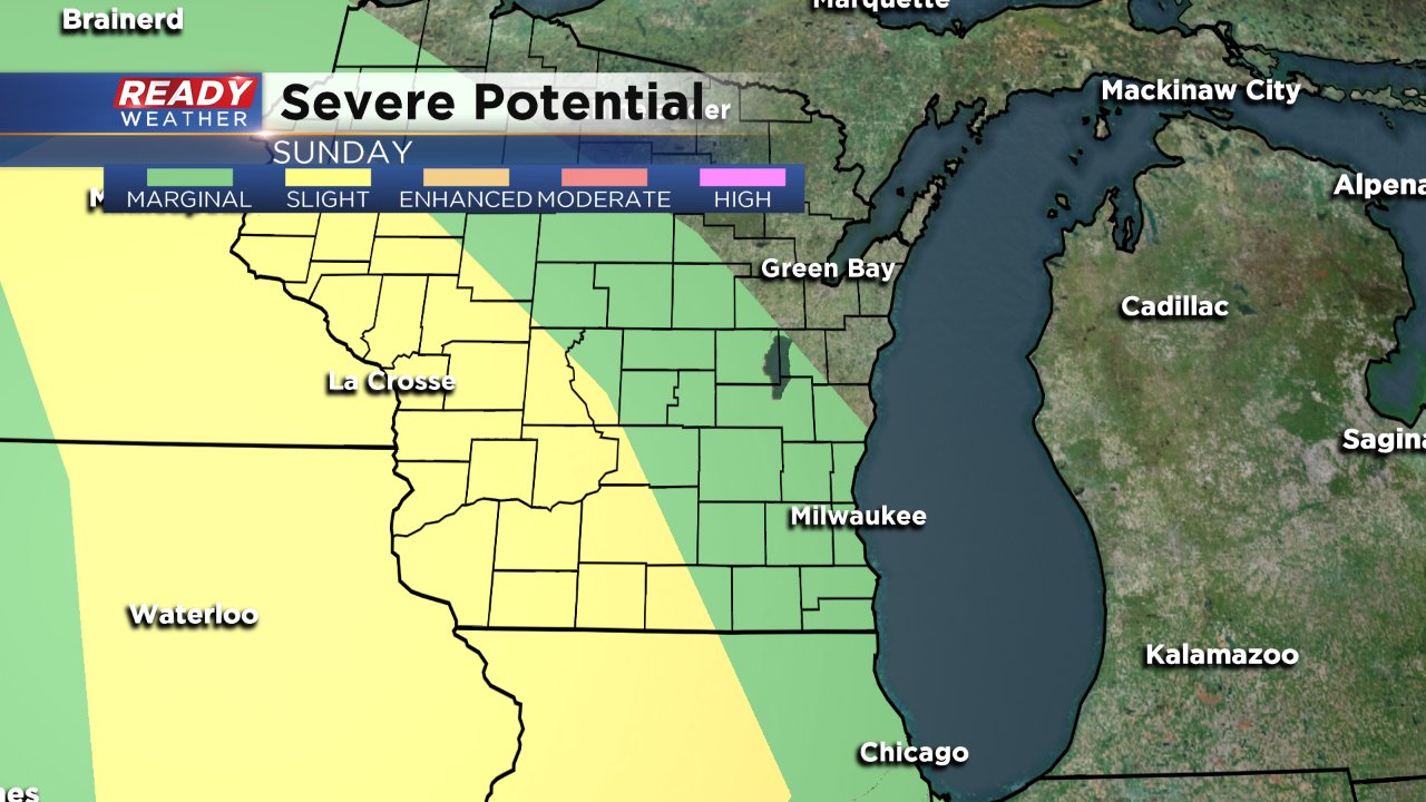
If severe storms do form over southeast Wisconsin large hail will be the main risk with strong wind possible as well. The tornado threat is low.
Download the CBS 58 Ready Weather app to track the storms and stay up to date on the latest forecast.
