First snowfall of season stays north
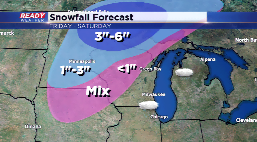
The first accumulating snow of the season is hitting parts of Minnesota and Upper Michigan right now, and will change over to all snow in northern Wisconsin today. Low pressure from the northwest is moving in slowly across the Great Lakes, but will quickly weaken as it occludes and cuts its moisture supply off.
Far northern Wisconsin, the UP, and northeast Minnesota could see 3”-6”, with isolated high amounts closer to Lake Superior. There will be a thin line of 1”-3” of Minnesota to northern Wisconsin, with a mix southwest and south of the snow track.
Southeastern Wisconsin will have to wait for its first snowstorm; however, snowflakes or a few flurries could be flying on the morning on Saturday. Again, don’t expect accumulating snow or anything major.
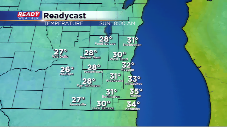
The cold temperatures will be the big story in the viewing area with the first hard freeze likely this season. Overnight lows in Milwaukee could fall to freezing for the first time since March, and inland spots could reach the 20's. Growing season will come to an end this weekend.