Dry spell continues, changes coming midweek!
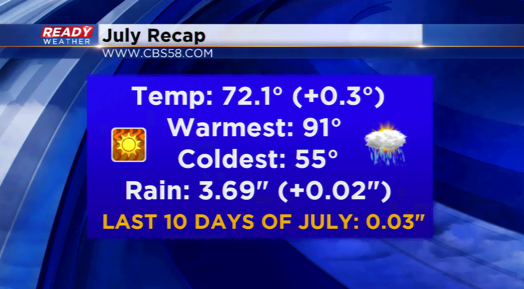
Today will usher in the sixth straight day of no precipitation in Milwaukee and for southeastern Wisconsin. The last time the region had a spell like this, snow was on the ground! If you’re keeping track at home, this was mid-February! Outside of the catastrophic flooding in our southern areas, nothing was eye-popping in our July stats. With all of the rain early in the month, the last ten days were VERY dry!
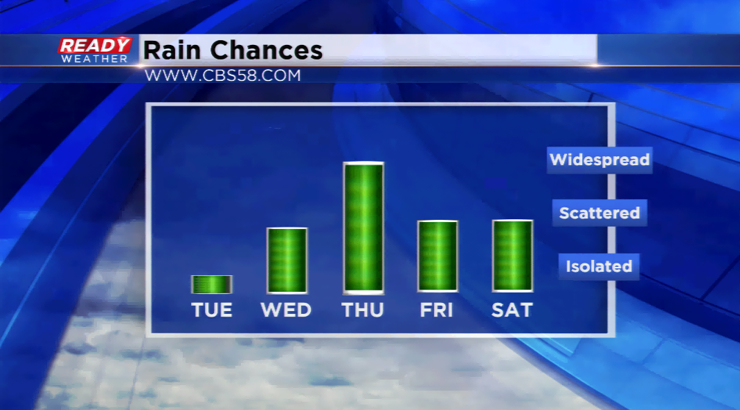
The streak could come to an end on Wednesday with a cold front passing through the area. Scattered showers and storms will be possible by tomorrow afternoon. The coverage will not be widespread, but chances will continue into Thursday. If there are any chances of stronger storms this week, it will be by Thursday. Small hail and gusty winds will be the primary threats. A big cool down is expected with highs dropping into the 70s, and possibly the 60s for Friday.
Looking ahead, there’s nothing on the menu for any substantial warm ups. Next week highs could make it back to around 80.