


Tuesday's winter storm is gone. Rain and wintry mix really reduced totals lakeside where 1-3" fell. Inland counties had some better snow totals with 3-7" reported with highest totals across parts of Waukesha, Washington and Sheboygan Counties.
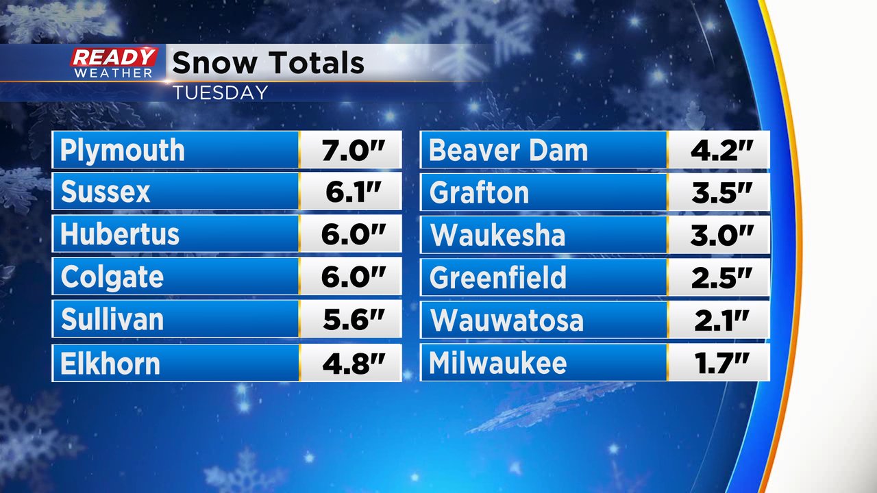
The snowfall in Milwaukee of 1.7" puts our season total at 7.7" which is almost exactly the number we were at at this point of the season last year. But the average is over 17" so we are almost 10" below average.

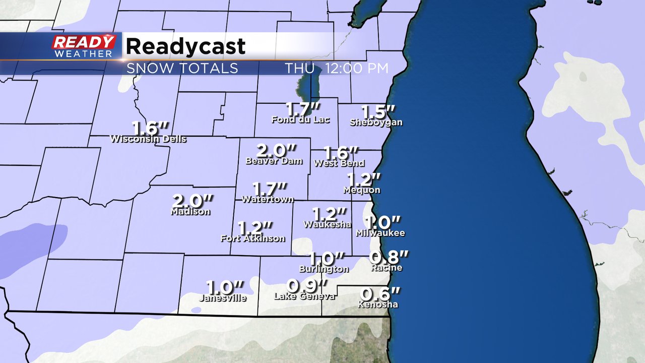
We will start to cut into that snow deficit over next few days with more snow chances. The next chance rolls in Wednesday evening through Thursday morning. The rough window for snowfall is 7 PM to 7 AM. The Thursday morning commute will likely see some minor impacts for the snow. Oftentimes it's the lower snowstorms with an inch or two of snow that can cause the most problems.

Most of southeast Wisconsin will pick up 1-2" of snowfall Wednesday evening through Thursday morning. A few southern counties might not reach the 1" mark and I wouldn't be surprised if we get some totals just over 2" but 1-2" looks good for most of us.
Download the CBS 58 Ready Weather app to track the Wednesday night snowfall with the interactive radar and look ahead to a bigger storm Friday into Saturday.