Another beautiful day before showers and storms return
 CBS 58
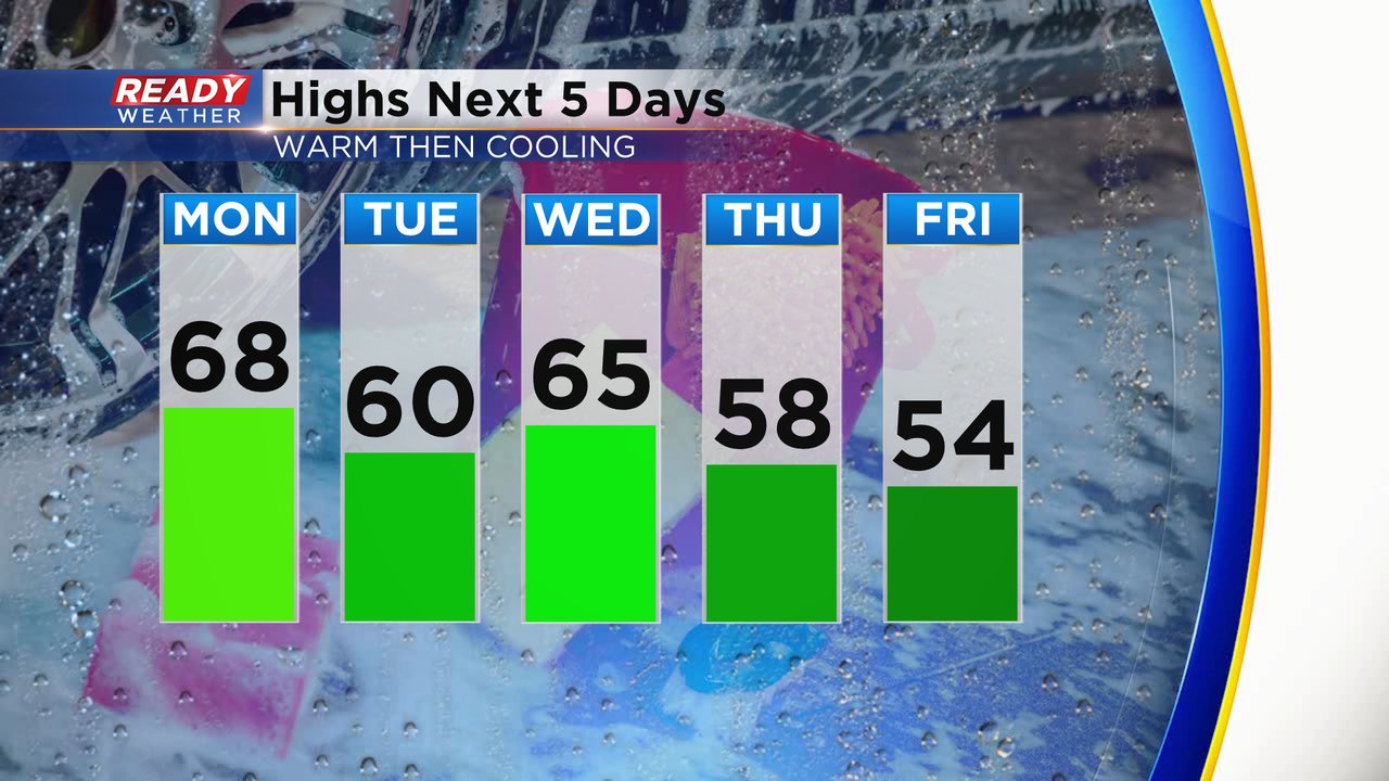
 The weekend was gorgeous!! Wonderful sunshine both days and warm. Highs on Sunday were the warmest of the year in the middle to upper 70s for most and even a few 80s! We are still warm Monday but likely cooler than Sunday with highs Monday in the upper 60s to around 70. We stay mild Tuesday and Wednesday then start to drop closer to average by the end of the work week.
Just like Sunday we will see a lake breeze kick in Monday afternoon. Lakeside communities will see their highs in the early afternoon then drop a bit while inland hometowns keep warming. The wind Monday stays pretty light but becomes gusty Tuesday and the breeze lingers into Wednesday.

After a dry start to the work week Tuesday also starts dry with sunshine then becomes mostly cloudy with a chance for showers and storms. Some rain can't be ruled out Tuesday late morning and afternoon but the best chance is Tuesday evening through Wednesday.

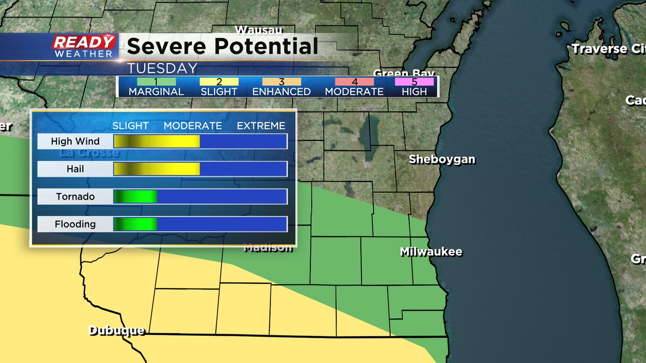
While widespread severe weather doesn't look likely in Wisconsin Tuesday, there is a chance for a few isolated strong to severe storms. That best chance for severe storms will be to our south across parts of Iowa, Missouri and Illinois. A sliver of Walworth County is under the Level 2 Slight Risk with a good chunk of the rest of southeast Wisconsin under a Level 1 Marginal Risk. Gusty wind and hail will be the primary threat with any strong storms that develop. An isolated tornado or some minor flooding can't be ruled out.
Download the CBS 58 Ready Weather app to track the warmth Monday and storms on Tuesday.