Warmth returns with more shower and storm chances

-
1:50

No hurdles block Franklin native Natalie’s path
-
2:28

Natalie’s Everyday Heroes: Milwaukee artist opens gallery to...
-
1:44

280 new graduates earn GED/HSED diplomas at emotional MATC ceremony
-
3:07

Records reveal why MPS Head Start funding got suspended; district...
-
2:05

Search intensifies for Milwaukee man who walked away from group...
-
1:24

Community shaken after 2 teens shot and killed on Milwaukee’s...
-
1:53

Admirals Game 2 preview
-
1:42

Trial begins for man accused of killing Navy sailor in West Allis
-
1:37

Dockless electric scooters now permanently in Milwaukee
-
1:38

’A public health issue’: Period Poverty Awareness Week addresses...
-
1:02

Petunia the therapy dog celebrates National Rescue Day with seniors...
-
3:17

Severe thunderstorm watch canceled for some counties.

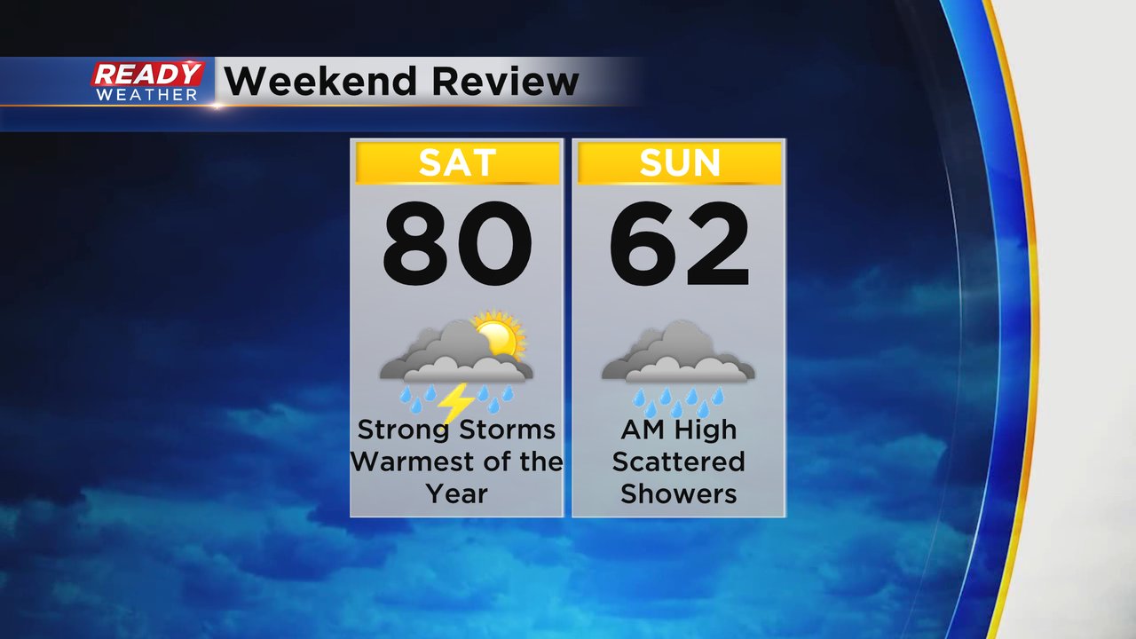
The weekend was a bit up and down. Saturday hit 80 degrees and was the warmest day of the year. Most of the day was dry before strong storms arrived in the evening. Sunday saw highs in the low 60s during the early morning hours and then dropped into the 50s by the afternoon. Light showers lingered throughout the day.
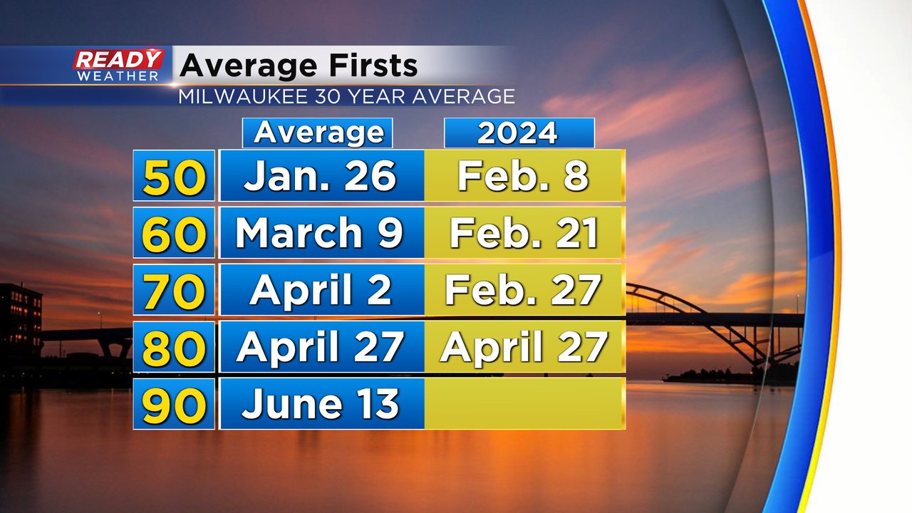
Hitting the first 80 of the season on Saturday was also the exact average date for our first 80 degree day. Now we look ahead to the 90s which don't usually happen until June.
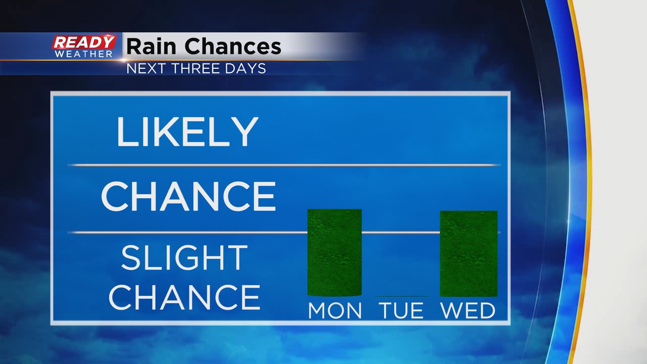
Temperatures this week are warming back up. 70s return on Monday then the rest of the week stays warm in the upper 60s and low 70s.
We saw a brief area of steady rain Monday morning but the rest of the day the rain chance looks pretty isolated with a few more showers through the late afternoon then drying out this evening. Tuesday looks all dry but Wednesday could see some showers or storms but timing is uncertain.
Download the CBS 58 Ready Weather app to track the temperatures and rain chances.