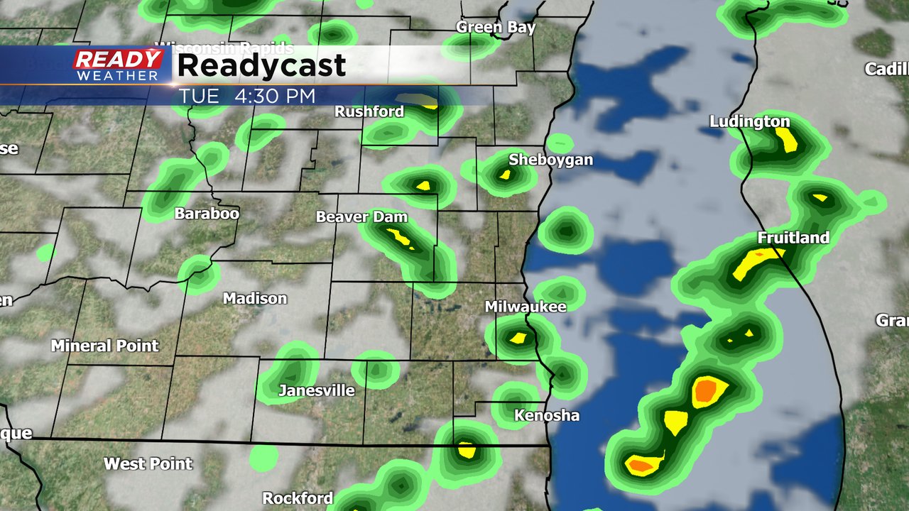
Scattered showers and storms expected Tuesday afternoon and evening


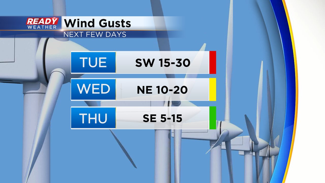
Tuesday will be another warm day with highs reaching the upper 60s to around 70 with a partly cloudy sky in the morning then some storm chances in the afternoon and evening. The wind stays gusty with a southwest wind pushing 30 mph at times. That wind stays strong Tuesday night but shifts to the north then a breezy NE wind is expected Wednesday with light wind on the way Thursday.
There's a good chance for at least a few showers and storms Tuesday afternoon and evening. The timing window looks best from 2-8 PM. Overall the rain looks pretty light with less than a tenth of an inch of rain expected for most of southeast Wisconsin but higher totals are possible in thunderstorms.
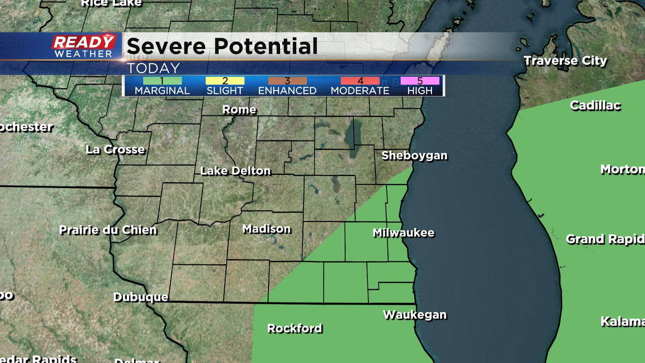
With all the warmth throughout the day we could get enough energy to see some very isolated strong to severe storms. Small hail and gusty wind may be a possibility with any storms that do develop so the Storm Prediction Center has added parts of southeast Wisconsin to the Level 1 Marginal Risk for severe weather.
Download the CBS 58 Ready Weather app to track the showers and storms Tuesday.