Wind Chill Temps. Dropping to Dangerous Levels
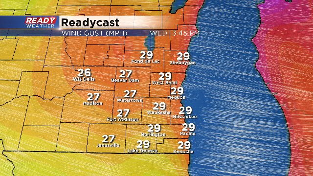
It's already cold outside. And soon, we'll be experiencing some dangerous wind chill readings. Highs the next few days will be in the low to mid teens. But with the wind, it'll feel like -5 to -15. On Wednesday, wind gusts pick up in the afternoon, creating even colder wind chills. Plus we could see blowing snow, especially in outlying areas.
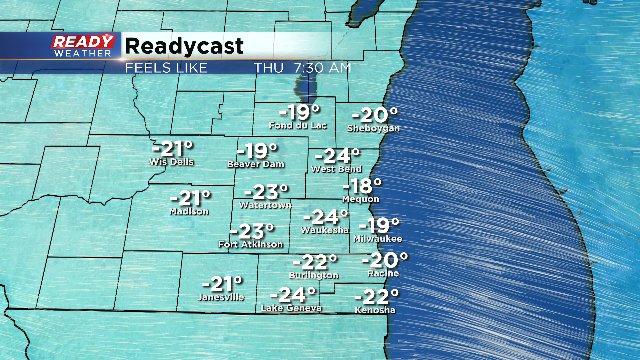
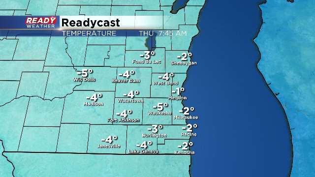
The core of the cold air reaches us from Canada Thursday morning. This is when we'll have overnight lows in the negative territory. In addition, the "real feel" deal will be -20 or colder. Highs on Thursday will only approach 10.

With this type of cold, it's best to limit your time outside, perhaps 10 to 15 minutes. Pets should be watched carefully and kept inside if possible. And with this type of weather, you shouldn't keep your child waiting too long at the bus stop.
It does get milder on Friday. But then the chance for snow increases, especially be the afternoon. Then the snow will stick around through Saturday. The storm looks similar to last week's event.
To keep track of all the changes, make sure to download the free CBS58 weather app.