
-
2:12

Meet CBS 58’s Pet of the Week: Joey
-
2:59

Natalie’s Everyday Heroes: Indy Slot Car Series going strong...
-
2:23

Sen. Ron Johnson calls for ’education campaign’ that includes...
-
1:46

History Channel star judges international contest at MSOE
-
2:09

Gov. Evers tours newly renovated Germantown Recycling Facility
-
2:04

Wisconsin nursing home advocates push back against new federal...
-
1:43

’It’s usually the innocent ones that are taken:’ Family...
-
2:20

Sade Robinson murder: Maxwell Anderson pleads not guilty to all...
-
1:22

’We all have a responsibility’: Volunteers pick up litter...
-
1:53

Marquette, MPS host 3rd annual mental health seminar for Black...
-
1:57

Do your part this Earth Day: Cut back on textile waste
-
2:10

Don’t plant yet! More frost and freeze conditions possible...

It's been a struggle on temperatures this month. Here's a check up on where we stand:
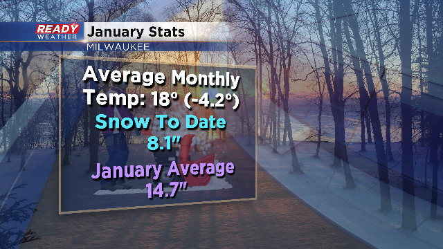
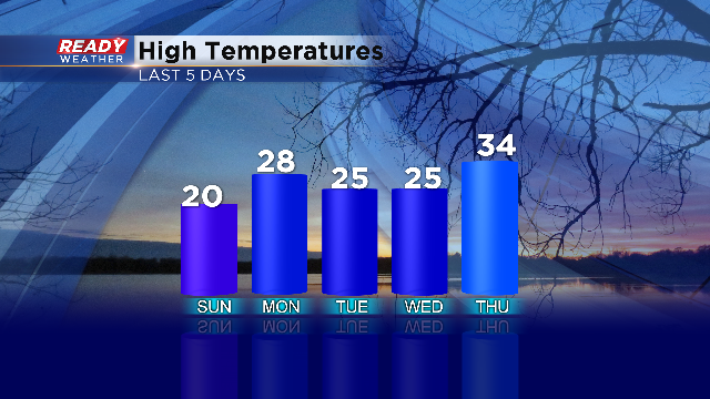
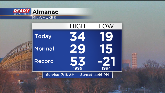

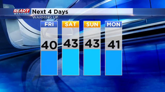

I'm meteorologist Rebecca Schuld
Sign up for the CBS 58 Newsletter