Temperatures Warm Our Hearts This Valentine's Day (for Now)

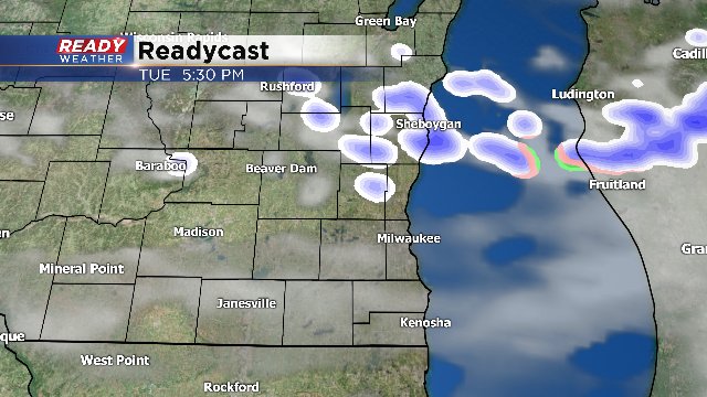
We get one more mild day and then the temperatures take a downward turn for the middle of the week. Just like yesterday, we'll see highs today in the 40s. But a weak "back door" cool front will slide down from the north by late in the day and even touch off a few flurries or light snow showers. These will not last long. In fact, they should be gone by mid-evening.
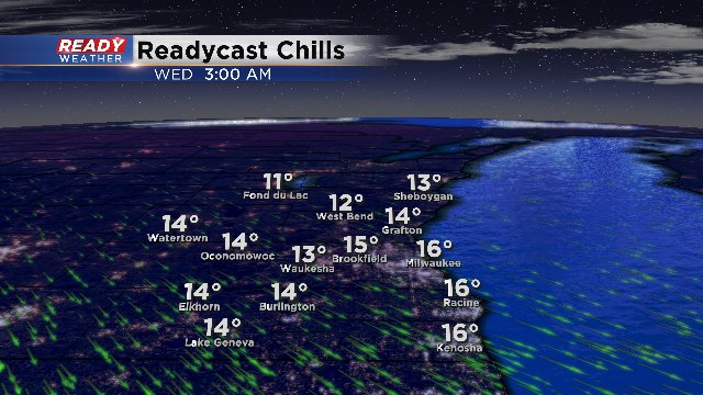
The airmass behind the system will be colder. We're talking about highs in the low to mid 30s for both Wednesday and Thursday. Any wind will make it feel like the single digits and teens.
But if you want the warmth back, you're in luck. How about 50s for the upcoming weekend? Just wait for a few days.
The next real chance for significant precipitation will be next Tuesday with the prospect for rain showers. We need the moisture. The snowfall deficit is about 9.5 inches.