Strong Storms and Heavy Rain Possible Friday
Heavy rain and flash flooding plagued much of south central and southwestern Wisconsin last night and this morning. A number of flash flood warnings had to be issued along with flood advisories. The Madison and La Crosse area both received 1”-3” of rainfall depending on the sensor. A number of damaging wind reports were seen in those locations as well. Rain showers and gusty winds were the norm in the complexes of storms the CBS58 viewing area saw last night and this morning.
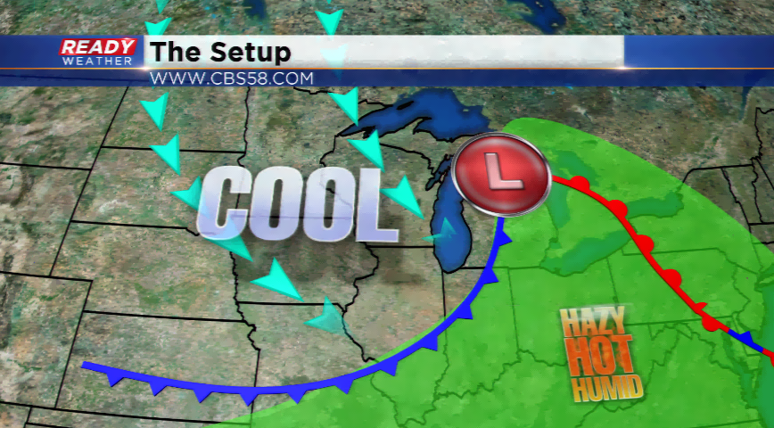
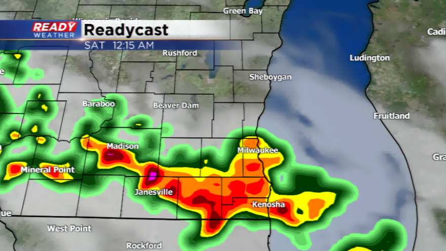
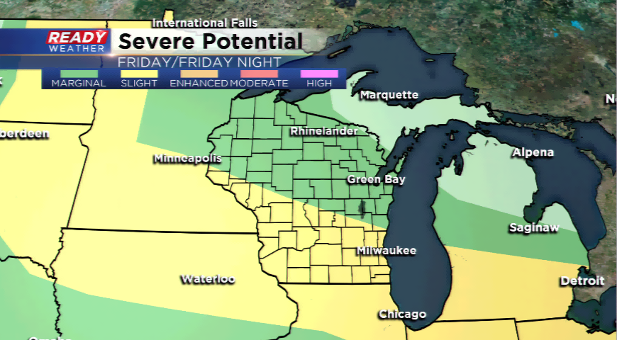
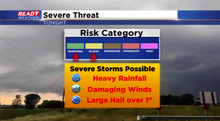
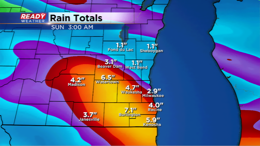
The next threat of heavy rainfall and strong to severe storms tracks in Friday. The Storm Prediction Center has placed the area under a *slight* risk of severe thunderstorms for the afternoon, evening, and overnight on Friday into Saturday morning. The best chances for strong winds and large hail will be Friday afternoon and evening. Expect the atmosphere to saturate quickly Friday night with very heavy rainfall possible around southern Wisconsin. From La Crosse to Madison to Walworth, Racine, and Kenosha – there could be flooding problems. Some computer models are hinting at 1”-3” of rainfall, with isolated locations picking up even more. This will have to be watched very closely.
The weather pattern quiets down by the end of the weekend and early next week with a sweeping cold front. Highs plunge back down into the 70s for daytime highs. Less humidity is expected for the first part of next week.