Storms Tonight, Warm Tomorrow
Lingering clouds and fog was the story of the day. But now our attention is focused on the chance for storms tonight. The National Weather Service's Storm Prediction Center has outlined a slight risk for severe storms to our south and a "marginal" risk across half of the viewing area. Take a look.
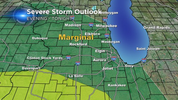
While the better chance for severe storms stay south, there's still a small chance for a few stronger storms in the green area.
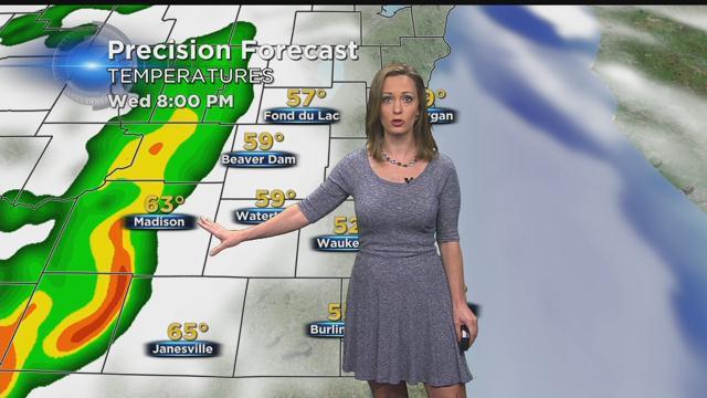
This is what we're monitoring this afternoon.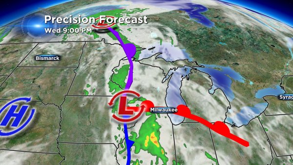
An area of low pressure is positioned just to our south and west. While we have been stuck under cloudy conditions, some sun breaking through to our south has aided in the development of strong storms in central Illinois. As we continue into the night, that warm front is progged to move into our area. That will be the focal point for some storm development from about 9PM to 1AM. We have plenty of moisture to work with, but the dynamics for severe storms in our area are fairly weak. In the strongest storms, look for some gusty wind and downpours.
The activity will be over by daybreak tomorrow. And behind this system brace for winds to whip around to the west. That will allow a quick warm-up for us tomorrow with highs around 70° under a mix of sun and clouds. Enjoy it, because it's back to the lower 60s Friday with afternoon showers and then 50s ahead for the weekend.
I'm meteorologist Rebecca Schuld