Storms Return for Wednesday....Strong to Severe?
Wednesday will be a very active day with two rounds of scattered showers and storms across SE WI. There will be a weakening complex of storms that will cross into our area between 8 am and 1 pm.
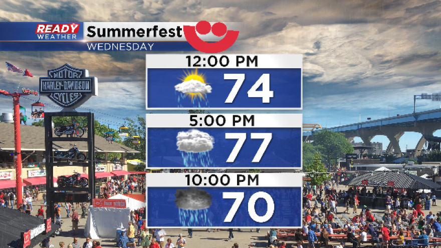
We don't expect the first round of showers and storms to become severe, but that lingering rain could impact the start of Summerfest if you are heading out during the afternoon.
The biggest question for tomorrow will be how much sunshine will return to destabilize the atmosphere for evening storms. Convective debris clouds and lingering showers will limit surface heating, and that will reduce the overall threat for strong to severe evening storms for our area.
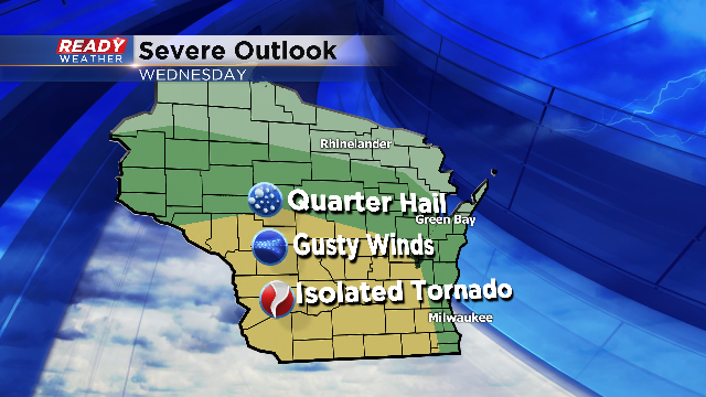
Take a look at the severe weather outlook. The greatest severe weather risk will be across SW WI. The best ingredients will pool there to produce isolated tornadoes.
Closer to home we could see small hail, gusty winds, and heavy rainfall. Please be mindful of lightning and thunder for your Summerfest plans. Seek shelter if you hear thunder approaching.