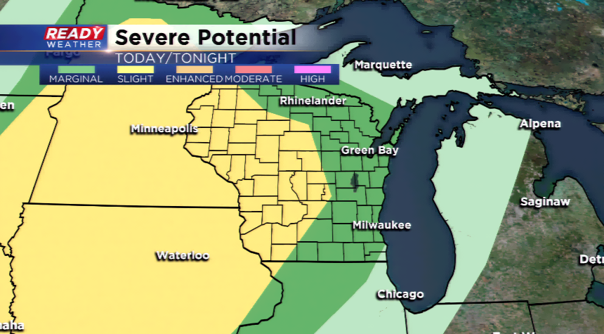
Storms, rain and flooding possible
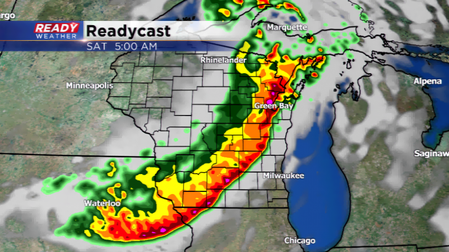
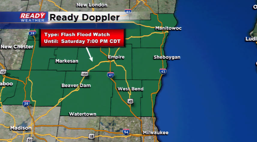
The weather has been nice the last two days with cooler than average temperatures and lower humidity levels behind a Canadian High. Our weather pattern will change around a deeper column of moisture and plenty of energy in the upper levels of the atmosphere with a disturbance. The advection of warmer air and more humidity may fire up a shower or a storm this afternoon. However, better chances will be available for widespread showers and storms late tonight. These storms could contain wind and heavy rainfall. The National Weather Service has issued a Flash Flood Watch for portions of our area north of Milwaukee.

Depending on where the line of storms goes tonight will ultimately direct what happens on Saturday. There could be more rounds of showers and storms if instability returns, but the low level jet which produces the nocturnal storms will not be as evident.
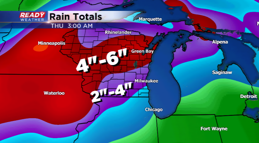
The unsettled weather will likely continue for the area with more rain and storms for Sunday, especially late, and again early next week. The rainfall totals could really stack up into the 4”-6” range, so flooding will be a problem for most in the upcoming week.