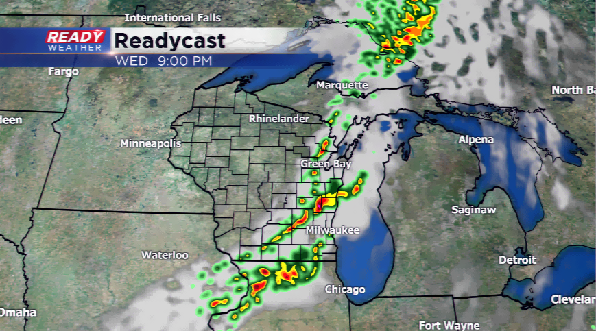
Storms could fire later today, some strong to severe
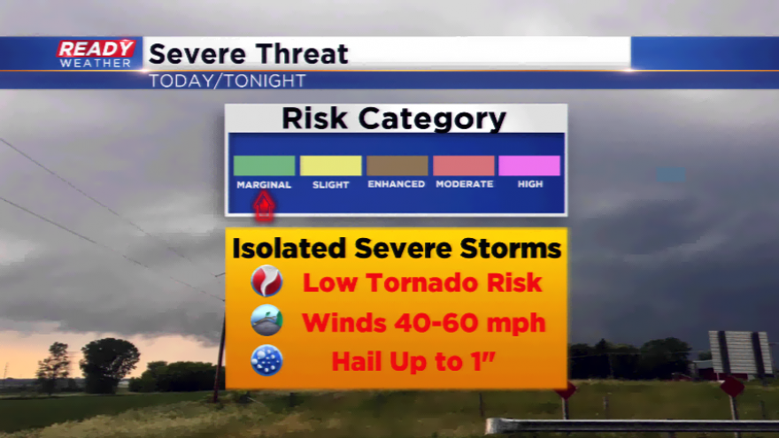
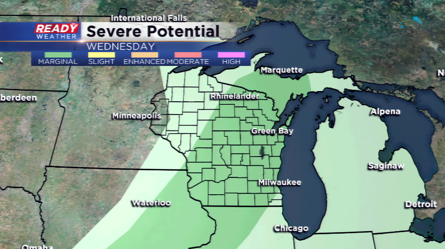
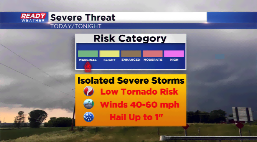
With those dynamics in place, some stronger storms are possible around a boundary later today and tonight. A weakening cold front will bring enough spring in the atmosphere and convergence to fire up showers and thunderstorms. The main concerns will be hail and gusty winds. The best chances start this evening after 7pm. Most of the activity will taper off by the commute Thursday morning, if not sooner.
If we can squeeze out this storm system without severe weather, that would be great. What we also want to wring out is some rain. The last time measurable rain fell in Milwaukee was September 8th, almost two weeks ago! The region is almost two inches below normal for rain this month, and well over five inches below average since the end of July. Rain, and no severe weather, would be welcomed in southeastern Wisconsin.