Solar eclipse weather update plus chance for severe storms
Not too much has changed in the forecast for the solar eclipse across southeast Wisconsin. A mostly cloudy sky is still expected with the chance for a few showers and storms. BUT, there is still some hope depending on which weather model you look at.
As of Sunday evening, the general consensus is that a cluster of storms across Iowa and southern Minnesota will move eastward early Monday morning. These are expected to weaken as they reach southeast Wisconsin so some may stay dry in the morning, but the cloud cover associated with the system is the real problem. The best chance for a few breaks will likely be towards the end of the partial eclipse around 2:30 PM when we get a lull between a morning chance for storms and a better chance in the evening.

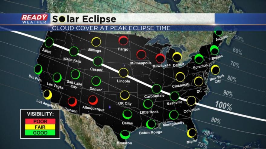
If you really want to see the eclipse, but can only drive a few hours then it's a tough call. Going NW may be an option towards central Wisconsin which should miss out on the morning storms to the south. Driving SW is also a possibility to go towards Rockford. My recommendation would be to wake up and look at the latest satellite image on the Ready Weather App and then make a decision from there. If you are planning on going to the path of totality down in Missouri or Southern Illinois your forecast looks pretty good with fair to good viewing conditions expected. The best spot to see it will be the Pacific Northwest and Tennessee Valley.
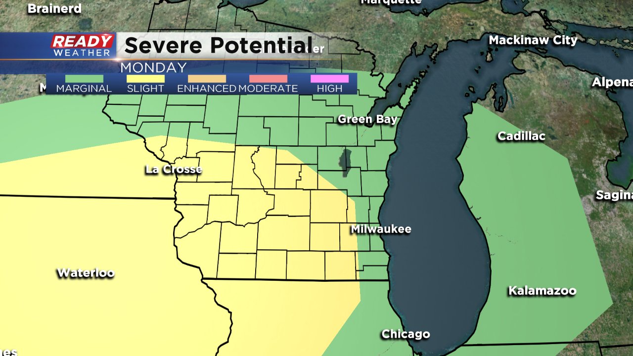
Regardless of the eclipse, Monday is expected to be warm and humid with highs in the middle 80s and dew points around 70° giving it a pretty tropical feel. All of that heat and humidity will bring in a chance for storms Monday evening. At this point it looks like a pretty late event with the strongest storms after sunset. A "slight" risk for severe weather has been issued for western counties in the viewing area. Damaging wind and large hail are the biggest threats, but there are signs that enough rotation may be around to present a tornado risk.
Rain will last into Tuesday morning with most spots seeing a little over one inch of rain by noon on Tuesday. Sunshine returns by Tuesday evening with cooler temps in the lower 70s moving in for the middle and end of the week.
Don't forget to download the CBS 58 Ready Weather App. Not only can you track the rain with the interactive radar, but you can read the latest eclipse forecast in the blog and track cloud cover too!