Snow Makes a Return to Southeast Wisconsin


CLICK HERE FOR THE LATEST ON THIS WINTER STORM.
Racine and Kenosha remain out of the Winter Weather Advisory at this time. Those areas will see the lowest snowfall totals between 1" to 3".
We are still on track for snow coming our way later this evening and much of Wednesday. The computer models are hinting at some colder air and slightly higher snow amounts as the storm track dips south.
A Winter Weather Advisory is issued when accumulating snow and travel issues are expected.
Snow is expected overnight into the morning commute. Snow will continue on and off throughout Wednesday, and again pick up for the evening commute. That will slow travel for Wednesday evening. This snow will be heavy and could burst at times, reducing visibility and causing dangerous road conditions. This snow will be very heavy to shovel, so please use caution if you are not in great health.
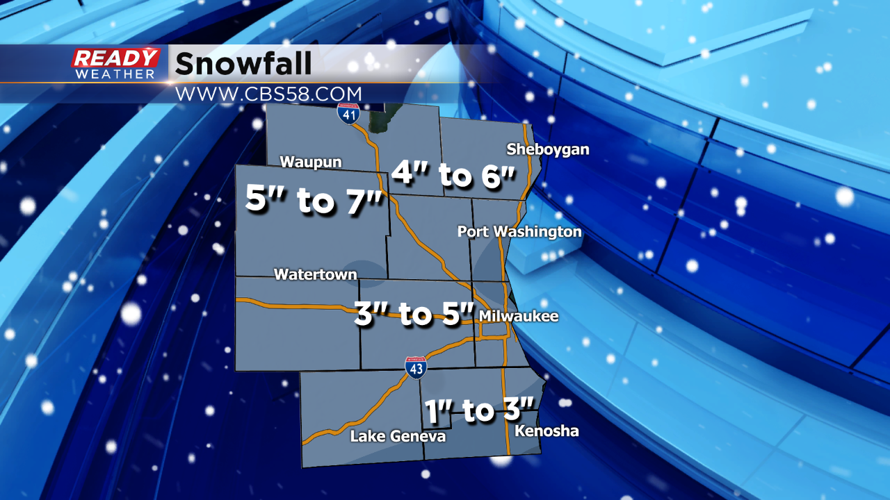
We are expecting a swath of 3" to 5" between Waukesha and Milwaukee. Our northern counties will have a decent chance to receive 5" to 7". The snow accumulation across our southern counties will be heavier away from the lake.
Stay tuned to CBS58 on air and online for the latest weather developments. The CBS58 Ready Weather team will keep you ahead of the storm. Also, make sure to download the free CBS58 weather app.