Overnight Update: Severe weather threat is over. More rain arrives.
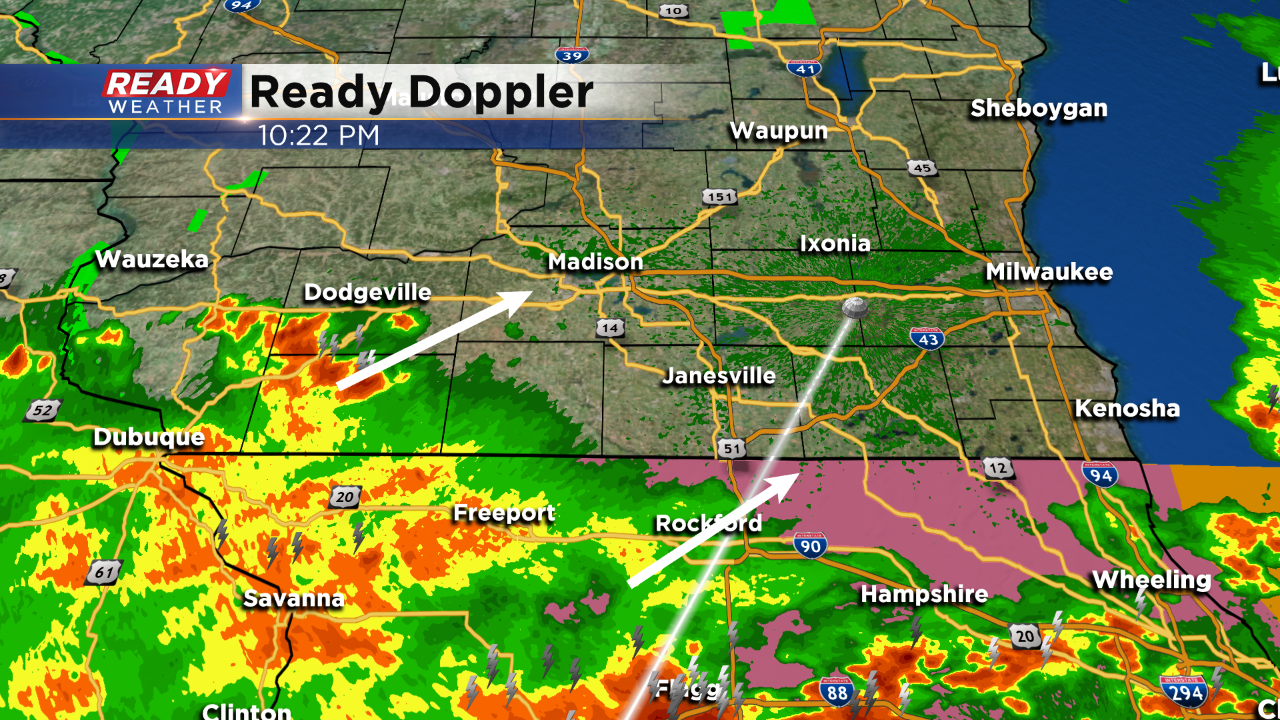
Plenty of severe weather reports across the area from a very intense line of showers and storms that started in western Wisconsin. This line was moving at 60 mph and produced 60 mph damaging wind gusts and golf ball hail in Walworth county. That line of severe storms has pushed through; however, the rain isn't over yet.
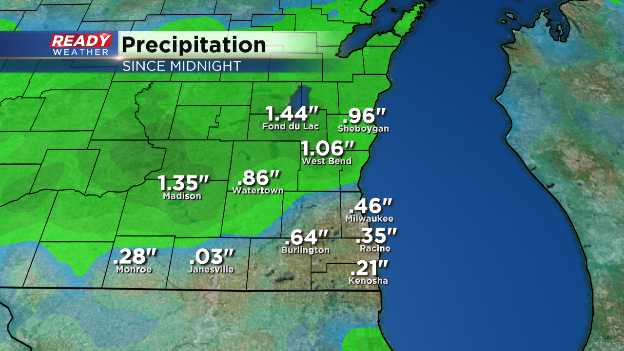
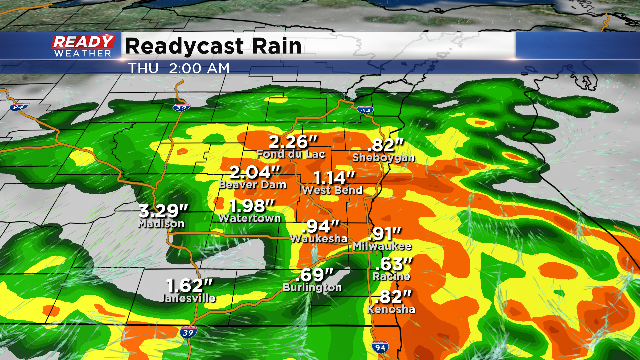
Today's rainfall was heavy at times. We are expecting more rain and some embedded thunder overnight. Rain will linger for your morning commute. A noticeable break arrives for Thursday afternoon with more rain and storms expected for Thursday night into early Friday morning. The greatest severe weather risk will slide across northern Illinois on Thursday.
8 PM Update:
A few isolated cells have brushed Kenosha county late this afternoon, but not severe. Now, a line of strong to severe storms is working through our western and central communities, and eventually will reach the lakefront. This line has triggered warnings for the potential of two inch diameter hail and winds to 60 mph. We’ve already had confirmed reports of quarter size (1”) hail in Dodge county around Ashippun and 60 mph winds just west of Jackson.
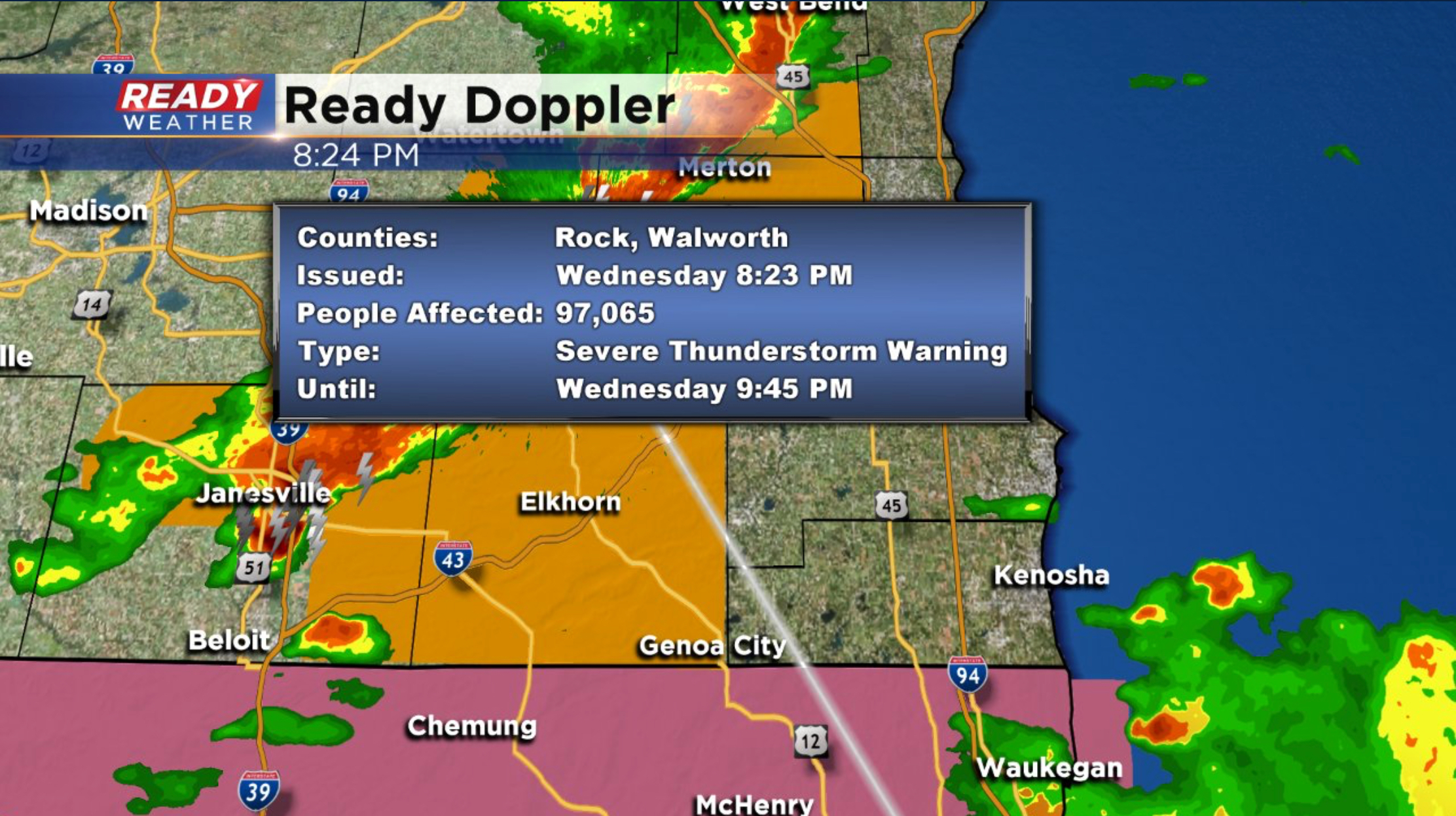
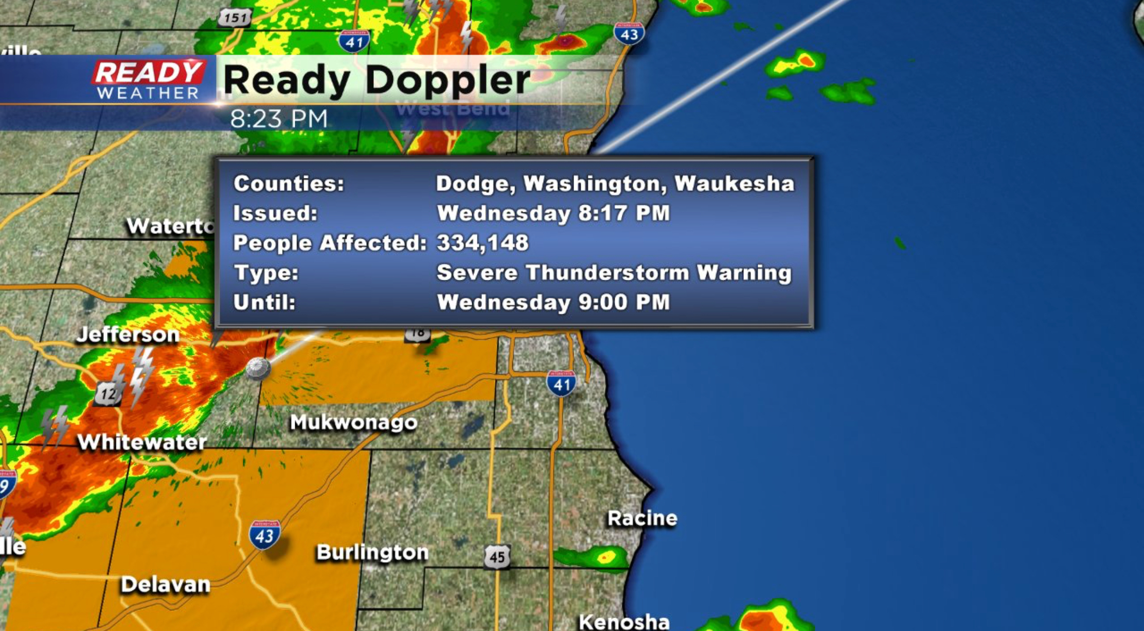
This line is moving east at 30-40 mph. Please take shelter if you are in line of these storms.
While most of the storms this afternoon and early evening have been confined across northern Illinois, a few storms have impacted Kenosha county.
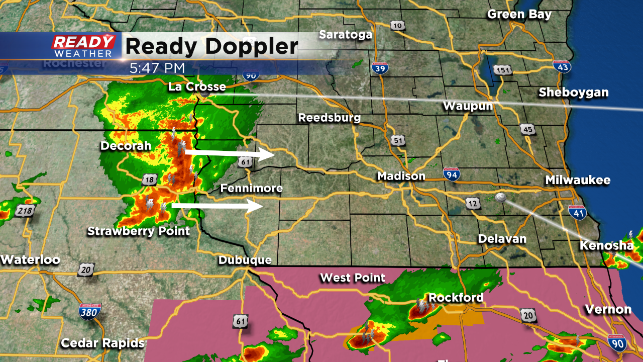
Additional storms across western Wisconsin will try to make a run at our area between 7 pm and 9 pm. These storms if they hold together could produce strong winds and small hail.
Regardless, more storms will develop across the entire area after midnight.
4 PM Update:
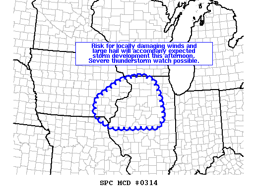
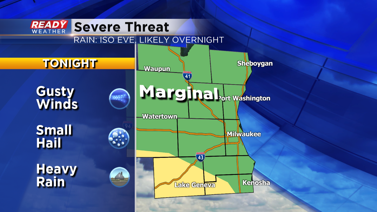
The SPC has shifted the marginal risk further south across our area. You can see the new graphic above. The best severe weather ingredients this evening will sit across the border of IL/WI, so that shift reflects the position.
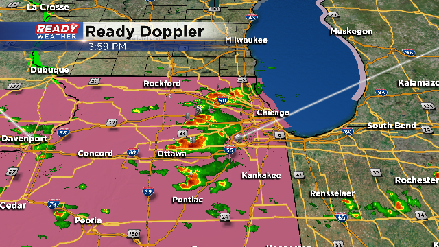
A new severe thunderstorm watch has been issued across northern Illinois. This does not include southeastern Wisconsin. If storms do develop further north as the models expect, areas like Walworth, Racine, and Kenosha counties could be impacted by strong to severe storms between 6 pm and 10 pm.
Additional storms are forecast overnight into early Thursday morning for the entire area.
2 PM Update:
The SPC is watching northern Illinois for a potential severe weather watch. The short term models develop showers and storms across our southern counties this evening, so I wouldn't be surprised if Walworth, Racine, and Kenosha counties are eventually added to a possible watch.
Strong to severe storms this evening could produce large hail and damaging winds. Another round of storms are expected overnight into Thursday morning. That round will provide more widespread rain across the area.
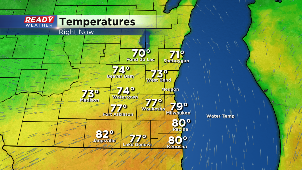
Noon Update: The sun is back out and temps are on the rise. A handful of locations are already in the 80s with more of us to follow suit this afternoon. Although there is a small risk for late afternoon storms, most activity would build closer to the IL border, an area we're watching for you today. The next substantial rain is on track to arrive after midnight. The risk for heavy rain and stronger storms still exists.
Today was the warmest of the year in Milwaukee! Temperatures spiked into the lower 80s as the humidity starts to creep back across southeastern Wisconsin. Milwaukee hasn't been this warm since October 3rd.
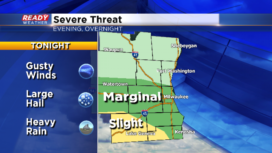
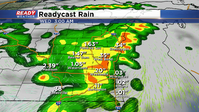
Tonight we are expecting scattered showers and storms to move across the viewing area after midnight. Storms will pack a punch as they move into western Wisconsin. The complex of storms will likely weaken as they approach our area; however, some storms will have a chance to produce gusty winds and small hail. While the overall severe weather risk is small, a few isolated warnings are possible.
A few lingering showers and storms are possible Wednesday morning.
Clearing will likely take place late Wednesday morning into the afternoon. Sunshine and higher dewpoints will allow the atmosphere to become unstable again. Highs could approach 80 degrees for Wednesday afternoon. The next round of storms is forecast late Wednesday evening into Thursday morning. Greater instability will create a better atmosphere for strong to severe storms Wednesday night.
We will watch the storms as they approach the area. Hail and damaging winds will be the primary threats.
The good news is the whole area will have a chance to pick up between 1.50" to 2.00" of rain through Friday. The area needs some rain to help with the fire threat.