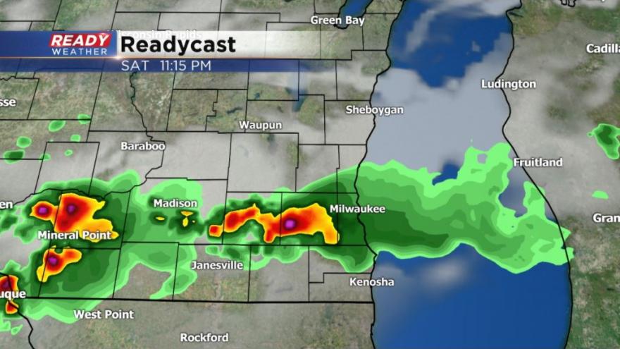
6 PM Update: Scattered line of strong storms rolls through Saturday night
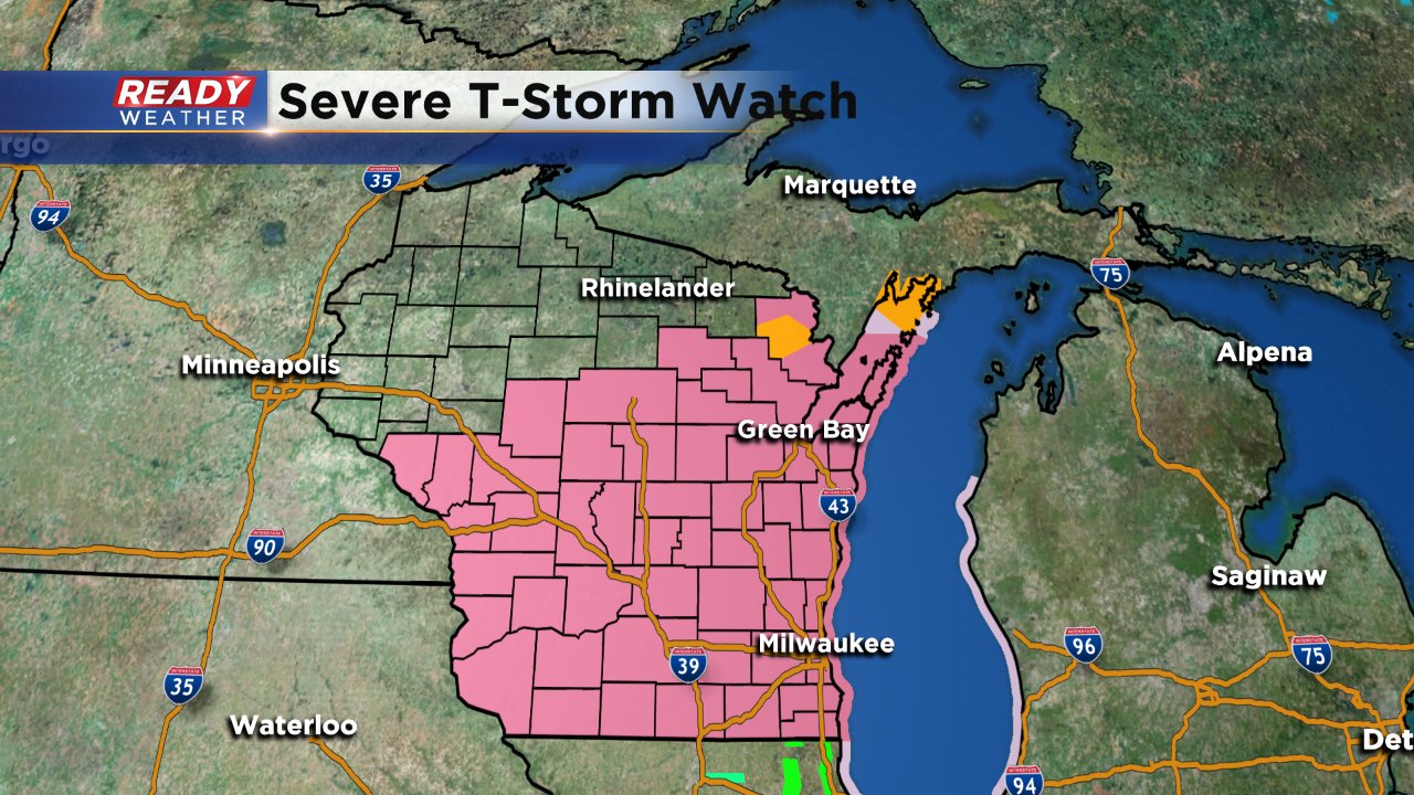
6 PM Update: A severe thunderstorm watch has been issued for all of southeast Wisconsin until 1 AM Sunday morning. Storms are still north of Green Bay and not expected to enter our area until after 8 PM.
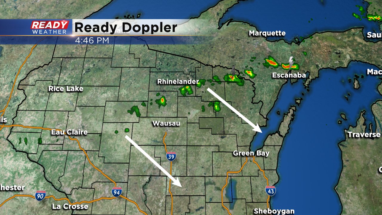
Temperatures have warmed back into the 80s this Saturday with a little humidity returning. A cold front will push across the state of Wisconsin Saturday afternoon and evening sparking storms as it moves southeast. So far weather models are handling the cold front and storms very well with the activity starting up north around 4:00 PM.
Timing for the line looks to be from 8:00 PM in our northwestern communities and arriving in Milwaukee and our central communities around 11:00 PM. The last storms should exit our southern spots shortly after midnight.
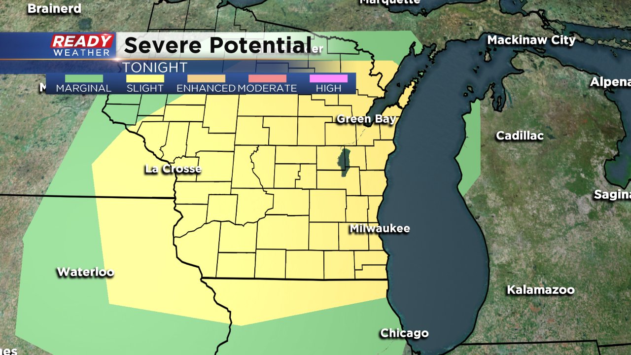
We are under a "slight" risk for severe weather, but it does look very isolated. The best chance for severe weather will be if any bowing line segments develop. Because of that, damaging wind will be the main threat with large hail and heavy rain also possible. The tornado threat is very low.
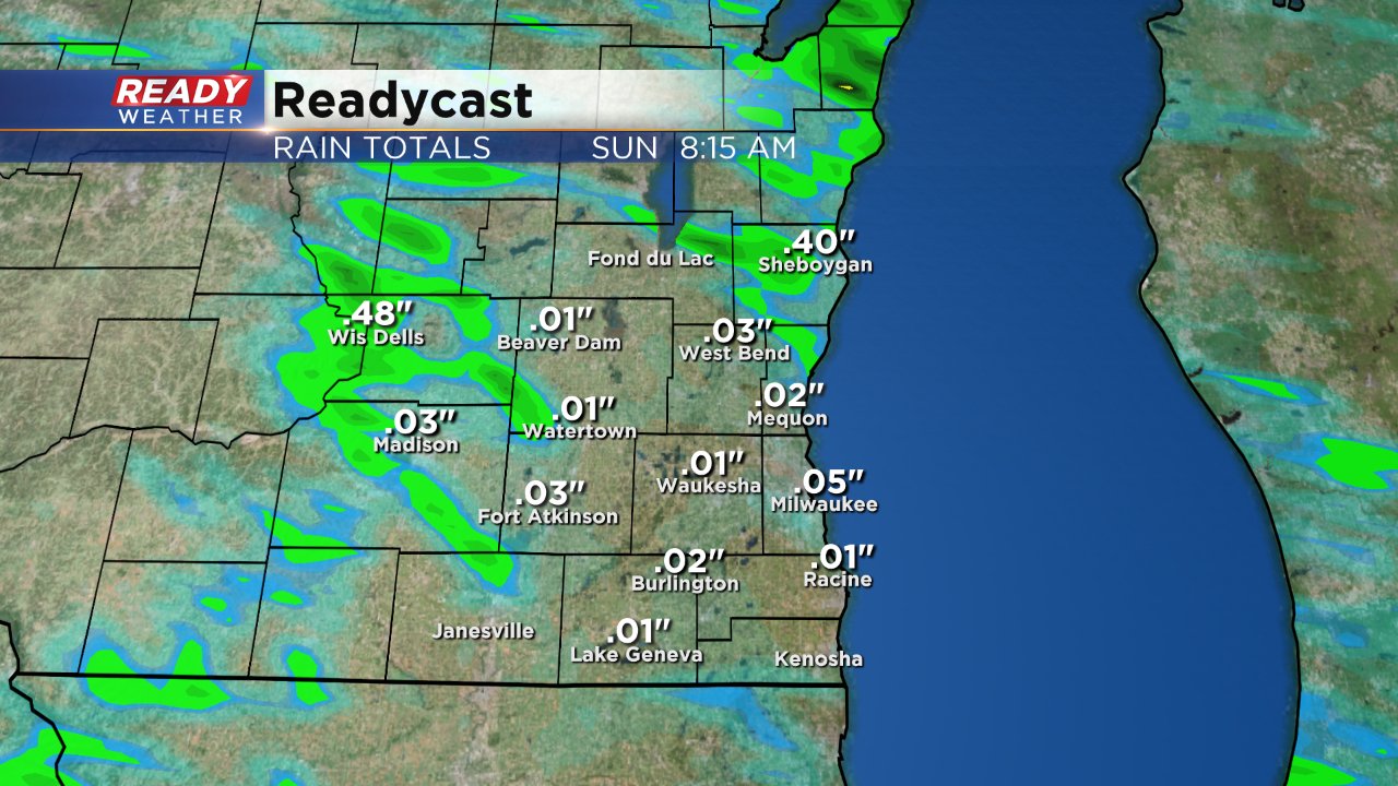
After this week's flooding, heavy rain is on the everyone's mind. Although stronger thunderstorms could drop a quick half inch of rain, widespread heavy rain and flooding is not expected.
Water levels on the Fox River in Walworth, Racine and Kenosha Counties should continue to decrease slowly the next few days, but it's not until next weekend that the river will go below flood stage.
Download the CBS 58 Ready Weather app to track the radar tonight as showers and storms roll through.