Rain to Snow on Wednesday!
Fall is typically full of extremes across southern Wisconsin. With cold fronts arriving every couple of days, we have chances for rain along with reinforcing shots of cold air. This fall has been somewhat atypical. The cold air has been bottled up to our north, and that has allowed us to remain dry and unseasonably warm. Our first real shot of significant cold air is coming for Wednesday!
A trough will provide scattered showers late in the day on Tuesday that should continue through early Wednesday. Rainfall totals should be close to a half an inch areawide, with some spots picking up close to 1.00". The colder changes will come Wednesday night.
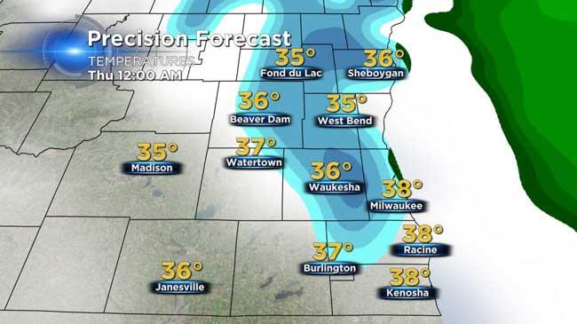
Residual moisture behind a strong cold front will have a chance to be in the form of light snow or flurries. While we are not expecting accumulation on roads, some light accumulation on grassy surfaces would be possible if there was a quick burst of snow. The window for snow will be from 6pm through 3 am Thursday.
It's interesting to note that the average first trace of snow for Milwaukee is October 28th, so our chance for snow on Wednesday/Thursday isn't that abnormal. The earliest one inch snow ever recorded was October 17th,1896. From 1900 to 2014, there have only been 19 years with measurable snowfall during the month of October.
Bottom line the bigger story is the colder air that will last for about 24 hours. Highs in the 40s on Thursday will be accompanied by clouds and windy conditions! Bundle up.....