Rain the main focus this week
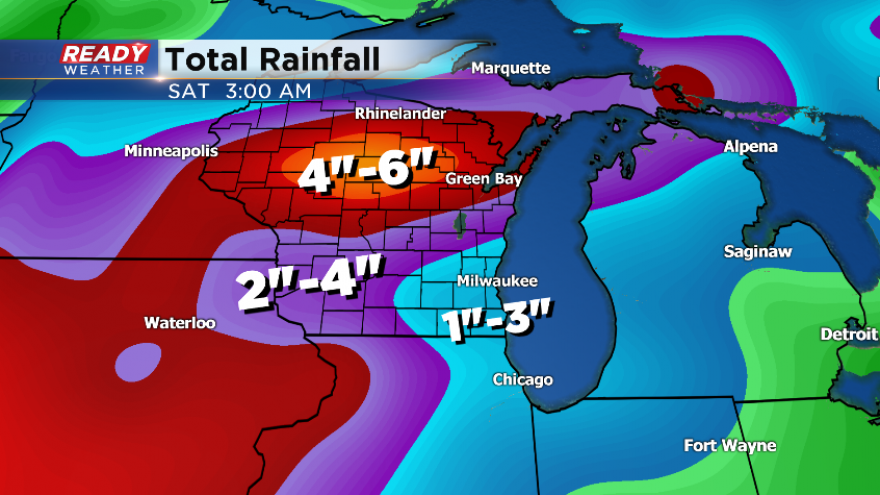
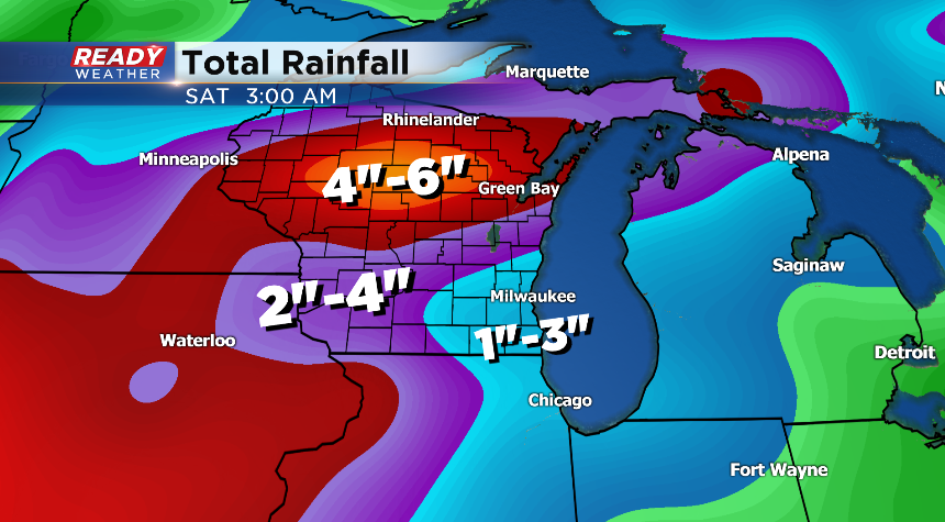
Here we go again! More rain is on the way today and this week. Expect the nose of the moisture to roll back in after some morning showers across the region. The next batch of rain will move in for this afternoon and evening around a disturbance and axis of humidity. If there’s any good news, it does look like the severe weather threat will be quite low for today with less instability. With the showers in the forecast, the temps will be cooler today around average.
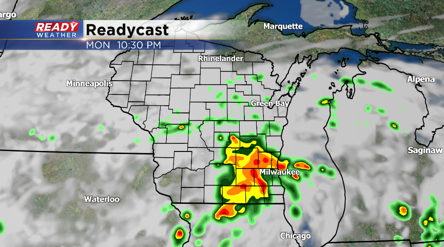
Tomorrow will be warmer as the region will be in the warm section of this system with the warm front lifting north. Once again the severe weather threat will be lower. However, expect some stronger storms where the warm front sits where there could be shear and instability in central Wisconsin; some could clip the northern sections of our area.
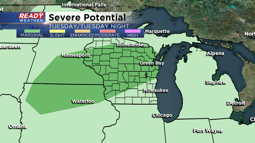
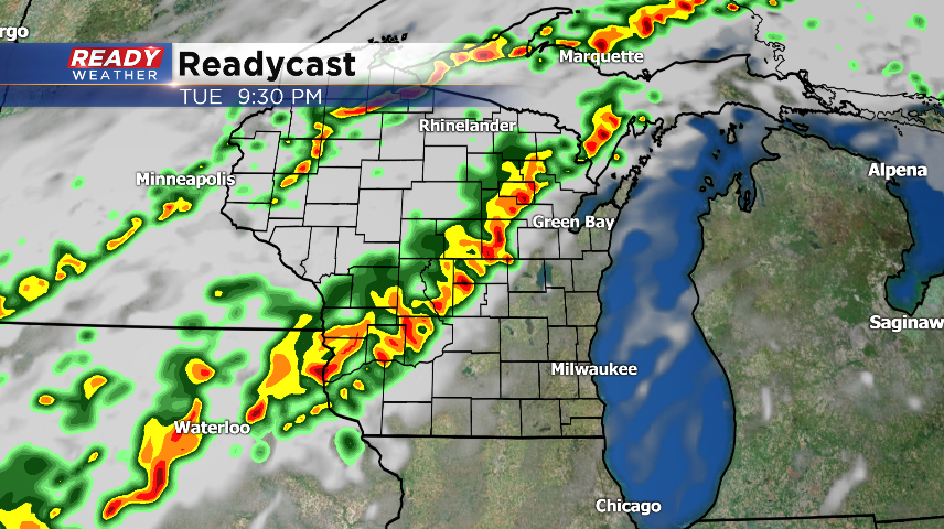
Another round of showers and storms will be on the way for Wednesday around a cold front. The better dynamics for severe weather could edge in the northern sections of our area, but it does look like most of the area will see mainly heavy downpours from the storms, which could produce minor flooding.
High pressure moves back in for the viewing area by the end of the week. This should usher in some drier weather. We will have to watch where this boundary sits, because if it drives north more rain could be on the way!