Prolonged dry pattern setting up into next week

-
2:26

Emotional vigil as family & friends tearfully remember Sade Robinson;...
-
2:50

Shouting, secret recordings, retaliation: What’s behind Thursday’s...
-
0:35

Third Ward Beer Garden kicks off season
-
1:01

City officials tour King Park neighborhood as a part of affordable...
-
3:00

2020 murder of Bernell Trammell’s remains unsolved
-
1:44

Kenosha community comes together to gift students with repaired...
-
1:50

Following fatal fire, MFD returns to south side neighborhood...
-
2:09

Marquette parents express frustration as graduation date remains...
-
0:51

City leaders gather ahead of Denim Day to address sexual assault...
-
0:53

City officials gathered in King Park neighborhood for tree canopy...
-
5:40

’48 Hours’ episode to feature Waukesha County eye drop murder...
-
1:28

Opening weekend is here for Slinger Speedway

There are not many weekends in summer where both days will feature “MUST BE OUTSIDE” kind of weather. Canadian high pressure slides in from the north opening up the door from drier and cooler air than we typically see in the end of July.
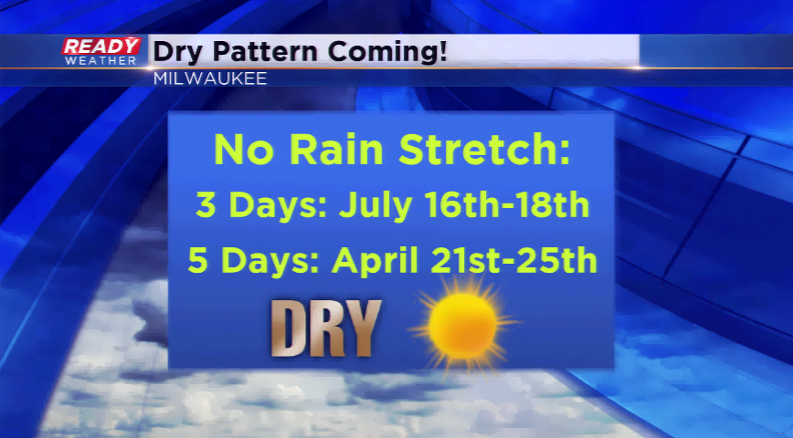
Highs will drop into the 70s for most of the viewing area today and Saturday before returning to around 80 by Sunday. More importantly, it will be the driest stretch of weather since we have had since February! Milwaukee had a streak of six straight days without any precipitation back on February 15th-20th. April also featured a five day stretch of no rainfall. The longest we have stayed dry this summer is three days back a few weeks ago from July 16th-18th. As the drier conditions move in, this will set back the July rainfall totals for the month back to around normal.
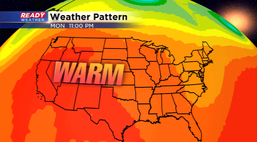
Expect a gradual warming trend next week with an amplified upper-level ridge building on the west coast which will slowly work to the east. This will help the flow return to more of an active setup. Highs get back into the 80s next week with chances of storms by Wednesday.
Enjoy the weekend!