Pesky showers could turn strong Sunday
A few showers and storms popped up Saturday afternoon with some reports of small hail. It seems like someone in southeast Wisconsin has seen rain almost every day this past week but the activity has been very isolated for the most part. Unfortunately, more of those isolated showers and storms will be possible on Sunday.
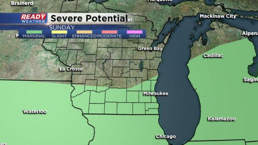
It looks like the best chance for some rain will be during the afternoon and evening on Sunday and southern communities closer to the border are more likely to see storms. The Storm Prediction Center does have most of the viewing area under a marginal risk for strong storms. Some severe weather ingredients are there so the risk is warranted, but still isolated.
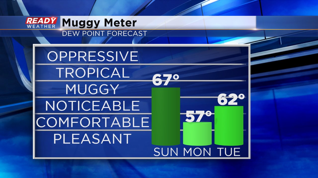
Temperatures Sunday will be warm and muggy with highs in the low to mid 80s and dew points in the low 60s. The humidity takes a break Monday and Tuesday as a lake breeze moves in so expect it to be a little cooler if you are heading to Summerfest for the 4th.
Storm chances for Independence Day have started to increase with evening storms possible. Not all weather models are showing the activity, but if you are planning to watch some fireworks pay attention to the forecast the next few days.
More storms will be possible Wednesday and Friday.